Good Tuesday, everyone. It’s a much better day taking shape across the region, but we are focusing on another massive storm due in town later this week. That system is likely to bring more nasty weather to our part of the world.
Temps out there today range from the middle 50s to low 60s with a mix of sun and clouds.
Clouds increase on a windy and warm Wednesday as temps spike deep into the 70s. This may put us close to record highs yet again.
Let’s focus on our late week setup. Here’s a breakdown:
- The first round of showers and storms arrives from the southwest Wednesday evening and goes through Thursday morning.
- A few of those storms could be strong and put down enough rain to cause local high water issues.
- We catch a bit of a break during the day Thursday before more rain and storms arrive during the evening.
- That’s ahead of a STRONG low pressure lifting into the Ohio Valley on Friday. This low may set some records for lowest barometric pressure.
- This strong low will bring high winds of 50mph-60mph
- Rounds of storms work through, some of which may be severe on Friday.
- Heavy rainfall is likely during this time and we may have, at least, local high water issues.
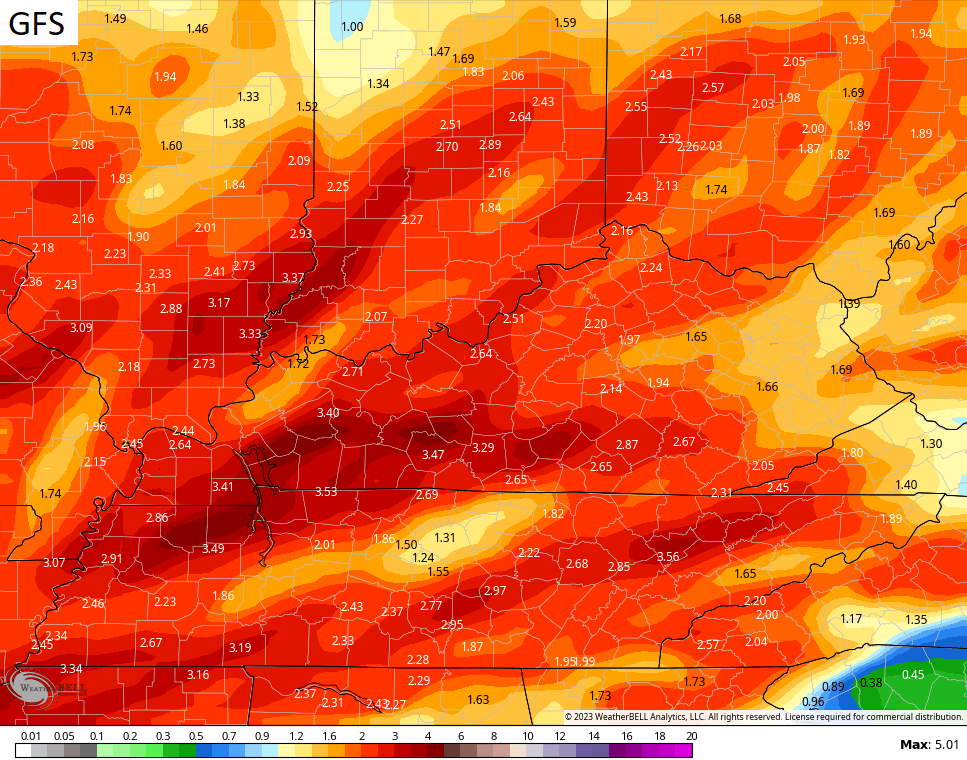
Here’s how the GFS sees this whole scenario playing out…
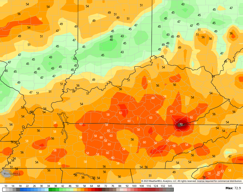
Wind gusts on that run are way up there once again…
The rainfall numbers from the GFS are also concerning…
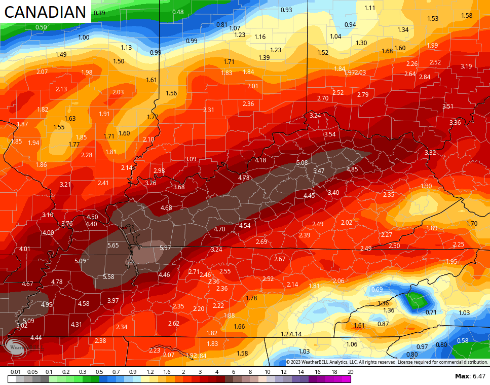
The Canadian is just ugly…
Looking down the road a bit, the indices are all lining up for much colder weather to engulf much of the country. Check out the temperature departures from the EURO Ensembles as we get into week two of March…
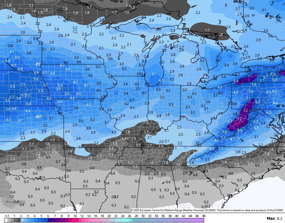
The same model has snow chances during that 7 day period…
Ugh.
I’ll have another update later today. Have a good one and take care.

So is LA NINA dying?? I can’t get over the crazy winds we’ve had the past month. This winter reminds me of 1992/93 back in western NC… We had NO winter at all…Not a flake of snow and not much cold… then March 13th 1993 happened.. Blizzard city..
Did you see all the rain in southern Cali? That was crazy.. I’m starting to think their drought must be gone at this point.
Mark, La Nina has weakened some, but still controlling the weather patterns. NOAA predicts a ENSO / neutral phase this Spring or Summer. I miss out on the blizzard of 93 as I was in Indiana. This area of Kentucky where I live now miss out too. I think the drought in California is over. It’s windy because of the differences in temperatures in the upper levels of the atmosphere and at the surface.
Thanks Chris. March coming in like a Lamb. Big Snowstorm for coastal areas of the East coast. Same ole same ole for the Ohio Valley. Freezes likely now for our area this Spring. UGH !!!
Here is the link for the summary of Monday morning’s heavy rains and rare February tornado touchdowns (albeit brief and rated EF-0) in the Chicago Metropolitan Area (including photos of the tornadoes and the minor damage they produced), the first February tornadoes for the Chicago Metro Area since February of 2017. Since 1950, there have been only eight February tornadoes in the NWS Chicago Forecast area before yesterday.
https://weather.gov/lot/2023feb27
Our Tornado season may be active due to an ENSO / neutral phase this Spring.
HAARP. Selective control of the weather.
There could be something to that HAARP controlling our weather. They lie about everything else.
The East Coast was predicted to receive a big Snowstorm. And now not.