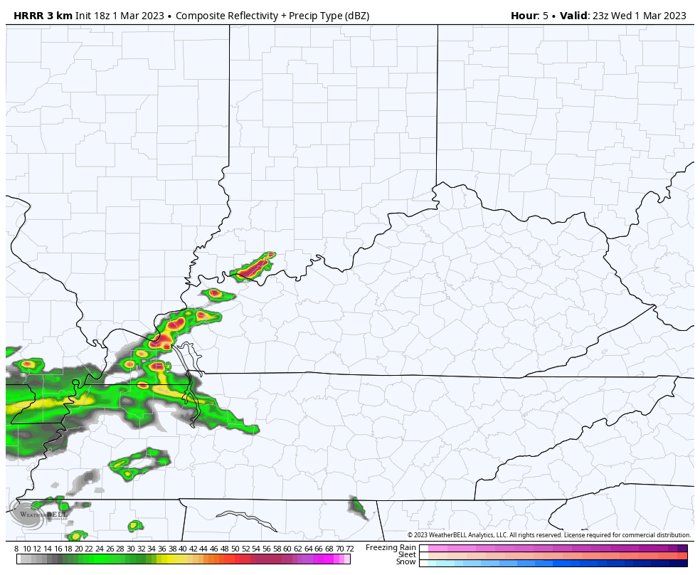
Good afternoon, everyone. A line of strong to severe storms develops and rolls across the state this evening. This is the opening act to what is likely to be a more significant severe weather and high wind event for Friday.
As expected, the Storm Prediction Center has the entire area in the low-end risk for severe storms this evening…

Damaging wind will be the primary threat.
Watch how quickly these storms ignite along the Ohio River and then how fast they dive to the southeast…
We catch a break in the action for Thursday, but some strong to severe storms may impact far southwestern Kentucky during the evening…

Friday continues to have a severe weather and high wind look to it. The Storm Prediction Center has a Marginal to Slight Risk for severe storms in central and eastern Kentucky…

An upgrade to that is a good possibility.
High winds of greater than 50mph will be likely outside of thunderstorms. The GFS wind gust forecast for Friday is absolutely insane…
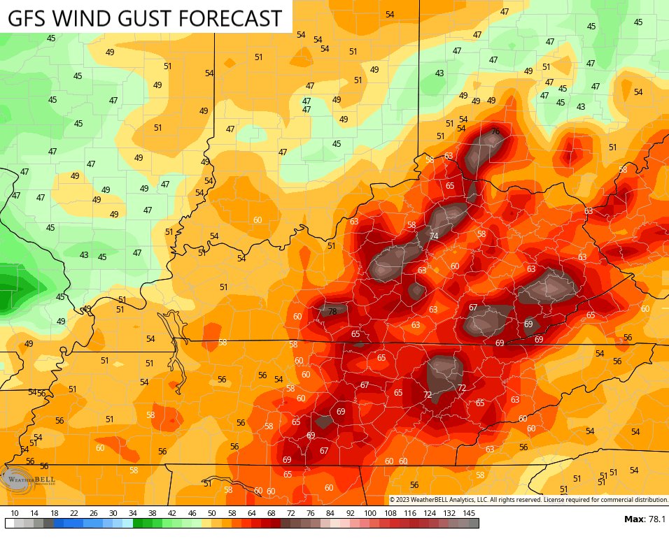
You can clearly see where the model is showing severe storms adding to the wind potential.
The Friday setup is one that can also spin up a few tornadoes. The potential is also there for some local high water issues.
I will have updates as needed and I’ll be on WKYT-TV with all your severe weather needs. Until then, here are your tracking tools for the day…

Current watches

Possible Watch Areas

Have a great evening and take care.

Thanks Chris. Two many severe storms for comfort. Isn’t there an end to this or is this way it’s going to be for now on ? I’d rather be where the cold and snow is. I wouldn’t be so nervous about my home and property.
I hope no flooding Schroeder. The wind is just unreal!! I would love to know if Chris or anyone has seen wind gust that high before here in Kentucky?? I remember years ago don’t remember the date or year but I was sitting outside had to go in these winds came through so suddenly and hard and very fast. I remember hearing the weather people talking about it being either straight line winds or possibly a derecho. I don’t know if it was confirmed but I know we immediately lost power it was just strange!
Did you happen to go back and look for Chris’s blog post called “A Night to Remember?” That one was a very memorable windy night with no storms to speak of.
I will have to do that Acwxman83 thanks
I sure hope we don’t loose power from these winds and storms. We had three times where the intense lightning fried our television set and the computer. When they are predicting severe thunderstorms anymore I disconnect the television set and the computer.
Crystal look at the KY MESONET the site they have for Pike Co. is on Flatwoods MTN at Dorton at 2800 ft. I think last week there was a 50 mph plus.
Also there is a history of all stations there.
Thanks I will.