Good evening, everyone. A major severe weather event is likely for the entire region on Friday. Damaging winds, large hail and a few tornadoes are likely as a potent low pressure intensifies as it moves into the Ohio Valley.
Let’s start with the multiple risks we are facing in the next 24 hours.
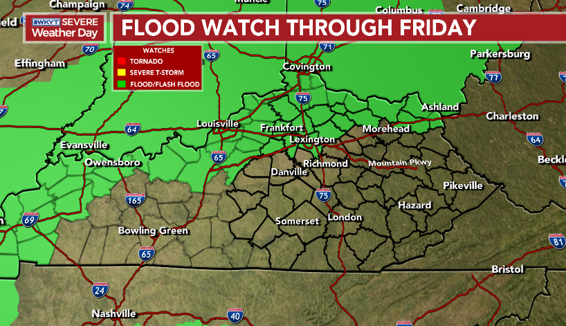
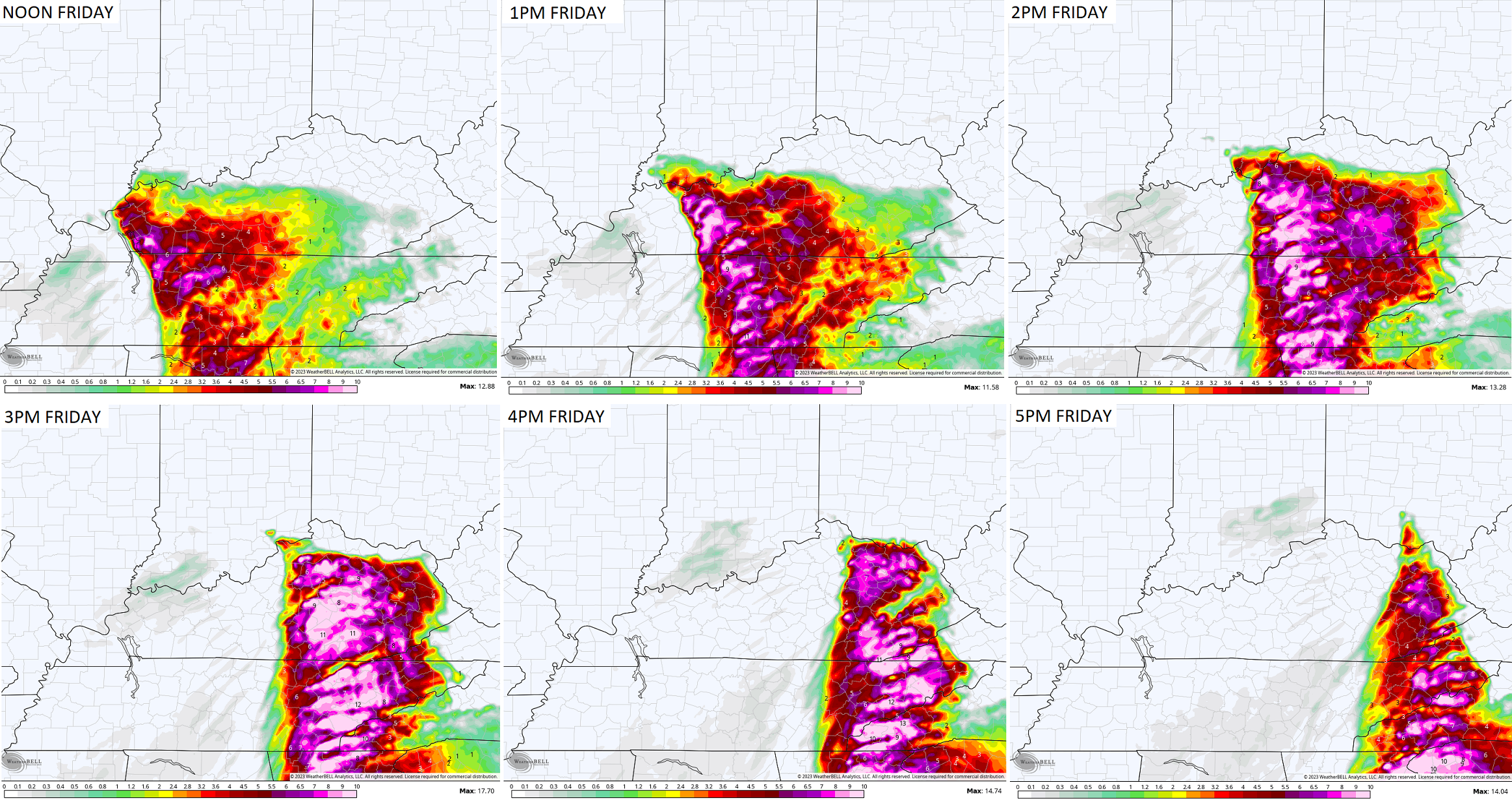
Heavy rain producing rain and storms develop this evening and lift to the north overnight into Friday morning. This may cause flooding issues for some, with the greatest threat across the northern half of the state.
This is where a Flood Watch is out…
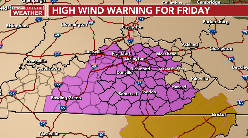
High winds are a MAJOR player on Friday and that’s with or without thunderstorms. Gusts of 60mph or higher will be possible. A High Wind Warning is out for many…
What’s up with Breathitt and Magoffin Counties being left out? That’s a terrible look from the NWS in Jackson.
As far as the severe thunderstorm risk, the Storm Prediction Center continues to play catch up in our region. The started the day with a Slight Risk for tomorrow, then upgraded to an Enhanced Risk…

I don’t think the Enhanced Risk is expansive enough and there’s a legit chance some of this is upgraded to a Moderate Risk.
The tornado threat is there and it’s increasing based on some of the short range models. One reason is this system is slowing down on the arrival time, coming in during the peak heating of the afternoon. The HRRR Significant Tornado Parameter is very high as it shows an increasing threat into central and eastern Kentucky…
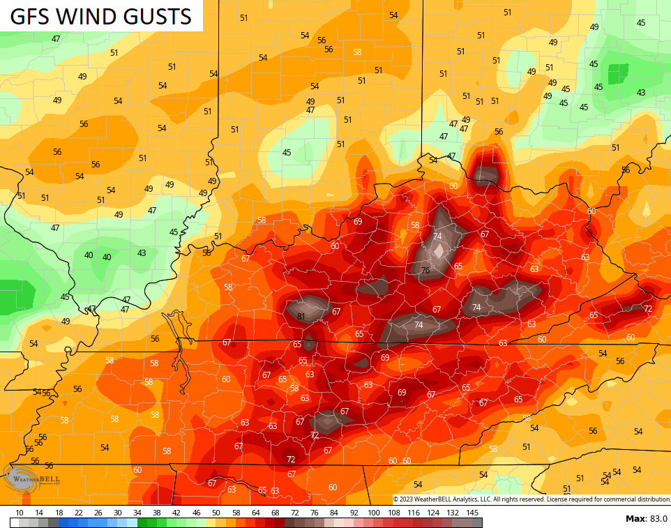
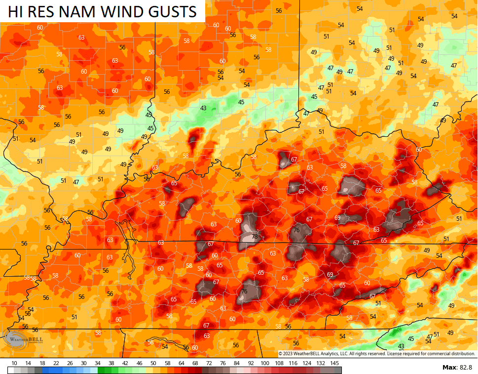
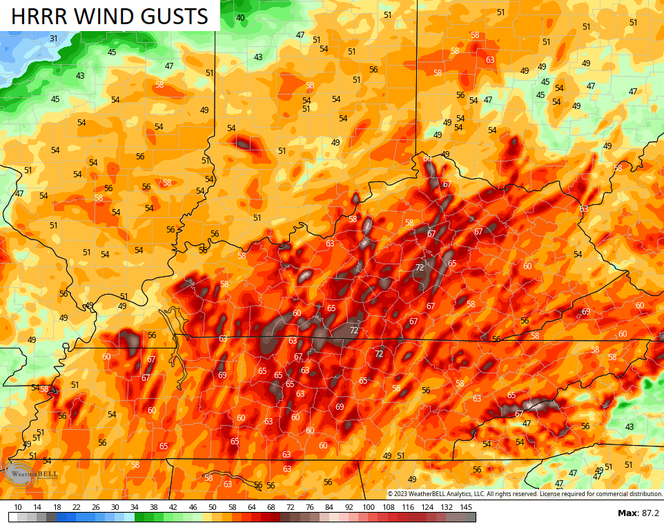
The wind gust forecasts from the models are insane…
Here are your tracking tools for the evening…

Current watches

Possible Watch Areas

Enjoy the day and take care.

Thanks Chris for the update. Looks really bad for my area. Maybe it will blow through quickly without widespread damage. One can hope.
so we get virtually NO winter and this is what we get instead??? Every year I get more and more creeped out over severe weather…I used to be fascinated by it and wanted to see it like some of the storm chasers… I think it’s because each year the world gets more crazy and unbelievable things happen… which makes me even more paranoid. I love regular non-threatening thunderstorms though.
I know Mark I am not looking forward to tomorrow. What has happened to a so called normal winter??? I saw where schools are cancelled for tomorrow sounds like a good decision. Today in my Facebook memories there were pictures when we had to go to West Liberty for business after the tornado I was stunned at the devastation of the tornado there I think it was about 8 years ago I Am sure Chris remembers and I guess everyone here does too. I think it was 8 years ago? Stay safe everyone and Chris get your roller skates on I am sure you are a busy man.
There is chatter this evening among my daughter’s friends that there will be school closings in Louisville area due to wind and afternoon severe weather. A friends told her that there are 2 counties who have already called school off. Not sure what counties.
LouTeach there is a big list of closings on WKYT page and in the east WYMT I don’t know if that covers your area.
Yeah, I saw those. Just looked at Wave 3 closings page, and nothing near us closed tomorrow at this time. Hopefully JCPS will do the smart thing and make tomorrow and NTI day instead of closing, then we do’t have to make up.