Good Saturday, everyone. Historic winds blasted the bluegrass state on Friday as an historic low pressure rolled through the region. Much better weather blows in for the weekend, but there’s a change toward a winter pattern on the way.
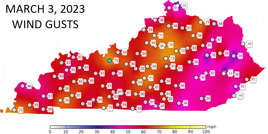
Before we look ahead, let’s look back at the winds of Friday. Widespread 70mph+ winds showed up across the state with a few spots nearing 80mph. Louisville recorded a 79mph gust while Lexington hit 78mph. Both of those are among the highest wind gusts ever recorded. Lexington had 50mph+ gusts for almost 8 straight hours!
Check out the top winds from the Kentucky Mesonet sites…
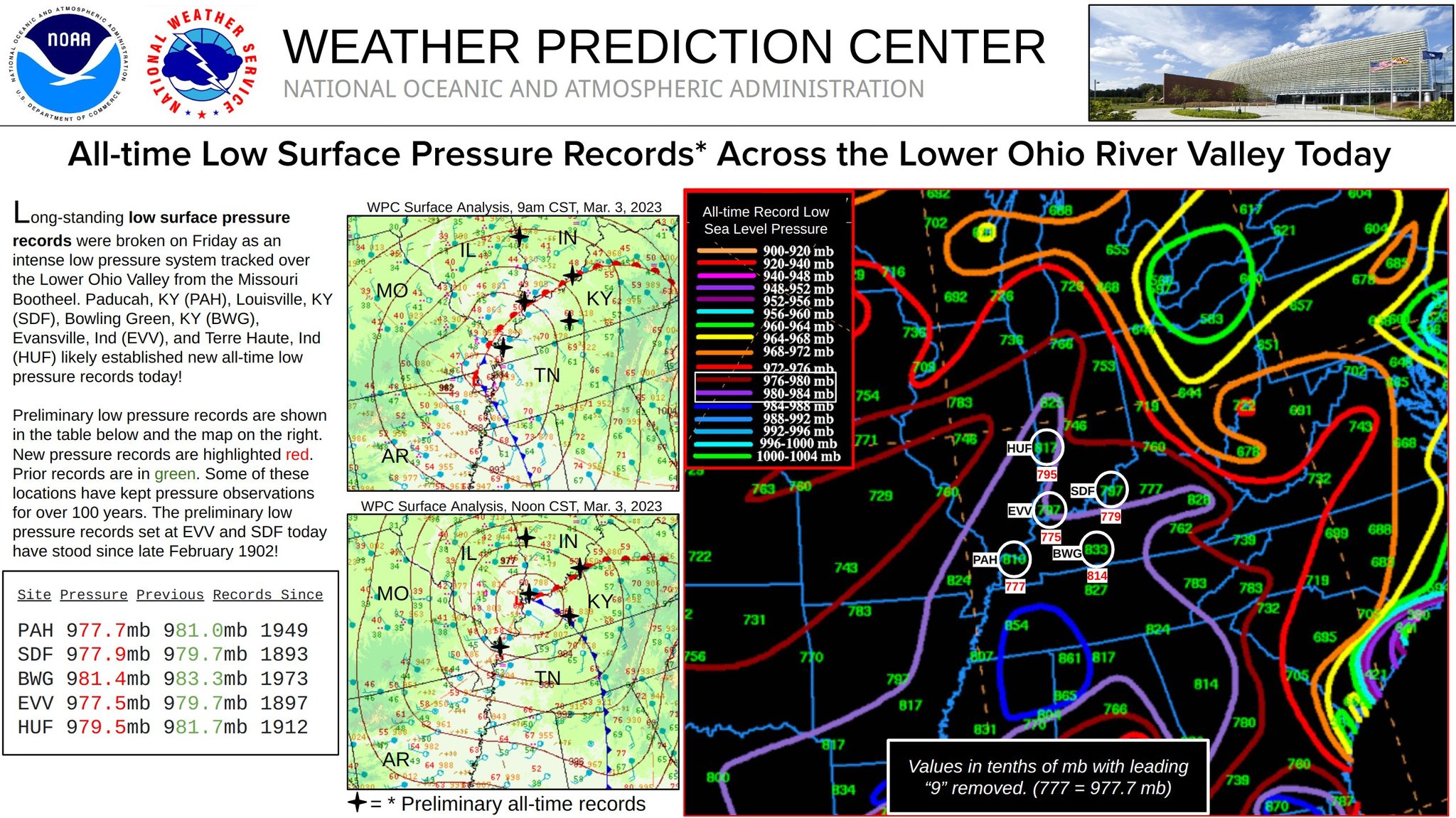
I mentioned early in the week how this storm may challenge lowest pressure records and the storm did just that, setting all-time record lowest pressure readings in Louisville, Bowling Green and Paducah…
Things are much better out there today with highs in the 50s with a mix of sun and clouds. Temps reach 60-65 degrees on Sunday with 70-75 on Monday with a mild wind blowing.
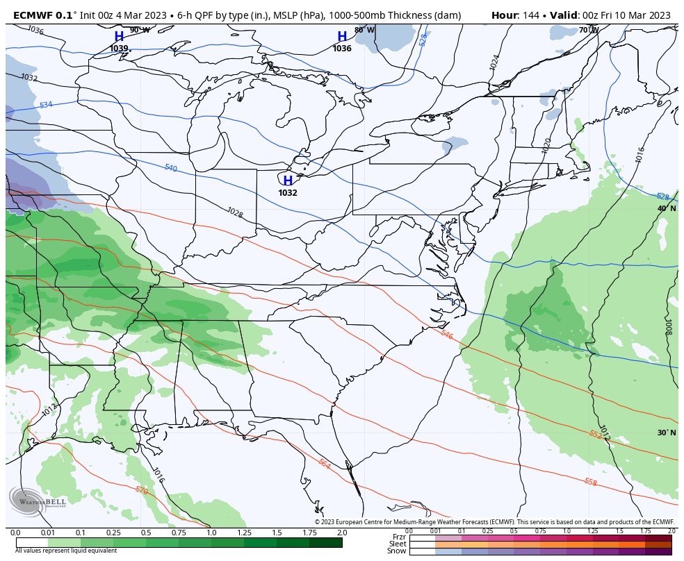
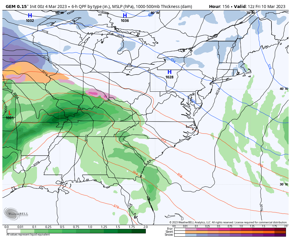
A few showers or storms will be possible by Tuesday as a cold front drops in. This is ahead of a stronger system arriving by the end of the week into next weekend. This is being pushed by much colder air and the chance for winter weather…
EURO
CANADIAN
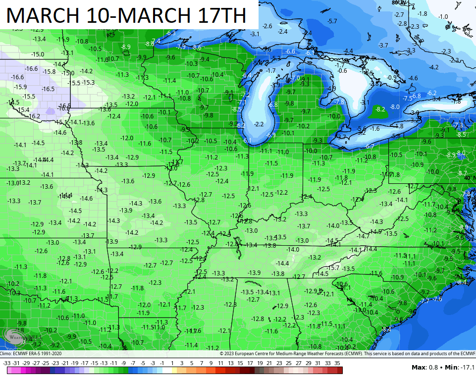
This is unlocking a MUCH colder than normal pattern into the middle of March. The 51 member EURO Ensembles show this well…
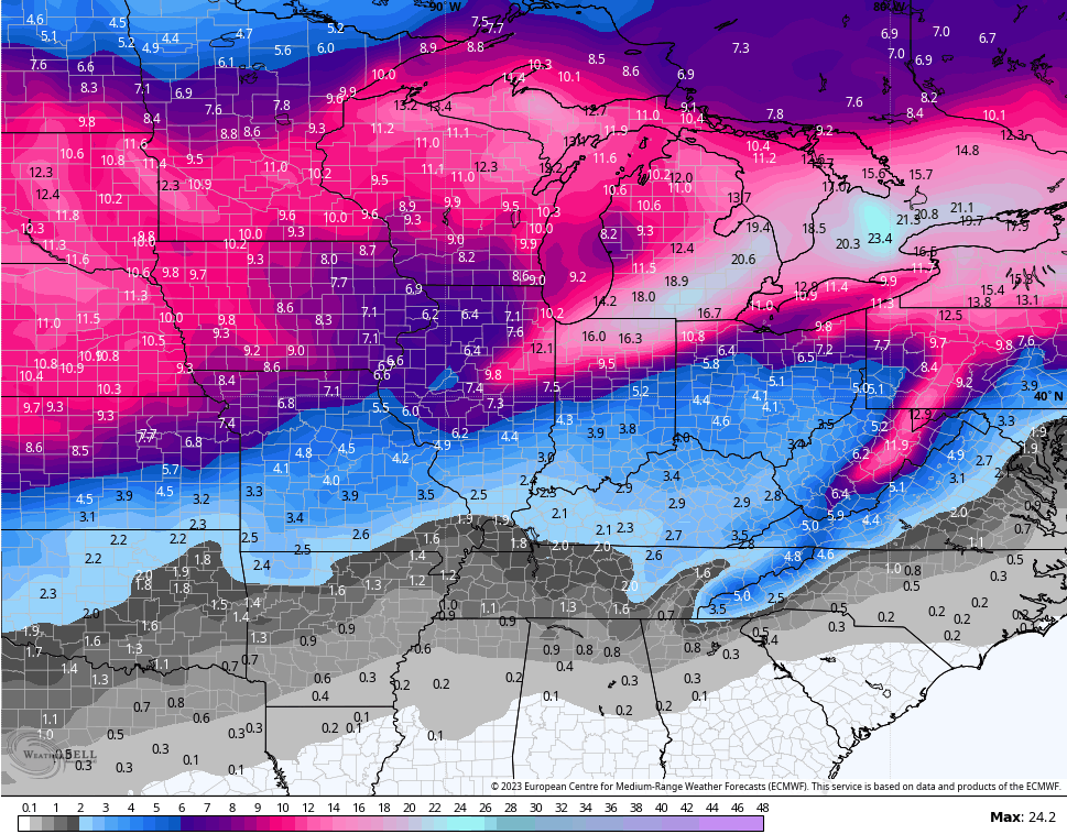
The same model run shows snow chances fairly deep into the south…
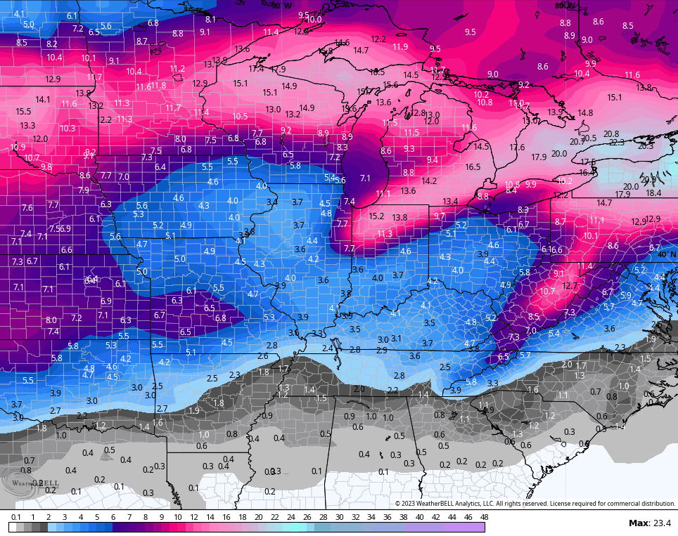
The GFS Ensembles are seeing the same thing…
We had spring in winter, so I guess it’s time for winter in spring.
I will update things later today. Make it a good one and take care.

You rocked it with yesterday’s forecast. Your detractors were left in the dust. Now let’s get ready to get the last of this wimpy winter outta here. 🙂
Just as expected… Now that we’re getting close to spring….here comes the cold. Oh well. Those winds were crazy. I feel like it’s almost becoming a regular thing now. LOL
I was too busy scrolling through twitter at the wind reports, that I didn’t notice an explanation on what exactly happened with the severe storms not verifying… what happened with that? Don’t get me wrong… I’m NOT complaining… I’m glad they didn’t verify… could you imagine if they had with all of that wind energy?
high wind warning kept louisville from issueing warnings. jackson issued warnings. lville said needed be 70ph wind to issue a warning. never heard that ever.
I cannot believe I didn’t lose my power.
I did lose a shingle off my roof. The week before I lost a piece of flashing around my chimney.
I am looking forward to the return of cold rain followed by festive flurries season. LOL
It’s sad that some plant life will be taking a major hit.
I notice a few Bradford tress have already started to bloom.
On the snowfall maps, the Chicago area is predicted to receive between 7 to 10 inches of snow between the 10th and the 17th. I’ll believe that when I actually see it.
Even much of Kentucky is predicted to receive between 2 to 4 inches of snow during that time frame.
I have no doubt that the cold air is coming by late next week, as the computer models usually do a good job with that, but I’m very skeptical of the snowfall amounts, especially after the Chicago area completely missed out on the snow on Friday in what was predicted to be a major snowstorm for at least part of the area just a few days before that.