Good evening, folks. We are tracking showers across the region as the overall weather pattern looks more like what we should have been seeing in February. This includes some snow chances rolling in over the next week or so.
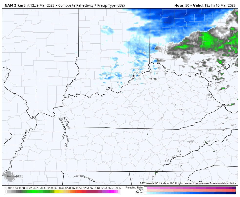
The showers that are out there this evening will continue into tonight. Here are your radars to follow along…

Colder winds blow on Friday as temps drop through the day. A few rain showers come back into the picture from the north during the afternoon. The chance is there for a few flakes to fly as we head into central and eastern Kentucky Friday night and early Saturday…
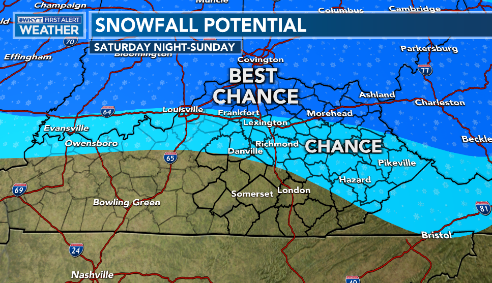
 Saturday afternoon is a nice one, but a bigger storm system rolls our way for Saturday night and Sunday. This one brings rain and a period of light snow. The best chance to put a little snow on the ground is across the north…
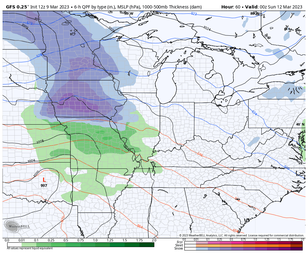
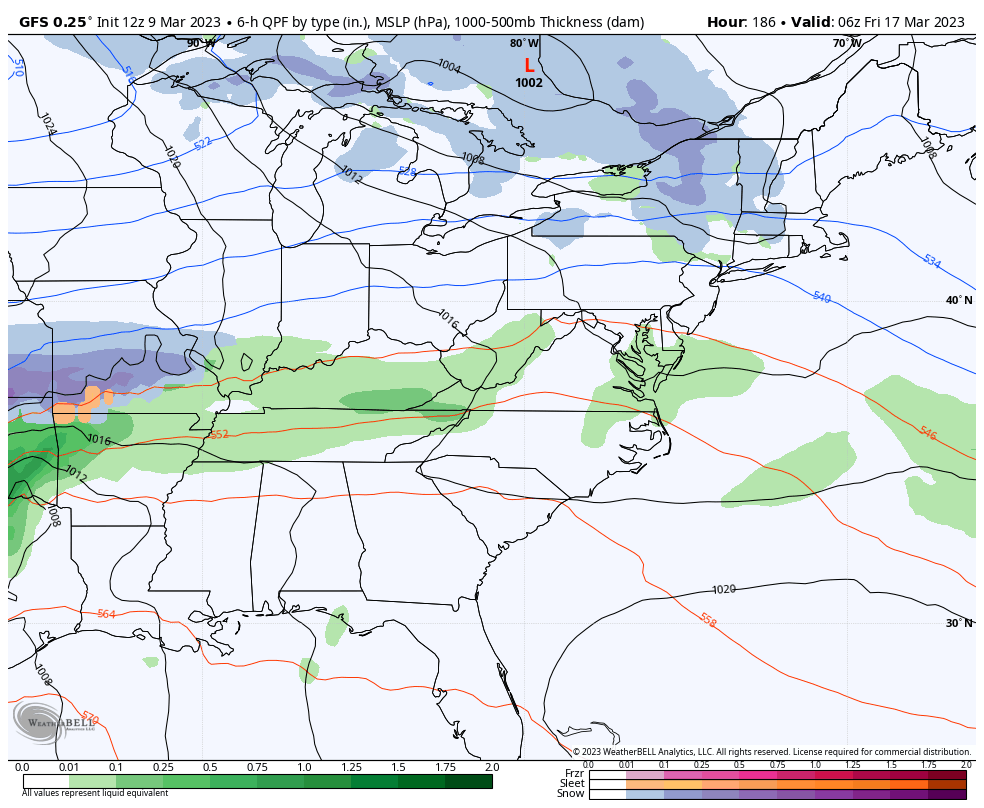
The GFS has the best swath of snow compared to the other models…
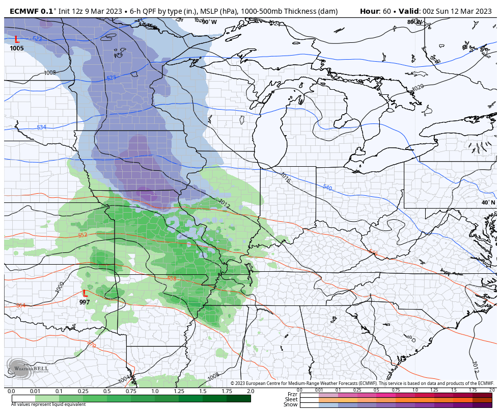
The EURO isn’t too far behind…
You can see how cold northwest winds behind that system spit out some snow showers and flurries for Monday and Tuesday. Highs may not get out of the 30s.
Temps may rebound for a day or two later next week ahead of another storm system that tries to unleash some more winter weather…
GFS
CANADIAN
This spring has the chance to deliver more snow than what we had in the winter months. I think I first made that statement at the end of February. #TeamSpring ain’t happy.
Enjoy the evening and take care.

Winter Weather Advisories are in effect for the Northern and Western Suburbs of Chicago for tonight through early Friday morning, with 3 to 6 inches of heavy wet snow for the counties near the Wisconsin border and 1 to 3 inches elsewhere. Here in the SW Suburbs where I am, less than an inch is expected.
Temperatures are still several degrees above freezing throughout the area, so many areas will receive a rain/snow mix before changing over to all snow later on.
Enjoy. I doubt we see much in Louisville.
It certainly is a sad winter Mike. I would have thought you would be rolling in snow that far north but it seems like a sad winter for everyone well everyone who enjoys snow. I know a lot of people don’t but I am not one of them lol. I have to admit days like today are nice though.
It might take 1 or 2 inches to top all of the previous winter combined.
Maybe only a1/4” in some areas. LOL