Good Friday to one and all. Colder winds are blowing in across the state today as we lock into a wintertime pattern. It’s a setup that will bring some flakes into the region on more than one occasion this weekend and into next week.
Our Friday starts with some showers working out of eastern Kentucky with a midday break set to follow. That’s short-lived as a few more showers work in this afternoon and evening. That’s when it gets cold enough for a few flakes to join in. Those flurries and snow showers will be noted across the eastern half of the state through early Saturday morning.
Here are your radars to follow today’s bit of ugly…

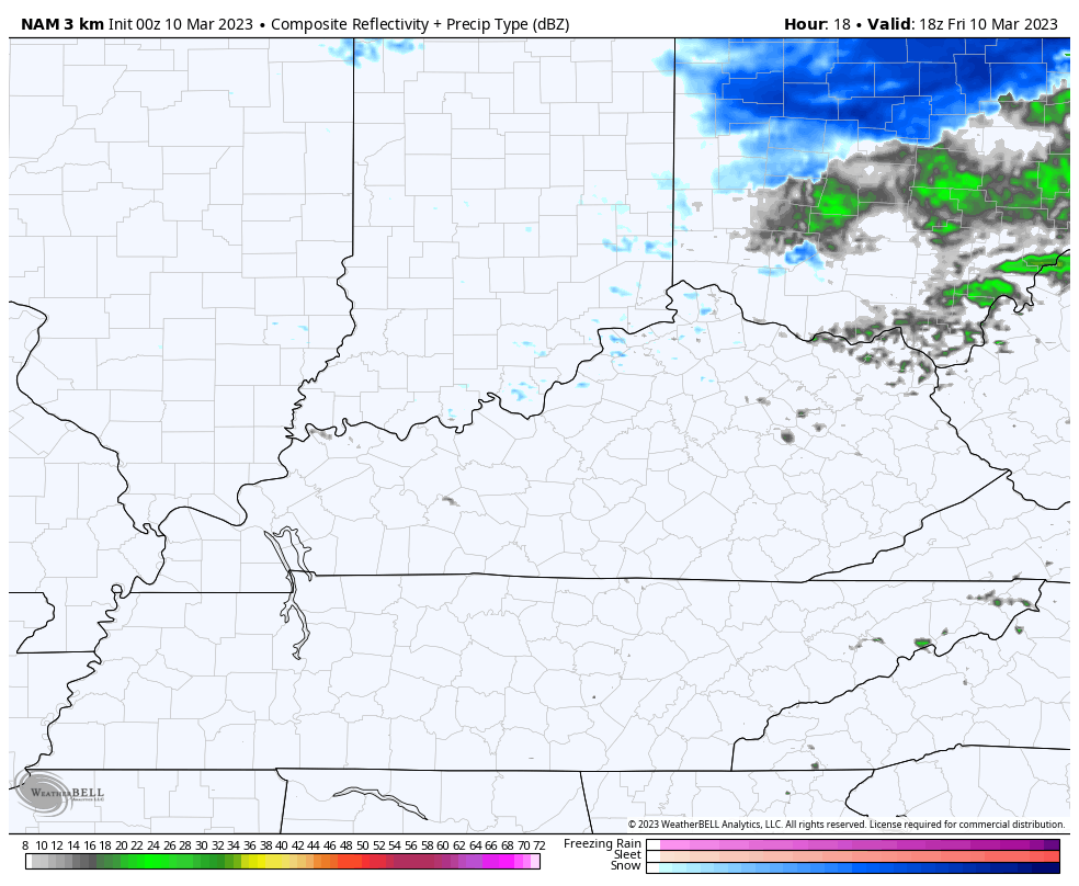
Here’s a look at the snow shower and flurries showing up on the Hi Res NAM…
Temps today will be on the chilly side with that strong northwest wind doing its thing.
Saturday looks like a better day with temps deep into the 40s with a mix of sun and clouds.
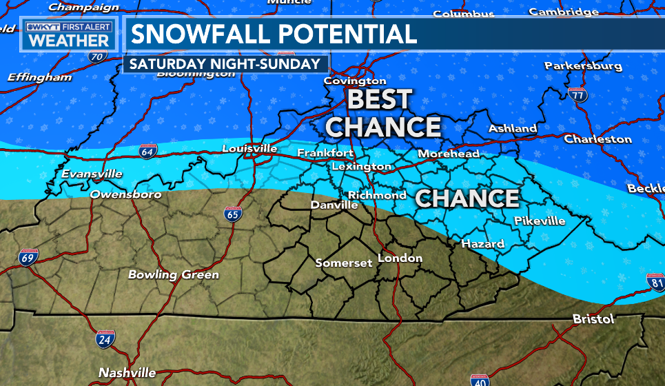
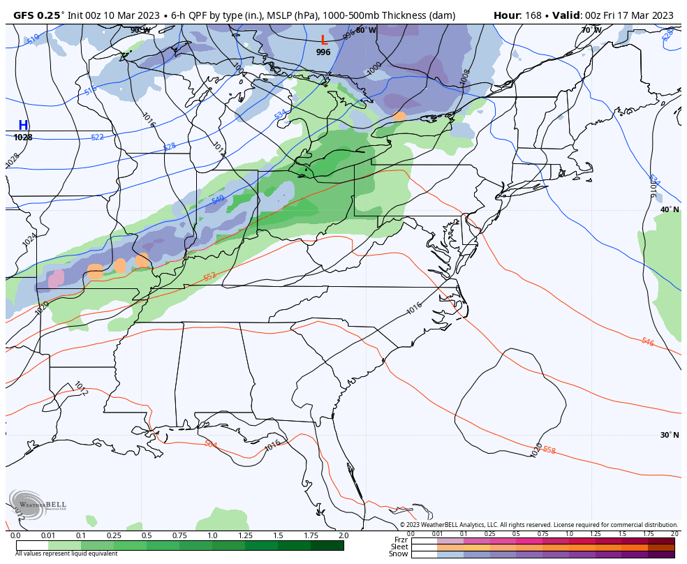
Clouds will quickly increase late in the day as rain arrives from the west during the evening. This is ahead of another storm system working into the Ohio Valley with rain and snow. The greatest chance for some slush is across the north and the northeast…
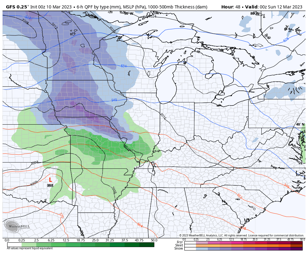
Here’s the GFS showing our system…
Much colder weather comes in behind this with many areas struggling to get to 40. There’s also the chance for a few snow showers and flurries…
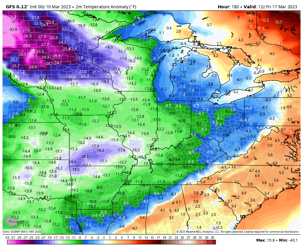
Temps bounce back for a few days next week before another surge of cold air dives in. That may bring some rain and snow by the end of the week, but the models will go back and forth on the evolution of this…
The cold behind this is impressive. Look how far below normal the numbers get…
I officially hate this pattern, but I’ll throw you another update later today. Have a good one and take care.

Such as life living in this region.
At least the winds have resided.
The cold may be impressive, but the Snow potential isn’t.
If the Pacific Decadal Oscillation which usually lags behind ENSO / El Nino doesn’t go positive by next Fall and Winter, there won’t be much change in the Winter pattern for the Eastern part of the country.
The far Northern and NW Suburbs of Chicago, near the Wisconsin border, received a big hit of between 6 and 9 inches of heavy, wet snow Thursday afternoon and night.
Most of the immediate Chicago Metro Area received only 1 to 2 inches though. O’Hare Airport recorded 1.2 inches, Midway Airport 0.5 inches. In the SW suburbs where I live, even though it was snowing steadily this morning, temps were above freezing and the snow did not accumulate.
O’Hare is now at 19.1 inches of snowfall for the season. They may break 20 inches yet! Here in the SW Suburbs, we’re only around 15 inches for the season. I’ll be surprised if we break 20 inches.
Here is the link for the summary: https://weather.gov/lot/2023mar0910