Good evening, folks. It’s a cold start to a cold weekend across the Commonwealth. This cold weather comes with a few flakes later tonight and some rain and snow blowing in for Saturday night and Sunday.
A few rain showers are moving through this evening and we may see some flakes mixing in by late evening into tonight. The best chance is across central and eastern Kentucky.
Here are your radars to follow along…

Better weather moves in for a time on Saturday afternoon, but that window of nice closes quickly. Rain develops in the west and moves in and takes us through Sunday. There’s the chance for a bit of a mix showing up and the north has the chance to pick up on some light accumulating snow…
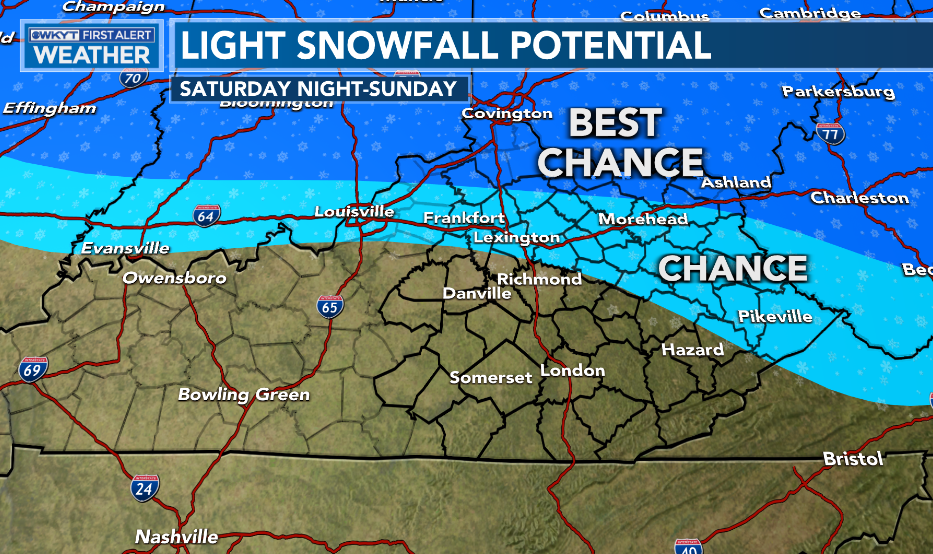
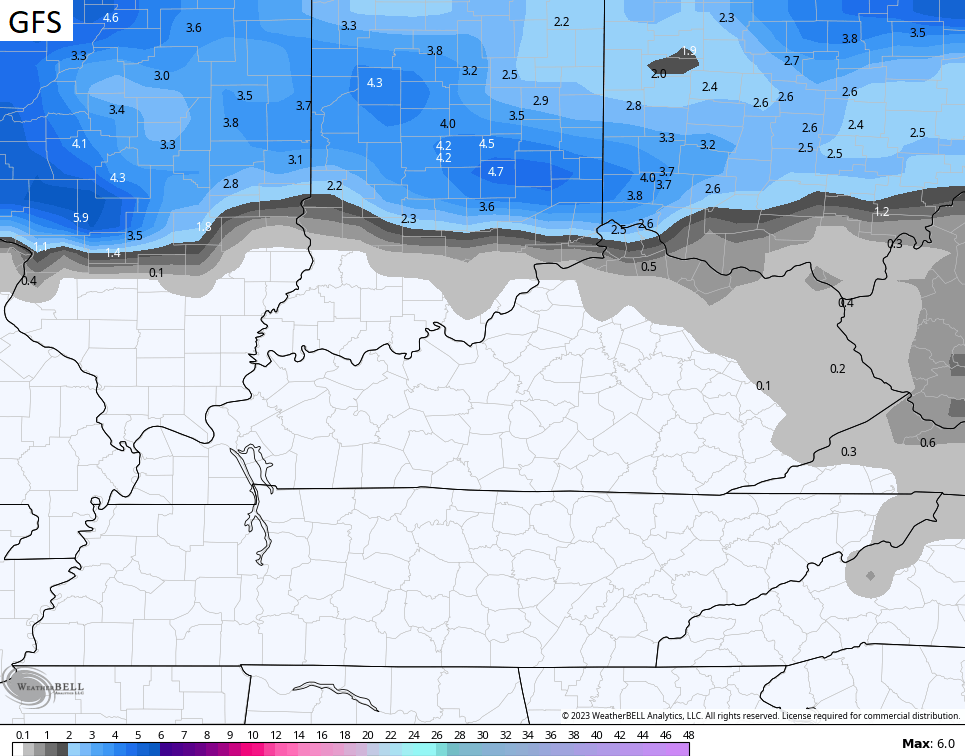
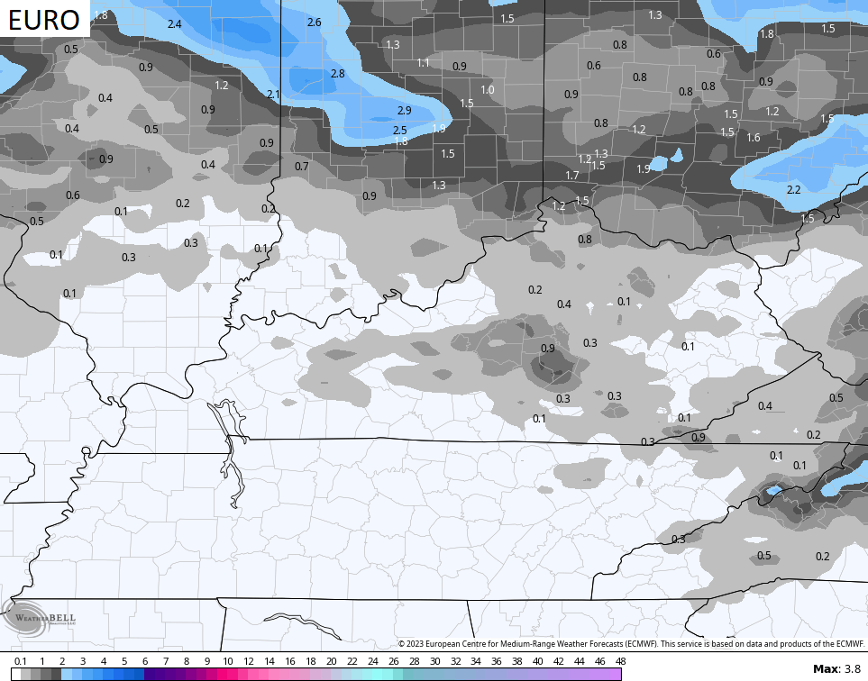
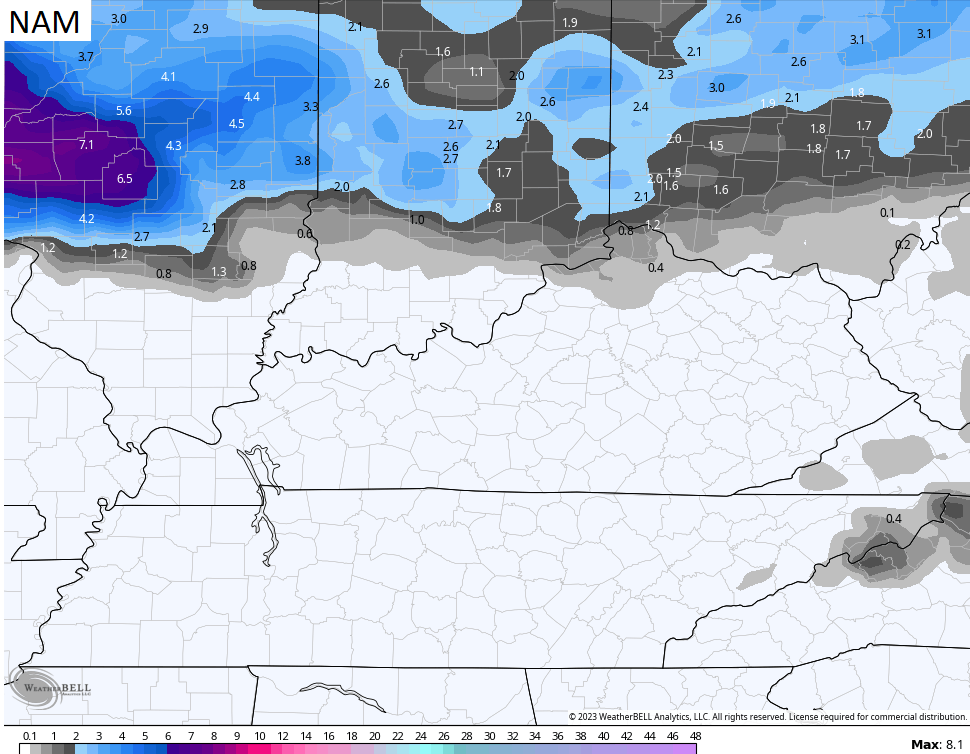
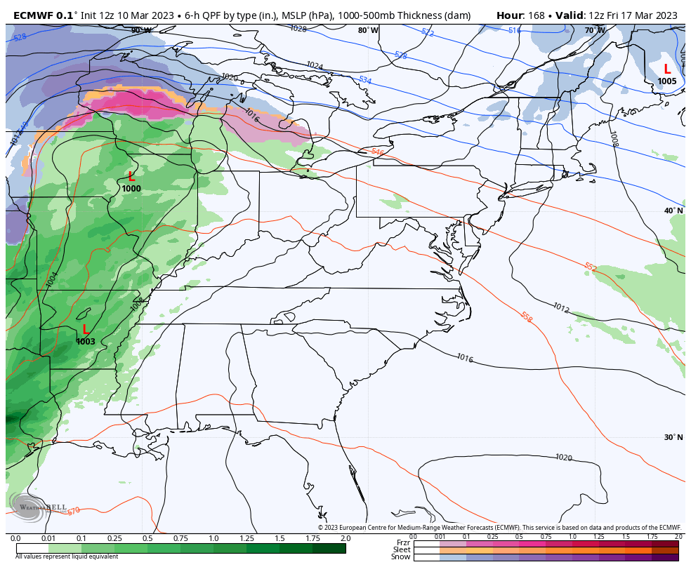
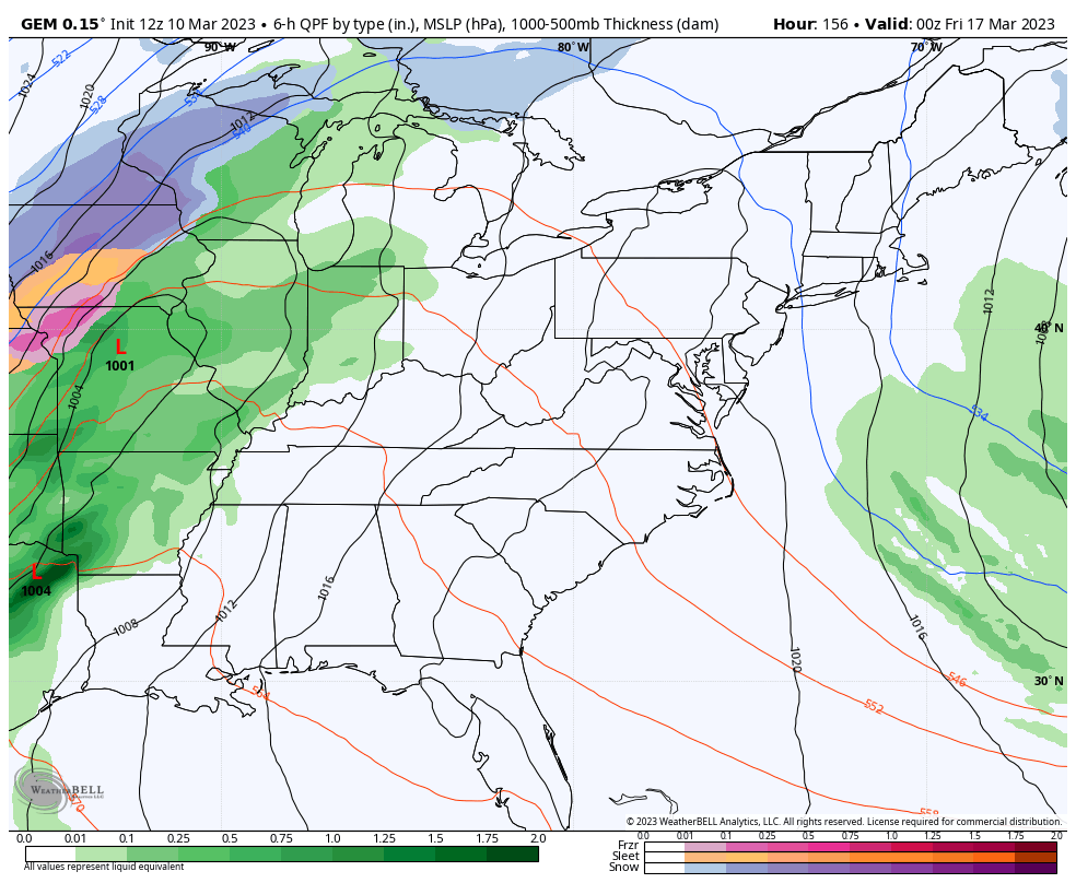
Here’s a look at some of the model forecasts for snow on Sunday…
Temps will be cold for Monday and Tuesday with highs in the upper 30s and low 40s. A few flurries and snow showers will be possible across the central and east.
Temps rebound for Wednesday and Thursday and should feel pretty good. This is ahead of another system working in here for Friday. That unleashes more cold and the chance for some winter weather…
EURO
CANADIAN
Enjoy the evening and take care.
