Good Saturday, everyone. Our weekend is off and running with colder than normal temps and another system working in from the west. This brings rain for many areas tonight and Sunday, but will also bring a little bit of snow with it in the north.
Our day is starting out with temps in the upper 20s to low 30s with a few flakes flying in the east. As the day wears on, skies are partly to mostly cloudy with temps mainly in the 40s. A 50 is possible in the west and south.
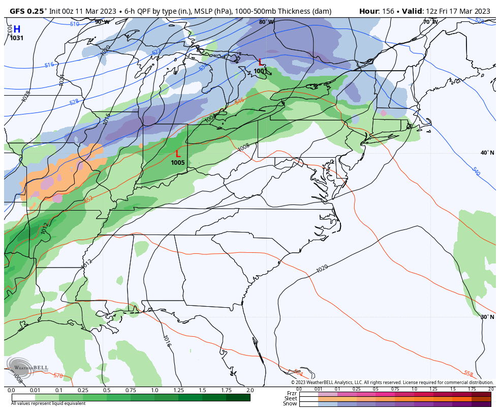
Rain will arrive from west to east from late this afternoon into the evening. Here are your radars for the day…

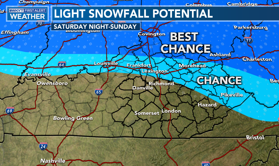
The system moving in will have a stripe of light snow with it on the northern and eastern edges. The best chance for some slush will be later tonight and early Sunday in the north…
The heaviest precipitation will taper from west to east during the day with temps ranging from the upper 30s to upper 40s.
Much colder air then filters in from Sunday night through Tuesday, bringing the chance for some flurries and snow showers in on a strong northwest flow.
Once this bounces out of here, temps rebound nicely for Wednesday and Thursday, but another cold blast is set to arrive Friday. That will be accompanied by another rain to potential winter weather maker…
The overall flow for the middle of the month is a cold one with a deep trough across much of the country…
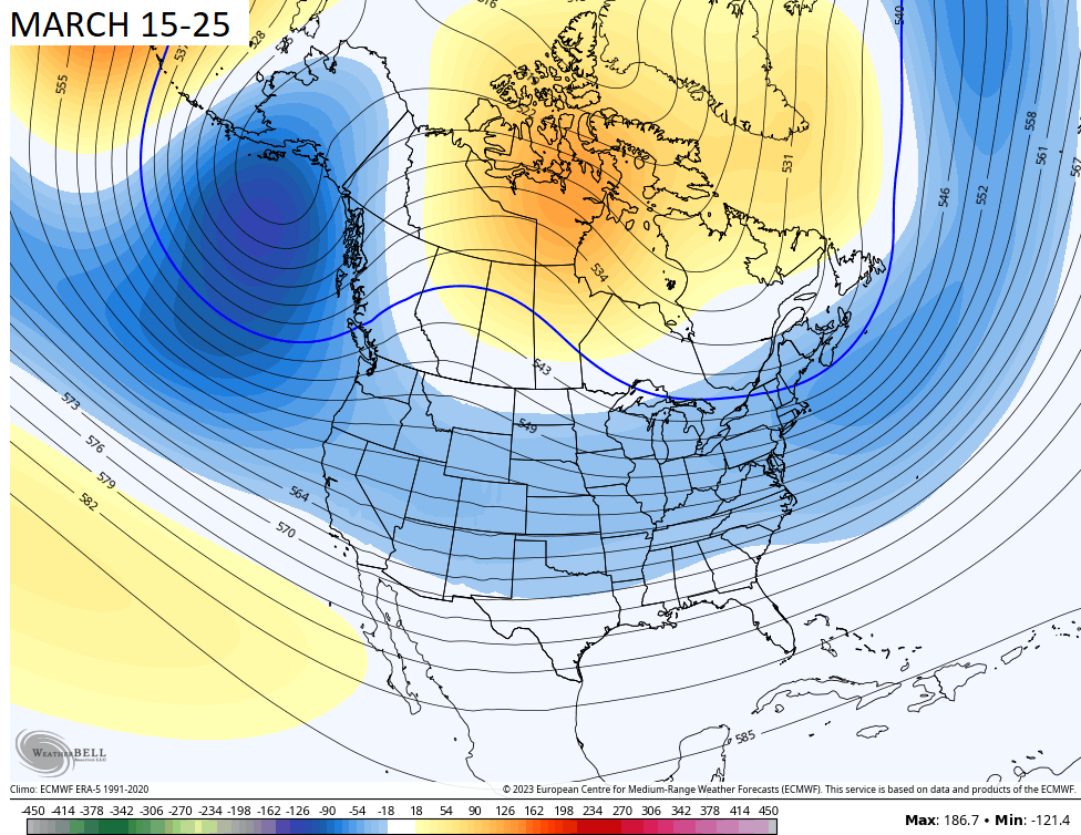
That brings us much colder than normal temperatures to go along with a few more snow chances.
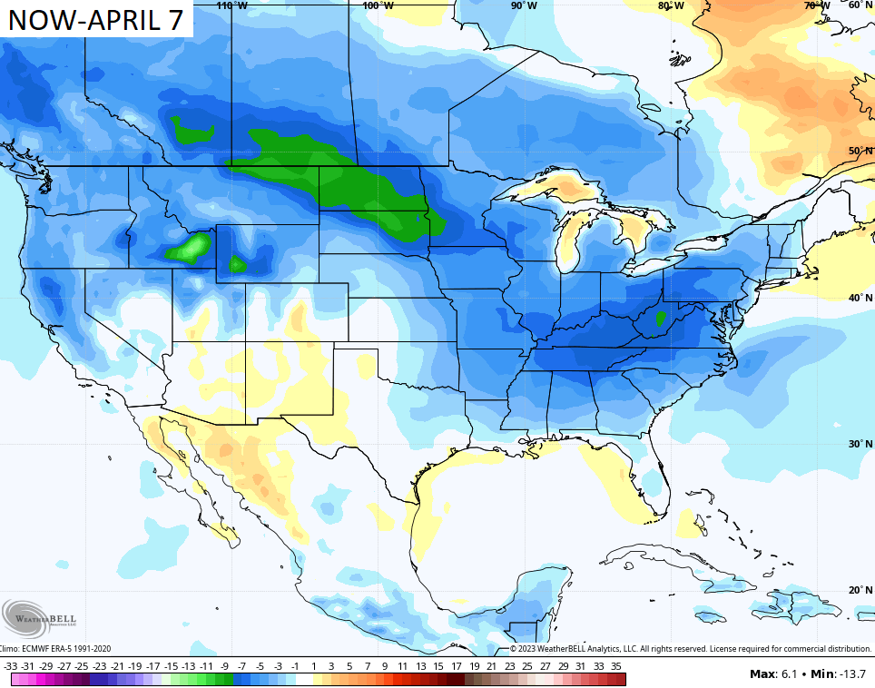
This pattern, unfortunately, looks like it will linger into early April. Look at how much of the country is colder than normal over the next 30s days on the GFS Extended…
What the what?!
I’ll drop by for another update later today. Make it a good one and take care.

Aside from late December’s big freeze, Winter in South Central Kentucky has been a bust, and though the forecast over the next several weeks will trend below normal, I think that our chances for measurable snow or even flurries during that period will be slim to none.
Latest ENSO discussion, effective 3/9/2023:
https://www.cpc.ncep.noaa.gov/products/analysis_monitoring/enso_advisory/ensodisc.shtml#:~:text=Synopsis%3A%20A%20transition%20from%20La,Ocean%20%5BFig.%201%5D
I agree Joe.
Here’s this month’s article on the ENSO Blog :
https://www.climate.gov/news-features/blogs/march-2023-enso-update-no-more-la-ni%C3%B1a
Went into town yesterday morning and saw the early flowering ornamental trees in full bloom. It was beautiful despite the gloomy weather in place. This morning I saw the phrase in my local forecast ” hard freeze and frost warning. ” No surprise here. This Spring along with other Springs of the past have really been disappointing for horticulturist to say the least. My one Rhododendron ( cold hardy Catawba ) had sixteen flower buds on and was really going to put on quite a show, but now not, due to the intense dry, frigid cold with no Snow cover at Christmas. I’ve now given up on growing any plant here in Maple. I don’t think that Central Kentucky has the humidity needed to grow Rhododendrons and Azaleas. Where I had my nursery several years ago, we had more humidity and my plants flourish.
My azalea bushes, which appeared to have been badly damaged by the late December sub-zero freeze, began showing hints of green during the most recent warm spells. I’m hopeful that it will pick back up once Spring takes hold.
Joe, if those azaleas don’t come back I would replace them with a foundation plant that’s commonly grown in the Bowling Green area so you won’t be disappointed at their performance ever again.
In my area Azaleas, Rhododendrons and American Hollies won’t do well due to the Winters being so dry when we have Arctic like temperatures. Humidity is not high enough during frigid spells to sustain the plant’s requirements.
I think the lack of humidity during very cold spells is the reason we see very few Winters with heavy Snow events.