Good evening, folks. After a decent weather day for many, rain and some light snow roll across the region tonight and Sunday. This band of light snow can put down some slushy accumulations across the north.
Rain is progressing across western Kentucky and moving into central Kentucky during the evening. Here are your radars to follow along…

The northern edge of this may be in the form of light snow later tonight and early Sunday. Light slushy accumulations will be possible in the areas I’ve been highlighting…
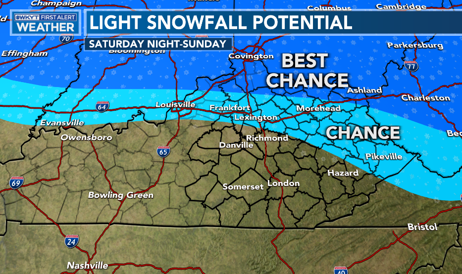
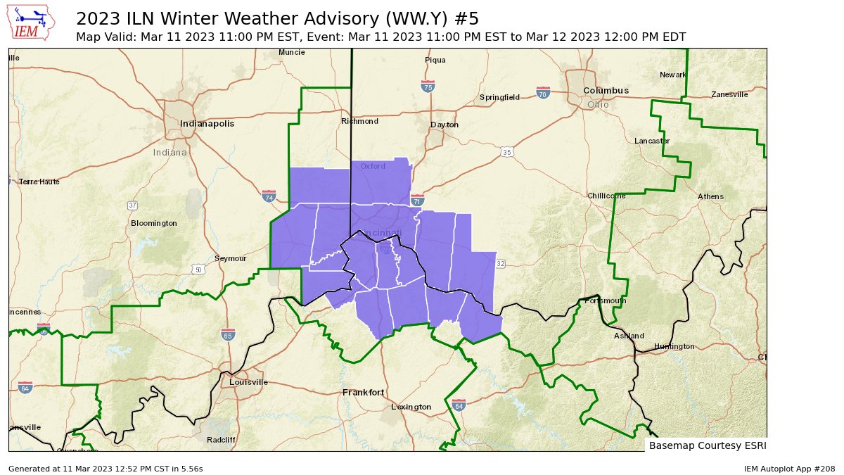
A Winter Weather Advisory is out for the far north tonight…
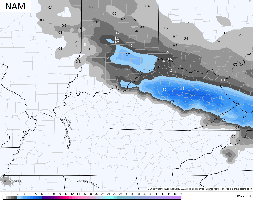
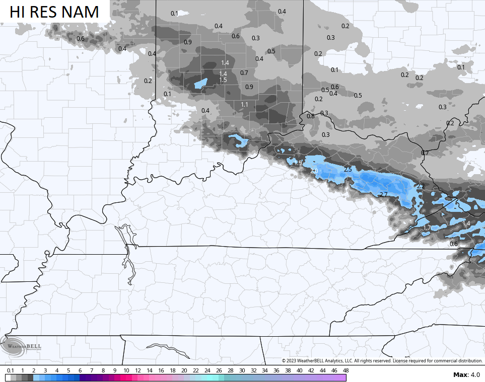
A few of the late day short range models are showing a little bit of a thumper snow possible farther south than that. The NAM and HI RES NAM are thumping away…
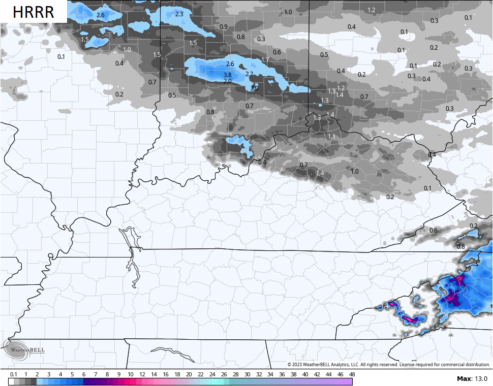
The HRRR isn’t to that extreme, but it’s a bit south…
Other models are more in line with the north and northeast having the best chance of some slush…
This will be followed by colder weather coming in for Monday and Tuesday with a few flurries or snow showers possible.
While all this is happening, folks in New England are getting ready for a blizzard…
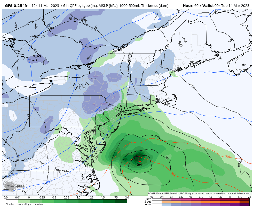
Road trip, anyone? 🏎️
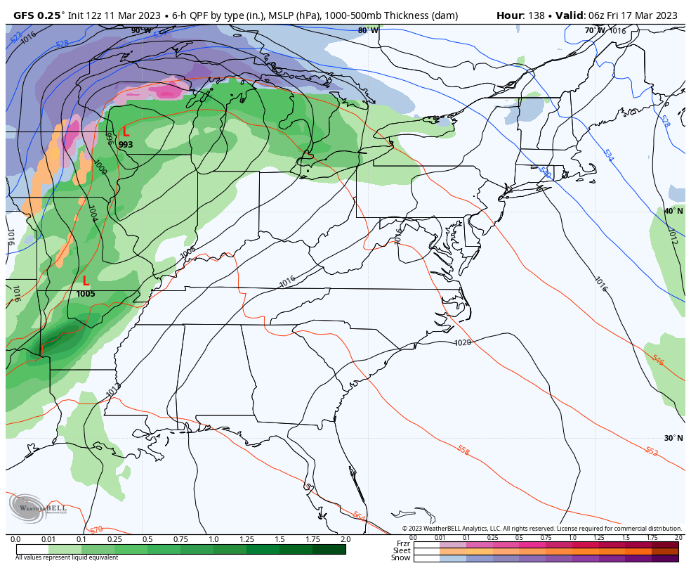
Back here in Kentucky, temps spike for Wednesday and Thursday ahead of another big cold blast coming for next weekend. That arrives on Friday as a strong cold front sweeps in with a possible wave of low pressure along it.
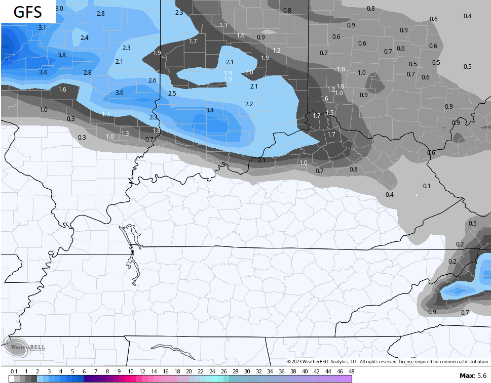
This shows up well on the GFS…
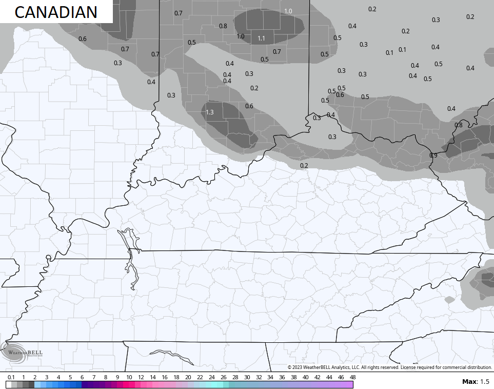
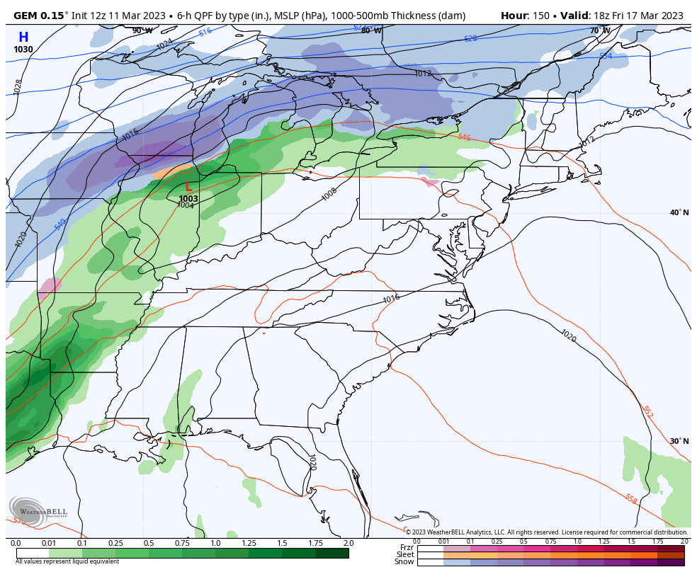
The Canadian is similar…
#TeamSpring ain’t happy.
Have a great rest of your day and take care.

Not much to be excited about.
Cant buy a flake of snow in central Ky . One of the absolute worst snow starved winters I can remember.
My total Snowfall for the Winter is 1.8 inches. Less Snow I have ever seen in any Winter. Last Snowstorm was in 2015, and it wasn’t very impressive. I really believe the reason is our geographic location and a very dominant Southeast Ridge.
Well, it is what is I reckon. I’m a snow lover and this winter has been so disappointing, but I’m just ready for Spring now.