Good Monday, everyone. We’ve made it to the middle of the month and, right on cue, Old Man Winter is showing up across Kentucky. This is bringing frigid temps and the chance for snow showers and flurries to start the week, with another potent cold front set to end it.
Before we get into the weather of the future, let’s take a look back at one of the all-time great storms to hit our region. The “Storm Of The Century” was pummeling our region 30 years ago right now. This historic late winter blizzard crushed central and eastern Kentucky. Let’s look back:
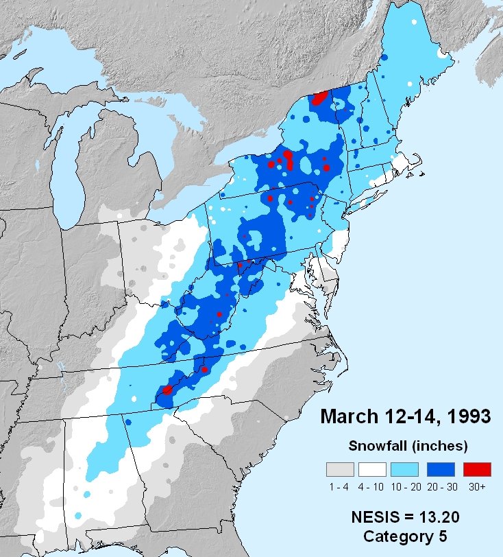
- This storm brought 6 to 30 inches of snow to central and eastern Kentucky from March 12-14, 1993.
- High winds accompanied the snow, resulting in blizzard conditions and snow drifts of 6 to 10 feet.
- Interstate 75 was closed from Lexington to the Tennessee border and Interstate 64 was closed from Lexington to the West Virginia border, both for a period of two days.
- Between 3,000 and 4,000 motorists were stranded along both highways, causing emergency shelters to be set up in several locations.
- Some of the highest totals were in eastern Kentucky. Hazard – 30 inches, Pikeville – 24 inches, Ashland – 22 inches, and London – 22 inches.
- At the Jackson National Weather Service Office, 19.8 inches fell in 24 hours.
- At Hazard, the 24 hour snowfall record for the state of Kentucky was set as 25 inches fell.
- In the higher terrain of Harlan County, 4 to 5 feet of snow were reported around the community of Mary Ellen.
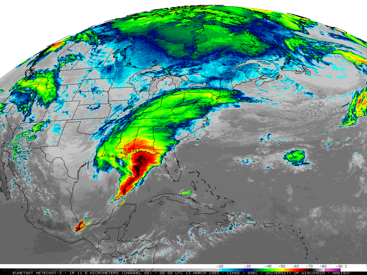
This storm impacted everyone east of the Mississippi River from the Gulf of Mexico to Canada. Check out this amazing animation of this monster…
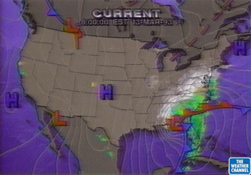
If you’re a true weather geek from way back, this animation from the younger years of The Weather Channel will bring back some memories…
The snowfall was staggering as it put down snow from the Florida Panhandle to Canada…
This was a true blizzard from Mississippi, Alabama and Georgia all the way to Canada. Now THAT is a storm, folks!!!
In terms of the weather out there today, we have snow showers and flurries dropping in from the northwest. This action will continue through Tuesday morning and there’s even the chance for a few hit and run coatings, especially tonight.
Here are your Monday flake tracking toys…

Go to our weathercams page to check out the views from across the state…
Temps are the other big story with many of us staying in the upper 30s today and Tuesday. Winds will make it feel even colder, especially Tuesday morning when wind chills are deep into the teens…

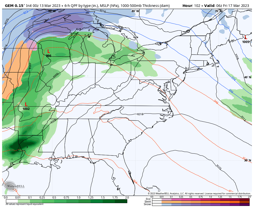
Temps will bounce back in a good way by Wednesday and Thursday ahead of another big cold front due in here for Friday. This will have rain and gusty winds ahead of it with a major temp crash behind it. We will need to watch for a wave of low pressure along the front as it moves just to our east.
The GFS…
Canadian…
That’s a pattern that may spawn a southern stream storm system early next week. The signal is there.
I will have another update later today. Until then, make it a good one and take care.

It won’t be cold much longer.
Thanks Chris. Interesting synopsis of the March storm of 1993. I was living in Southwest Indiana at the time, so we miss out on the storm. Just a cold and windy day. At that time we were in a strong El Nino.
Schroeder did you ever hear of Bargersville Indiana?? My sister lives there it’s near Greenwood Indiana but she says even up there it has been a mild winter compared to other winters.
Yep, Bargersville, Indiana is just South of Indianapolis in Johnson County. The blizzard of 1978 closed about every area up that way. My younger sister lives in Mulberry, Indiana and they had some Snowy days this Winter.
Super Storm 93 had to drive thru 7 ft. drifts to get cooks for a loca rehab. school it was a rough 4 days
Has anyone else had trouble getting comment to post? Thanks Chris For posting this radar and animation. Great memories! Kentucky sure has changed.
It is frustrating to not have your comments recorded after writing a long @n@lsis.
I wish Chris would remove the PPF from this website.
If somebody is using profanity have them removed or put into a timeout.
Hoping we phase into an El Nino for next Fall and Winter, but NOAA is not sure this will happen ? We are in neutral now and is expected to last through the Summer.
Here is an in-depth article about “The Storm of the Century” from Wikipedia.
https://en.wikipedia.org/wiki/1993_Storm_of_the_Century
This amazing storm caused $5.5 billion dollars worth of damage and killed 318 people.
Thanks for sharing Mike. I remember the usually cool Summer of 1991 due to the eruption of Mount Pinatubo. If that was the cause for the blizzard of 1993 that would be extremely interesting.