Good Tuesday, folks. It’s another windy and cold day in the Bluegrass state with a little bit of snow thrown in for good measure. After a short break over the next few days, wintertime flexes again for the upcoming weekend.
Wind chills this morning are in the upper teens for some areas with temps in the 20s. A few flurries and snow showers continue across central and eastern Kentucky and there’s the chance for a small accumulation in spots.
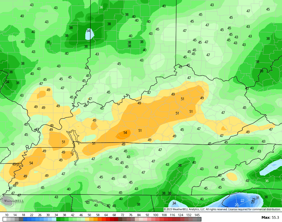
Here are your radars to follow the flakes…

Temps tonight reach 20-25 in most areas with a few spots reaching the upper teens. Better air blows in during the afternoon with temps flirting with 50 for many and even hitting the low 50s for some. That bleeds over into a milder Thursday with temps reaching the middle 50s to low 60s.
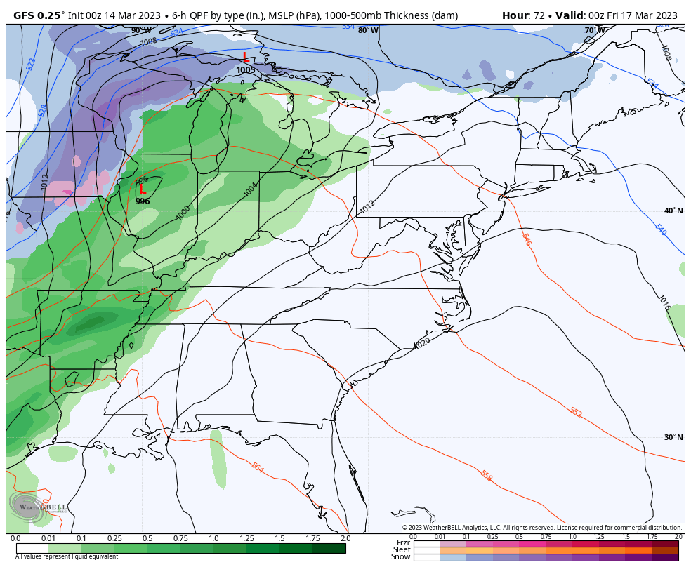
That comes on a strong southwest wind gusting ahead of a strong cold front arriving on Friday. Wind gusts will top 40mph at times with this front as it barrels through from west to east, bringing rain along for the ride. Some gusts of 50mph will be possible…
A few flakes may fly right behind the front with some flurries or snow showers possible over the weekend. The GFS is even showing my wave of low pressure idea along the front…
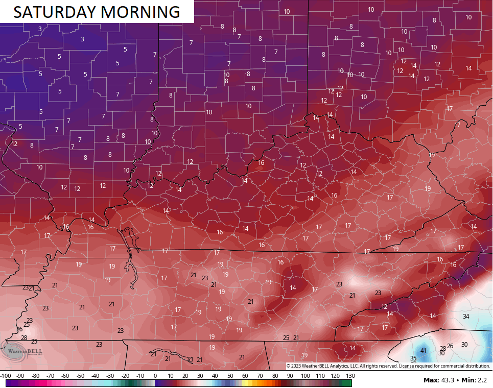
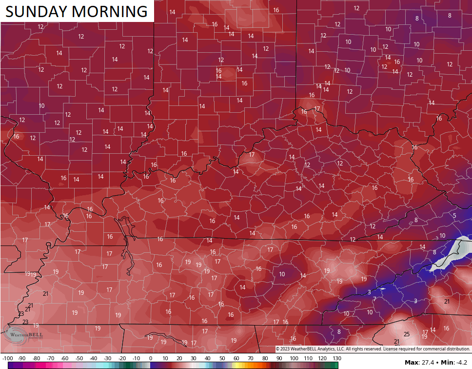
 Temps are frigid once again with wind chills approaching 10 degrees by Saturday and Sunday mornings…
I want my spring!!! 🤬🤬
Another update comes your way later today. Until then, have a good one and take care.

Snow flurries the last time I looked out very cold.
Well at least the wind will only be topping out at 40mph.
It’s just like it’s been all Winter all the Snow well to our North. Not even a Snow flurry here in Maple. Mother Nature please lets have Spring. I’m tired of this ‘ cat and mouse ‘ game of a Winter.
please
The cold weather is a result of the HAARP…..just a distraction from the banks going belly up. Stock up on firewood, water, gold, and medicines. Looks like the collapse is upon us.
The World is going in the left’s direction, but GOD will soon step in and restore our Great Country’s freedom The United States of America.
There’s a Special Weather Statement out for all of Central Kentucky and Southern Indiana today for a hard freeze overnight. The local fcst in BG is calling for a low around 24°F, and that could spell disaster for local peach orchards, as their trees have begun to blossom.
You are right fruit trees are in jeopardy.
Easy to predict hard Spring freeze damage when you have a mild January / February when fruit tree’s dormancy along with early flowering ornamentals has been satisfied. Seems to happen quite often in the Ohio Valley. Up North where those areas had Snow all Winter and consistent cold will have a normal Spring with a bounty of fruit. It’s aggravating and disappointing to grow any kind of early flowering shrub or trees in our climate. It’s better to plant annuals and plants or trees that are native.
If your using Windows 10 you can post on Chris’s Blog, but if your using Windows 11 you will have trouble logging on. Don’t know why this is ?
Schroeder I had trouble logging in this morning but it’s fine now.
I logged early this morning on Window 11, but when I logged off and then went back I was unable to log on until now. The trick is to stay logged in always.