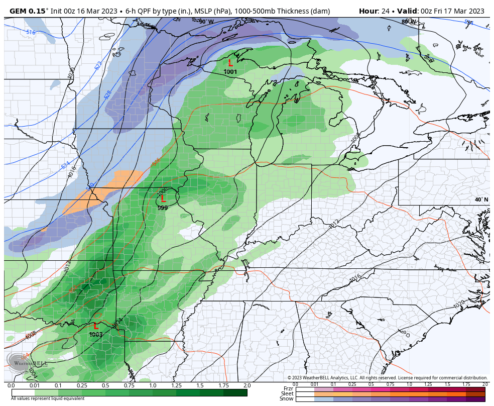
Good Thursday, everyone. Today is by far and away the best weather day of the week as we get set for another cold front to slam in here on Friday. That brings more in the way of frigid temps for the weekend and will be introduced by rain and gusty winds.
Temps out there today will reach the upper 50s to middle 60s. Clouds and winds will both increase this afternoon and evening as a strong cold front moves closer from the west. Rain will move into western Kentucky. Here are your radars to track that in from the west…

Here’s a breakdown of how the front plays out:
- Widespread rain and a rumble of thunder will be possible ahead of the front late tonight and Friday morning.
- Wind gusts along and ahead of the front may reach 40mph-50mph at times.
- Temps crash from west to east Friday. Temps are into the 50s ahead of the front and reach the 30s after it passes.
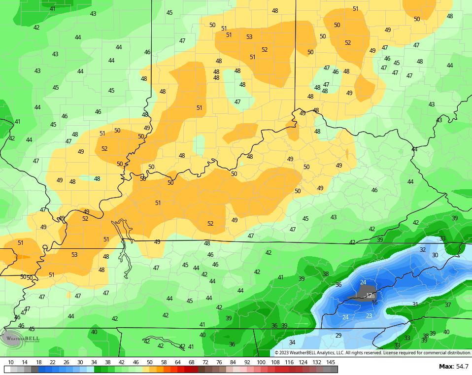
- The weekend will feature a few flurries or snow showers on Saturday.
- Temps are in the 30s for highs with lows dropping into the upper teens and low 20s by Sunday morning.
- Wind chills are way down this weekend and may bottom out around 10 degrees early Sunday.
Here’s this system as a whole…
As mentioned, winds are going to be a big time player. Check out those gusts later tonight and early Friday…
The pattern behind this looks like it keeps the southern storm system to our southeast into the middle of next week, allowing temps to respond with some pleasant days. That could set the stage for a strong thunderstorm maker by the end of the week…

As long as it means milder temps, I’m in! 😁
I’ll see you with another update later today. Until then, have a good day and take care.

Thanks Chris. I have a few choirs to do outdoors and this sounds like the day to get that done. The native trees at my place are still quite dormant and that’s a good thing. After the coming week Spring weather may take hold along with the usual thunderstorm events. Enjoy the day.
It will be nice day to be outside.
I am going to try to complete all outdoor activities before the tournament starts at13:00. (Glued to the tv).
I got my choirs completed and one of those choirs was to remove more than 20 frozen buds off the Rhododendron and to apply some slow release fertilizer 38-0-0 nitro-form and watered it in, so it will have a good chance to recover from that awful freeze we had last Christmas.
Looking at NOAA’s latest chart of the Pacific and found That the SST along the West Coast are showing cooler than normal temperatures despite that La Nina has phased to ENSO / neutral. La Nina is still playing around with the atmosphere. No change in overall weather pattern across the US.
Here’s the latest Chart from NOAA :
https://www.ospo.noaa.gov/Products/ocean/sst/anomaly/
NOAA today released the Spring Outlook (April, May, and June) for drought, temperature, and precipitation.
We sure don’t have to worry about any drought developing. In fact, there is a risk for at least some minor flooding this Spring east of the Mississippi River.
Above-normal temperatures are favored for much of the southern and eastern half of the US.
Here is the link: https://noaa.gov/news-release/spring-outlook-california-drought-cut-by-half-with-more-relief-to-come
Thanks for sharing Mike. It’s just what I expected. Even in an ENSO / neutral the Southeast Ridge still dominates and most of the rains will be North of the Ohio River ( AMJ. ) Next Fall and Winter may feature the same tired old weather pattern. A fourth year La Nina is not yet off NOAA’s weather table.
Thanks for sharing Mike. It’s just what I expected. Even in an ENSO / neutral the Southeast Ridge still dominates and most of the rains will be North of the Ohio River ( AMJ. ) Next Fall and Winter may feature the same tired old weather pattern. A fourth year La Nina is not yet off NOAA’s weather table.
Sorry for the double click. Oops