Good Saturday, everyone. It’s an absolutely frigid weekend across Kentucky and it’s starting out with a few flakes. The extreme cold will move out early next week with much milder air taking over for the middle and end of next week.
Let’s begin with what’s going today.
Winds are very gusty as another cold front sweeps through the region. This is bringing a few flurries and snow showers along for the ride. This isn’t that widespread, but our radars will pick up on some of the scattered stuff…

Cold winds are a big player and make today’s 30s feel like the 20s. Temps tonight absolutely tank with readings likely deep into the teens with a wind chill closer to 10.
Sunday features skies becoming mostly sunny, but it’s flat out frigid! Highs are only in the 30s with a wind chills below freezing.
After starting out in the upper teens and low 20s, Monday sees a nice recovery in temps. Many of us will be in the 45-50 degree range by the afternoon. This sets the stage for milder winds to blow for the middle and end of next week.
Some scattered showers and storms may show up as early as Wednesday as a strong storm system gathers steam and rolls toward us by Friday…
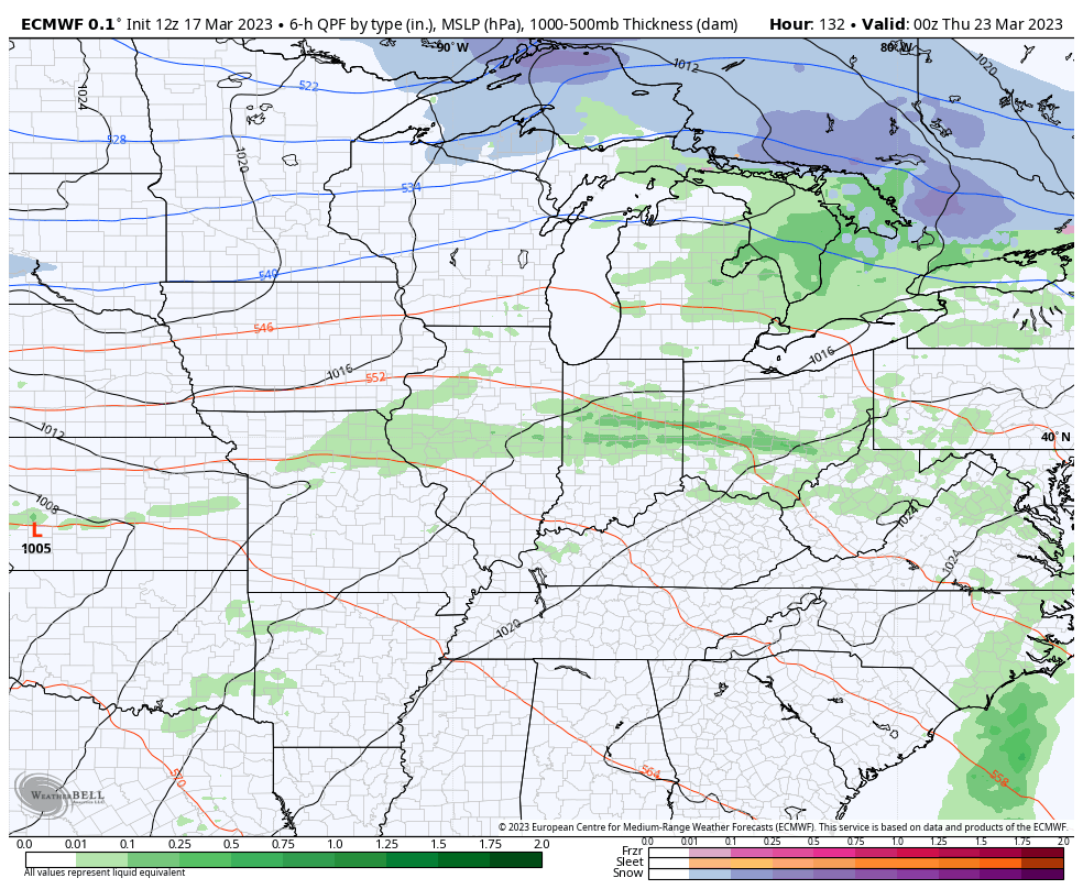
That setup may bring strong storms to the region on Friday and that’s something for us to watch for in the coming days.
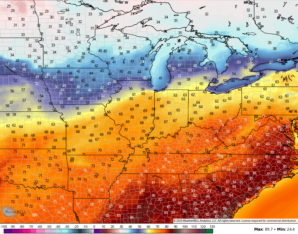
Temps ahead of this storm may spike toward the 70s…
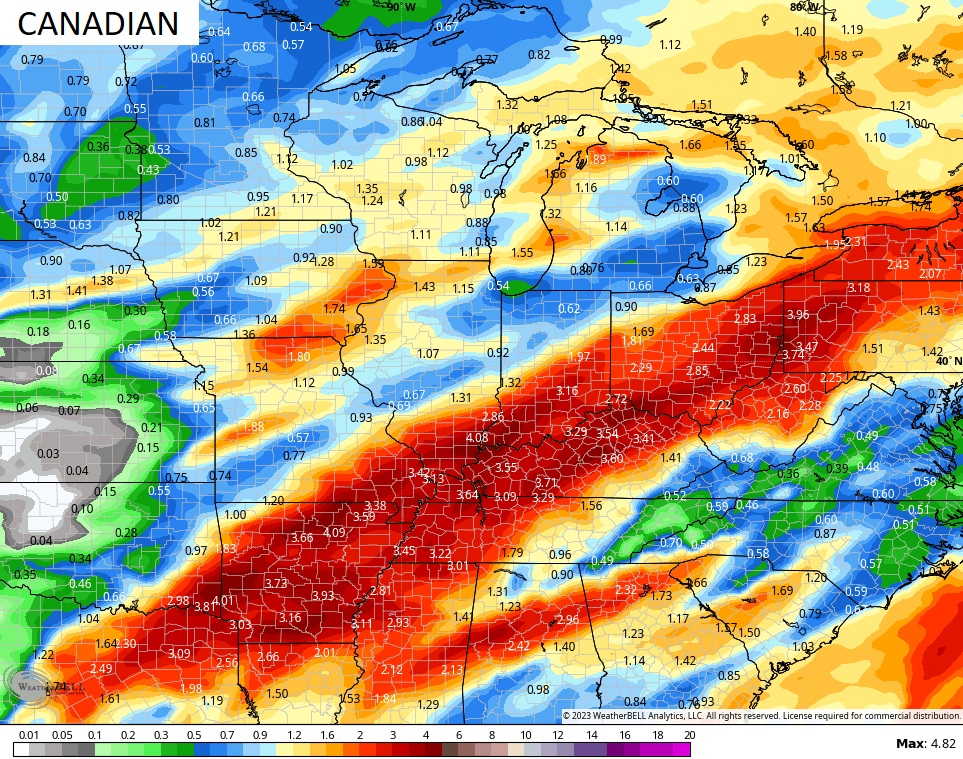
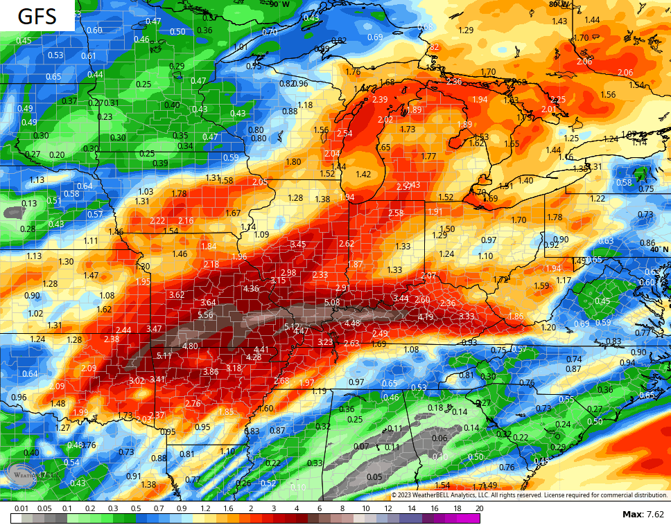
There’s a lot of back and forth in the pattern ahead and that’s usually good for a very active setup across our region. The models are beginning to sniff that out with 10 day rainfall totals that are way up there…
Make it a great Saturday and take care.

Thanks Chris. I’ll be glad when the word frigid is gone in all weather forecast along with Snow flurries and Snow showers, which my area never receives anymore. Looking forward to the milder days, but not the high winds.
Enjoy the ” March Madness “
When I got off work this morning shortly before 8 AM, it was a brutally cold 12 degrees with a gusty wind from the West making it feel like 5 below zero! For it to get this cold so late in the season with no snow on the ground is very impressive.
There’s wind-blown light snow on occasion today in the Chicago Metro Area, but nothing more than a dusting in spots.