Good Tuesday, folks. It’s a much better feeling day across the region as milder air begins to flex a bit. This flex will give way to a stormy setup that will do some flexing of its own with the potential for heavy rain and some strong storms.
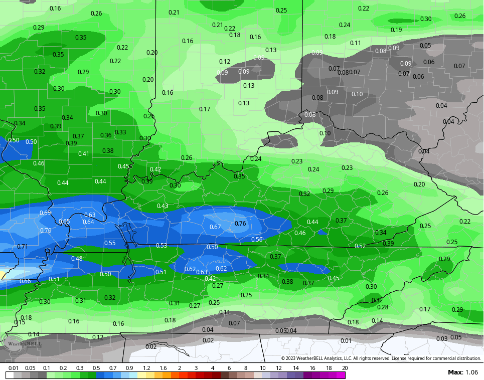
Temps today range from the upper 50s to low 60s for most of the state. Clouds will thicken as we get set for rain to roll in from the west this evening into Wednesday. This isn’t constant stuff, but some decent totals show up…
This is along a surge of much warmer air blowing in from the southwest. Temps for Thursday reach 70-75 on a gusty southwest wind and just the chance for a shower or storm going up.
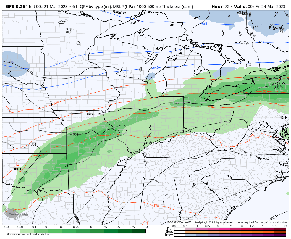
The setup after this will feature waves of showers and thunderstorms move into the region from Friday into Saturday. Heavy rain is likely for much of the region…
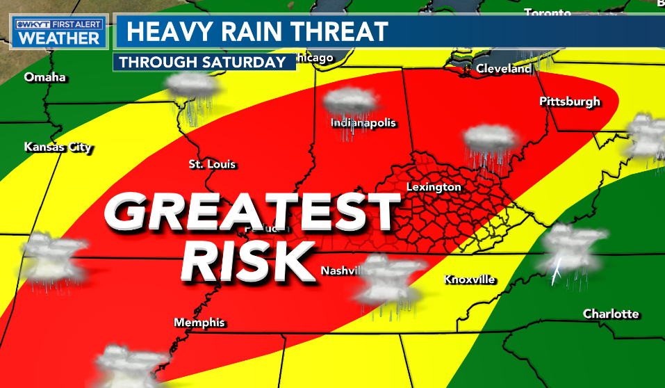
This happens as a front moves in and stalls Friday and hangs around until a stronger low pressure clears it out on Saturday. The end result will be waves of heavy rain producing showers and storms…
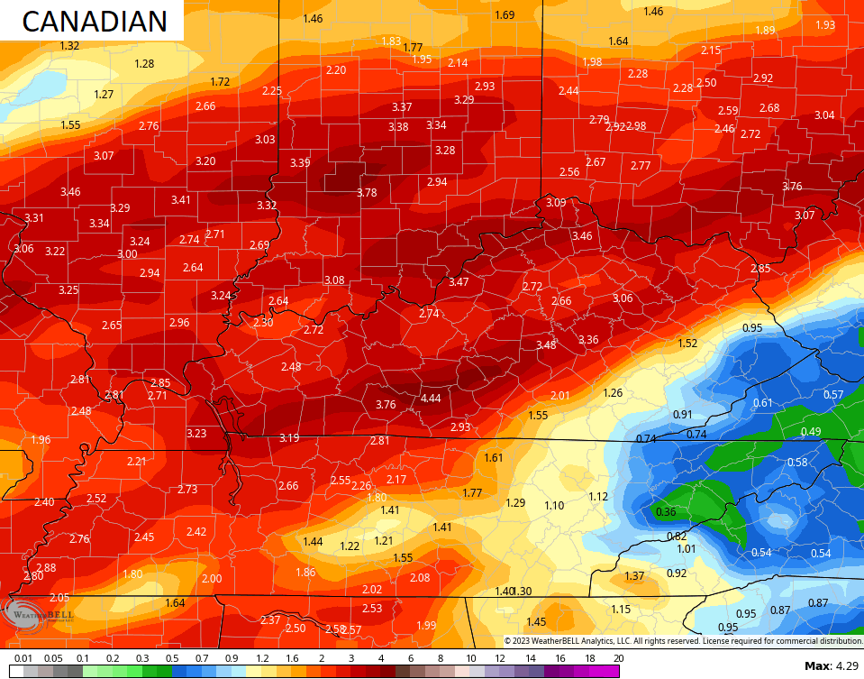
The models are spitting out some concerning totals…
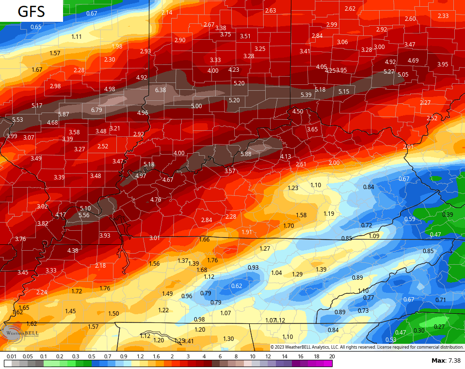
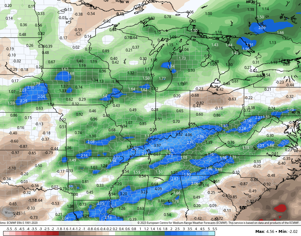
This overall stormy setup continues to be backed up by the various ensembles. The GFS shows well above normal numbers over the next 2 weeks…
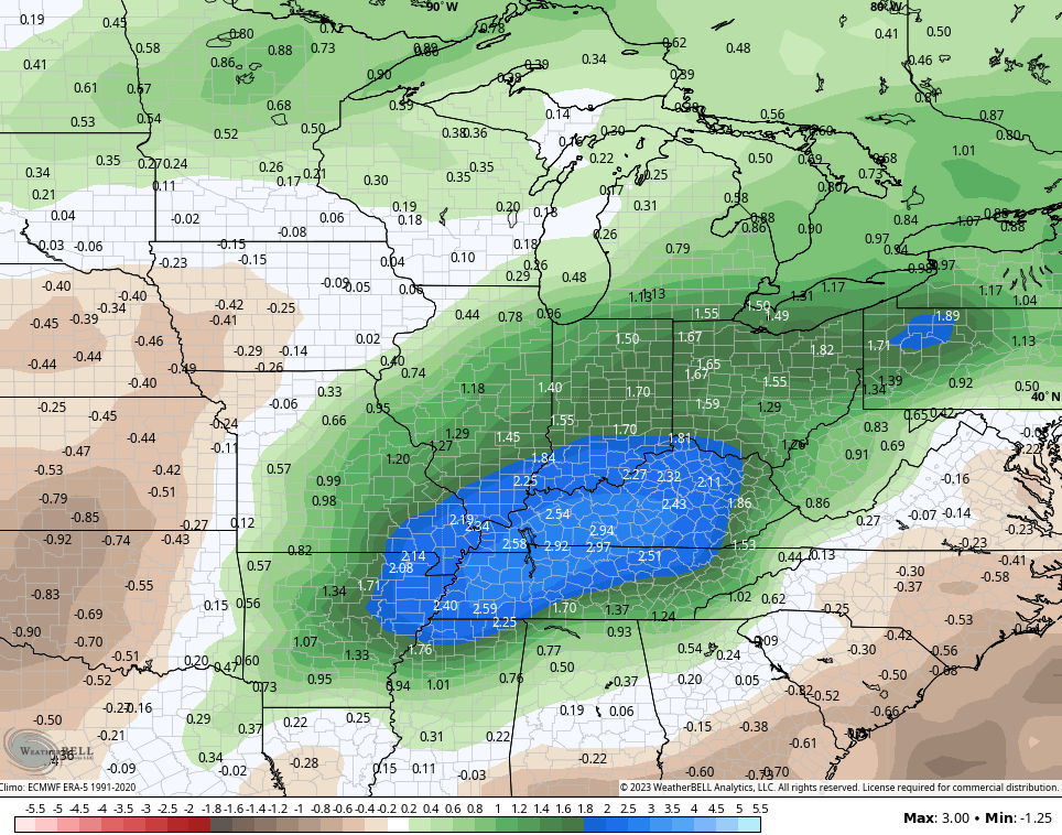
The Control Run of the EURO Ensembles…
I see no reason for this pattern to go away as we go through the month of April.
I leave you with your radars to track the rain into western Kentucky…

Make it a great day and take care.

Yesterday I went outside an investigative my plants around the home.
They seem to be doing fine.
My plants really took a brutal beating from the December freeze. I’m hoping they will all recover when the warm rains of Spring take over.
I don’t see April being a washout.