Good Wednesday to one and all. It’s a rather ugly day across the state as we get set for rounds of heavy rain and storms. This action targets us Friday and Saturday and could bring strong storms and flooding rains to the region.
Let’s start with today and roll forward. A few showers are pushing across the region as a warm front lifts northward through the area. These showers aren’t all day, so expect several dry hours.
Here are your radars…

Thursday is a much better day with temps surging toward 70-75 for most areas. Winds will gust up with a mix of sun and clouds and a small chance for showers and storms. The best chance is across the north as a front works toward the region.
That front stalls near the Ohio River on Friday as waves of showers and storms develop and roll along it. This means the best threat for heavy rain is across the west and north with drier and warmer times south of this. That boundary hangs around until low pressure works into the region on Saturday.
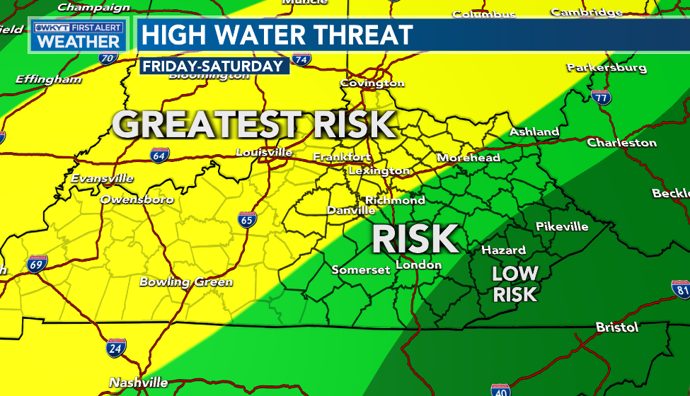
This setup means, at least, a local high water threat across parts of the state. Here’s the early look at the risk…
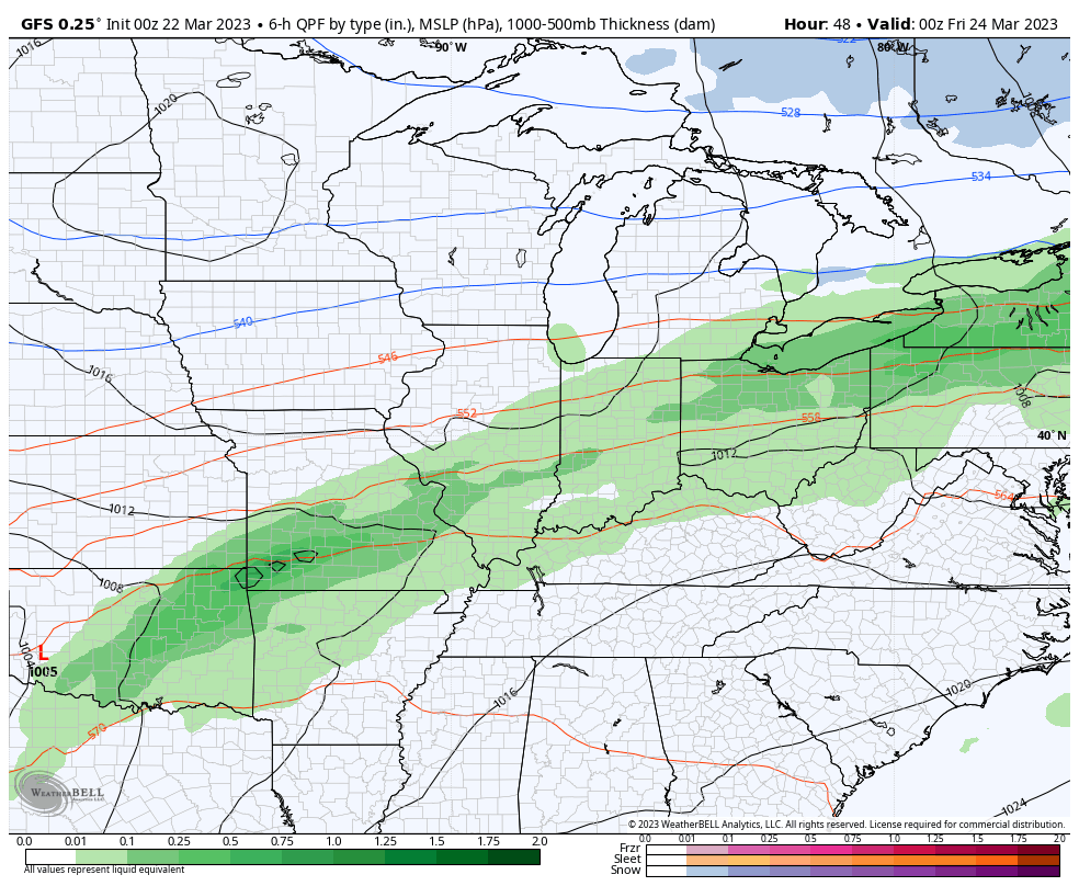
Depending on where this front stalls and the track of that low, the potential for a few strong to severe storms is also there. The Storm Prediction Center shows the best chance for Friday is across the west…

That threat then focuses farther east Friday night and Saturday morning.
Here’s a look at this whole scenario…
Once this moves away, we focus on another storm system coming at us with some showers and storms Sunday night and Monday. Another cold setup looks to follow into the middle and end of next week.
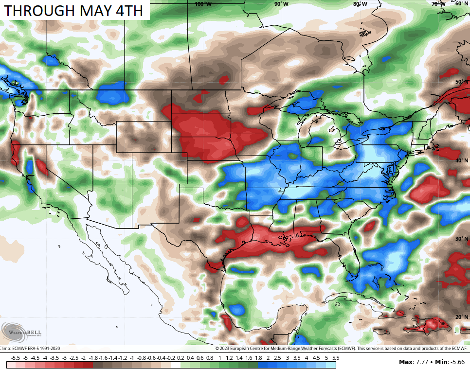
This colder than normal pattern is likely to hang tough into April. It’s also likely to feature a continuation of above normal rainfall. The EURO weeklies show the above normal bullseye right on top of us through May 4th…

I will drop by for another update later today. Make it a wonderful Wednesday and take care.

Gloomy.
Thanks Chris. Looks like a typical start to Spring in the Ohio River Valley. Hoping for a bountiful growing season ahead.
Long range models aren’t the most accurate most times.