Good Tuesday, folks. We continue to track another potent storm system toward the region for the end of the week into the start of the weekend. This brings the potential for (Stop me if you’ve heard this one before) severe storms, heavy rain and high winds.
Before we get into all that, let’s concentrate on the precious present. It’s a windy and seasonably chilly day with highs in the 50s with a mix of sun and clouds. There’s the chance for a stray shower or two late today into tonight, esepcially across the north and east. Here are your radars in case they show up…

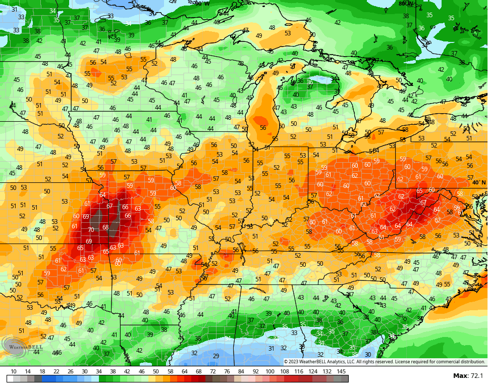
Chilly winds blow again on Wednesday, but those winds flip around for Thursday. That’s a southwest wind kicking in and it boosts temps into the 60s with the chance for a 70 in the west. Clouds will increase late in the day with the chance for a shower or storm showing up in the west by Thursday night.
The pattern for Friday and Saturday continues to have the look for much of our region…
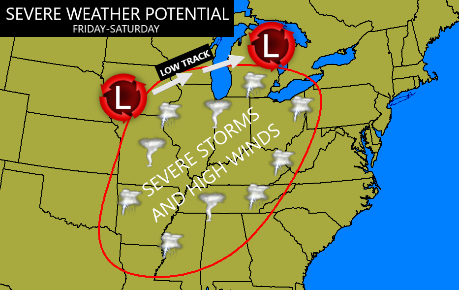
Rounds of storms will develop Thursday night and Friday as warm air surges in from the southwest. As the system ejects from the Midwest to the Great Lakes, strong to severe storms develop in the Mississippi Valley and sweep eastward late Friday into early Saturday. Damaging winds and a few tornadoes will be possible, especially in the western half of the state.
Once the line of storms moves through, high winds are likely to develop once again. This is a scenario we’ve seen on more than one occasion over the past few months. Non-thunderstorm wind gusts of 50mph-60mph will be possible once again…
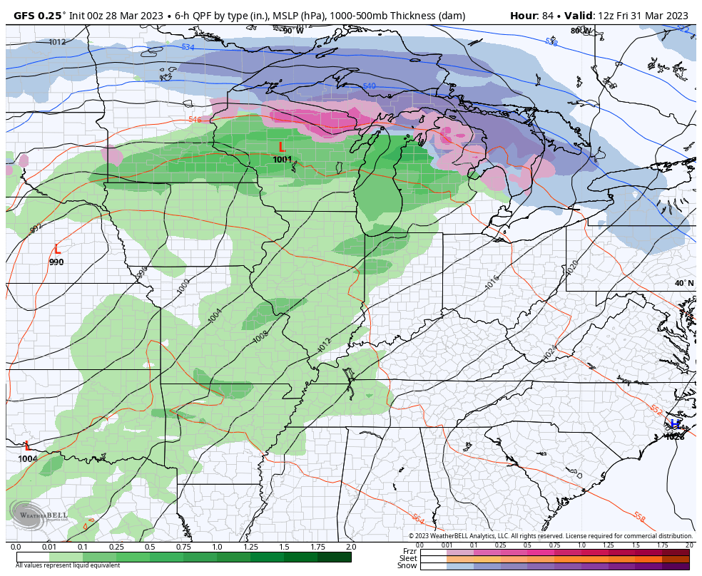
Here’s how that system looks on the GFS…
A brief chill down rolls in behind this system for Sunday, but the numbers bounce right back early next week. It may get pretty warm around here as we watch more rounds of thunderstorms develop and roll across the region through the middle of next week, at least. More severe weather is possible with this setup…
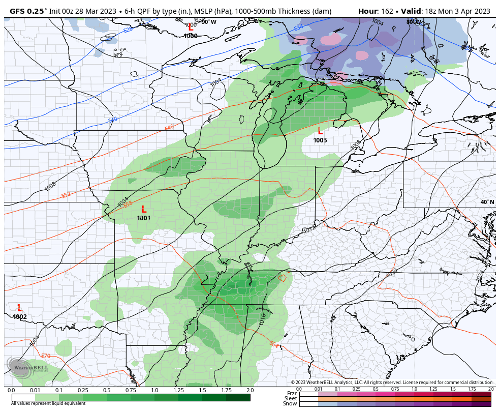
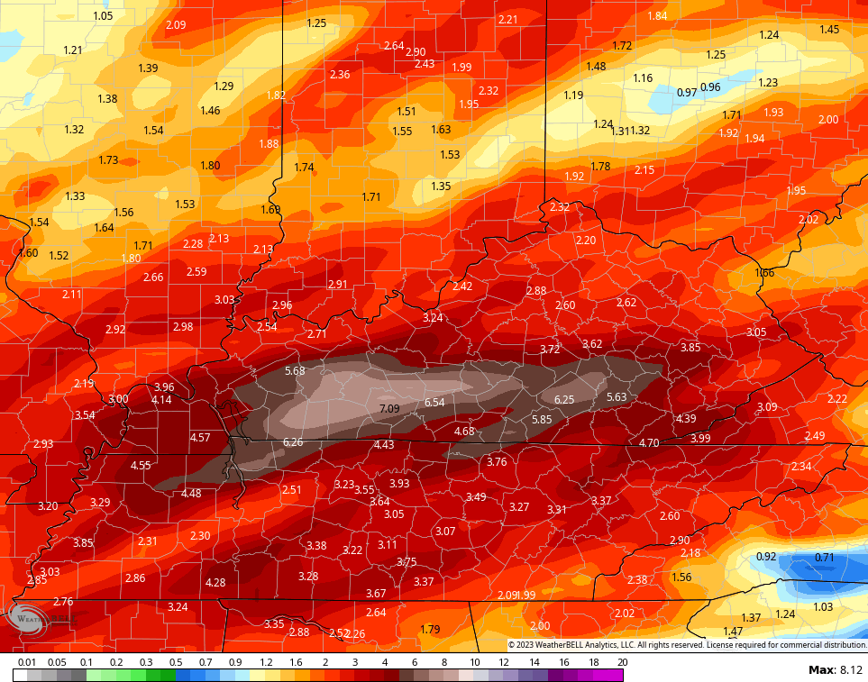
A lot of rain may also fall over the next week or so and the models aren’t shy with the numbers…
I will have another update later today, so check back. Make it a terrific Tuesday and take care.

Hold onto your hat.
I have had to go onto my roof already twice this year to put back shingles that have fallen off my roof.
My Brother in Law was a roofer and contractor and he always told me to nail the shingles down with the nails coming through the roof of the attic. He and my oldest Sister live in Florida now and that’s the law in that state.
Yeah, I am using nails. It is not hot enough for me to trust glue sealer.
Wish we were on the other side of the ridge. When will this south east ridge ever break apart or change position or just go away?? It seems like the severe weather is here to stay for awhile. I do think we will get more cold weather before summer starts. I remember my Mom and Grandmother talking about redbud winter or something like that in April.
Crystal, the Southeast Ridge ( Bermuda High ) has moved farther West and always has a back and forth motion. It has amplified because of the phase of ENSO / La Nina over the past several years. Main reason we didn’t receive any Winter weather ( Snowstorms ) like we would if the system was acting like it did in 2015. If we ever phase out of ENSO / neutral to a ENSO / El Nino with the Pacific Decadal Oscillation becoming way positive we would have our season’s weather back.
Severe Weather is always a threat in any season. This year the energy coming off the Pacific is causing our weekly severe weather events. Cold negative colliding with an abnormally warm positive Gulf is an atmospheric explosion.
I always remember years ago my Grandmother was always bringing up the old saying ” Blackberry Winter. ” She was always a believer in the ” wooly worms ” color and the predictions from the Persimmon seed.
Wooly Worms I heard her talk about that too. My sister found an old picture of us in the snow and we use to get some big snows!! Good times.
Yeah, I remember years ago the areas of East and Southeast Kentucky would really catch the biggest Snows. What happened ? I have a theory, but if I posted such Chris Bailey would not let me comment on his Blog.
Here’s the Operational 5km SST Anomaly Chart ( NOAA Coral Reef Watch ) Notice the cold waters off the entire Coast of California in contrast to the very warm waters in the adjacent Pacific. This is what’s causing the very strong Tornadoes to occur as the negative energy from the Pacific collides with the positive warm waters of the Gulf.
https://www.ospo.noaa.gov/Products/ocean/sst/anomaly/