Good Wednesday to one and all. We have a bit of a chill in the air today, but our temps are set to warm over the next few days. But, when it warms, it storms and that’s exactly what it’s going to do. Severe storms and high winds are possible Friday and Saturday then again early next week.
Temps out there today start below freezing and end in the 50s for many. A mix of sun and clouds will be noted with the slightest chance for a late shower in the north and northeast, but most stay dry.
Thursday is a better looking and feeling day with temps warming into the 60s as some clouds roll in. Those clouds are ahead of the stormy setup for Friday and Saturday. This is another setup that can bring strong to severe storms and high winds back into the area. This is a fairly widespread looking system…
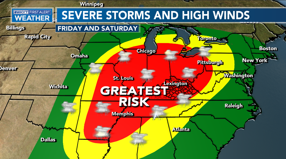
The Storm Prediction Center continues to focus on central and western Kentucky for the greatest true severe thunderstorm risk for Friday…

Here’s a breakdown of how things may play out:
- Scattered showers and storms sweep eastward late Thursday night into Friday. A few could be strong.
- A line of strong to severe storms then works from west to east from late Friday evening through the wee hours of Saturday.
- Damaging wind is the primary threat from these storms.
- There’s also a low-end tornado risk in the west.
- Local high water issues are also a concern, though not a great one.
- Saturday will likely feature another round of high winds with sunshine. Wind gusts of 50mph-60mph will be possible as low pressure strengthens to our north and northeast.
- Chilly air comes into play with readings dropping through the day.
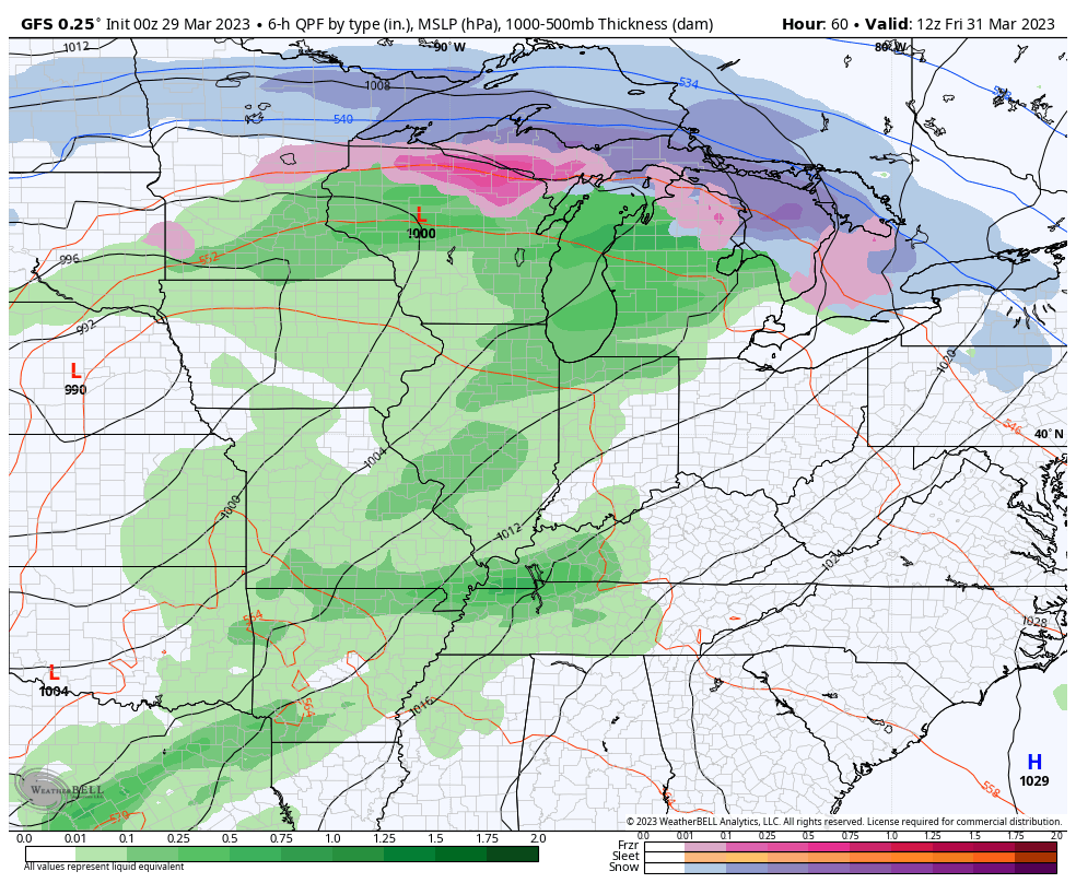
Here’s a look at our system on the GFS…
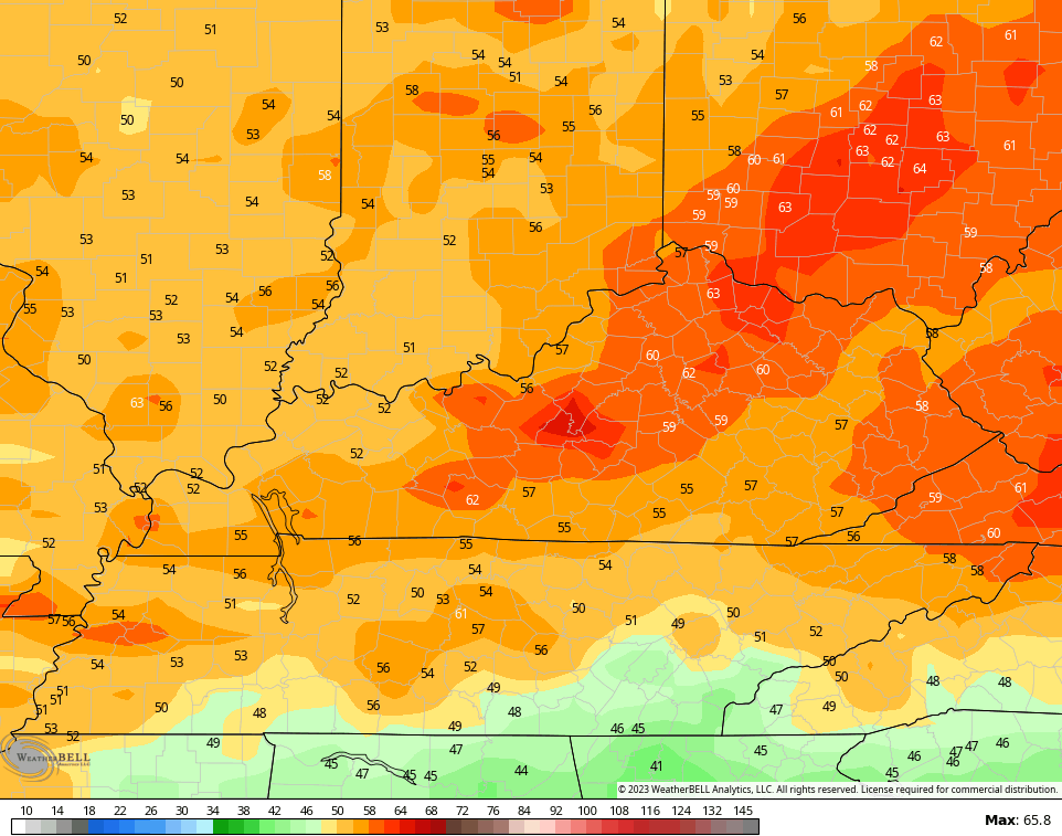
Check out the peak wind gusts from this run…
Chilly weather blows in later Saturday into Sunday before we get set for a May-like pattern into the first half of next week. Temps surge into the 70s as humidity levels come up. There’s also a lot of instability available to produce waves of thunderstorms through the region. Some of these are likely to be strong and severe…
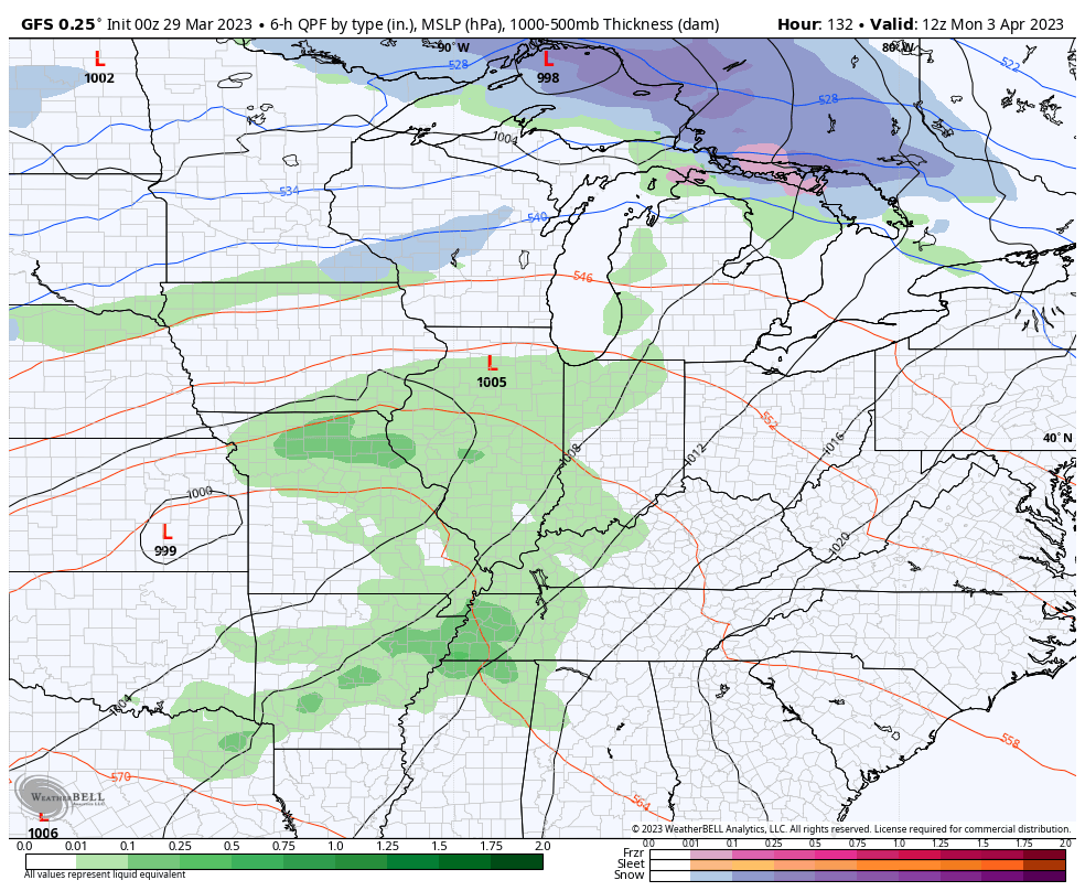
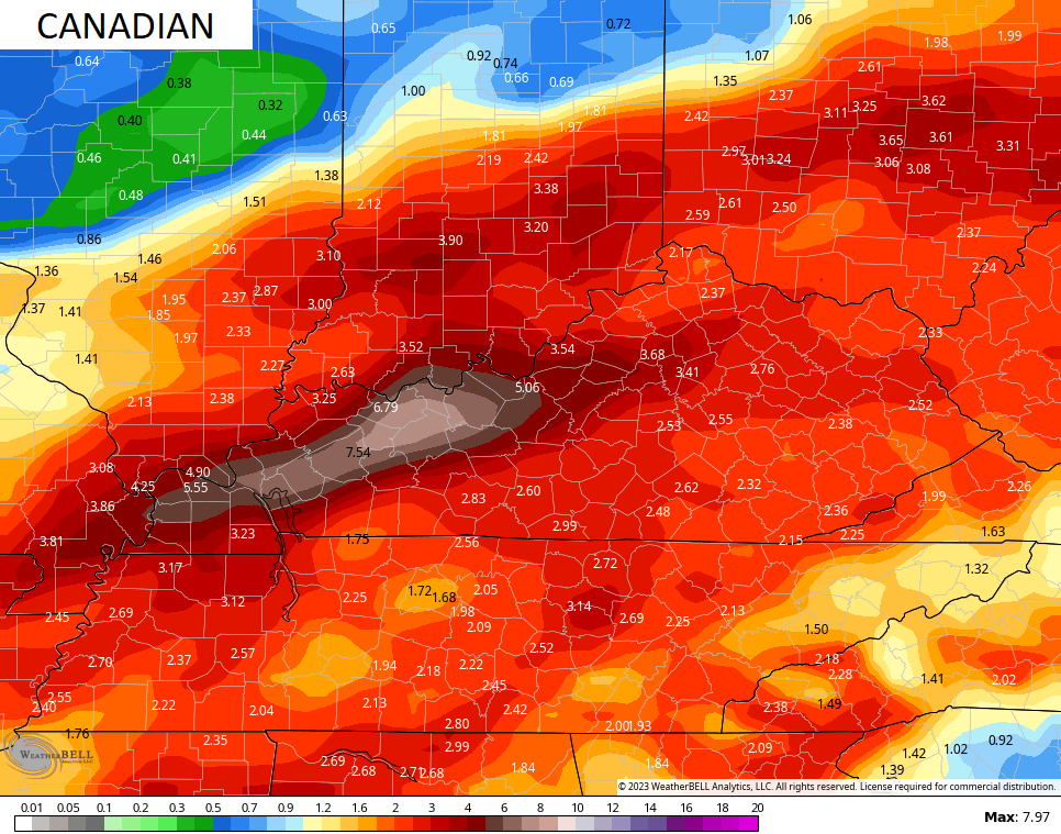
In addition to the severe threat and high winds, the next week is likely to produce a lot of rain that can lead to some flooding issues. Check out the 7 day rainfall totals…

I’ll hook you up with another update later today. Make it a wonderful Wednesday and take care.

I will take the rain over the extreme high winds.
I will always take the rains over the predicted high winds that are in the medium to high probability for late Friday and earlier Saturday. This weather pattern is very interesting and at the sametime very dangerous for some areas that are in the enhanced category. The slight category is not exactly safe. Watch and pay attention to all watches and warnings that may be issued late Friday and early Saturday.
https://www.spc.noaa.gov/products/outlook/day3otlk.html
That is one of the largest Enhanced Risk regions, in terms of area, that I can ever remember the SPC defining. One reason for this is the vast extent of the surface low, which entered the west coast a a “bomb cyclone”. It will be another major wind producer, similar to what we saw 2 weeks ago.
That’s when we lost power for three days.
bailey the mecca opens a week from friday!!!!!!!!!!!!!!! so get a handle on things.