Good evening, folks. It’s full steam ahead toward a very stormy and windy system moving in for Friday and Saturday. This brings another severe weather threat and high wind threat to the region. Oh, and next week comes another big threat.
The Storm Prediction Center has a Marginal Risk to Enhanced Risk across the state…

Here’s a breakdown of how things shake out:
- Scattered showers and storms sweep eastward late Thursday night into Friday. A few could be strong.
- A line of strong to severe storms then works from west to east from late Friday evening through the wee hours of Saturday.
- Damaging wind is the primary threat from these storms.
- There’s also a low-end tornado risk in the west, especially.
- Local high water issues are also a concern, though not a great one.
- Saturday will likely feature another round of high winds with sunshine. Wind gusts of 50mph-60mph will be possible as low pressure strengthens to our north and northeast.
- Chilly air comes into play with readings dropping through the day.
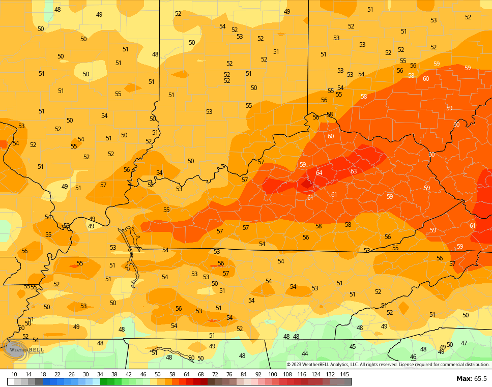
Check out those wind gusts coming from the GFS…
The setup for the first half of next week is one that can bring rounds of strong to severe storms into the region from Monday through Wednesday. The Storm Prediction Center is already highlighting the region for severe weather on Tuesday…

It’s a stormy setup, folks.
Enjoy the rest of the day and take care.

Thanks Chris. Friday and Saturday is sounding worse and worse. I have heard others talk about it as well. I really dread it especially the winds.
I’m dreading it too but hoping it’s not as bad as the last ones.
I hate the fact that I may have to fire up the Generator again. I wonder how many of these potential power outages we will have to pay for before the atmospheric temperatures stabilize ?
Schroeder just curious how many things can you plug-in a generator?? Just wondering how it works. Dottie I hope it won’t be bad either but I hear a lot of people talking about it. I will be glued to Chris for information.
I have a Storm Responder Generator that I purchased during the Ice Storm in January 2009. I can operate many items off a receptacle portable breaker connected to the Generator that is operating on the driveway 25 feet from the garage. Appliances like refrigerator, microwave, coffee pot, toaster, computer and television etc. But not at the same time.
Most forecast models are showing the isobar lines encircling the surface Low to be tightly packed on Friday pm, meaning that winds are expected to howl statewide due to the extreme difference in pressure between High pressure to our SE and Low pressure to our NW. Recent runs of the GFS & Euro models showed estimated wind gusts in Central Ky. at 9:00pm CDT to peak around 65 mph.