Good Thursday, everyone. Today is a really nice day and you should make some time to get out and enjoy it. Strong to severe storms and high winds roll in for Friday and Saturday kicking off another very active period. That will be followed up by more severe weather threats early next week.
Our Thursday starts with some frost and ends with some awesome. Highs reach the 60s across the area with a 70 in the west. Skies will be partly sunny as clouds start to roll in by the end of the day. Those clouds are ahead of our busy setup for Friday and Saurday.
Here’s a breakdown:
- Clusters of showers and storms develop tonight in the west and roll eastward by morning.
- A few rounds of storms will be across the state on Friday. Some of these may be strong.
- A line of severe storms develops west of the Mississippi River Friday afternoon and enters western Kentucky during the evening.
- That line then crosses the state from west to east Friday night.
- Damaging winds and a few tornadoes are possible along this line.
- The greatest tornado risk is across the western half of the state.
- Locally heavy rains of up to 1″-2″ will be possible Friday and Friday night.
- High winds impact central and eastern Kentucky Saturday. These non-thunderstorm wind gusts should reach 50mph-60mph at times.
- Wind damage is very possible Friday night and Saturday.
The Storm Prediction Center continues to show the increased potential for severe weather across the area…

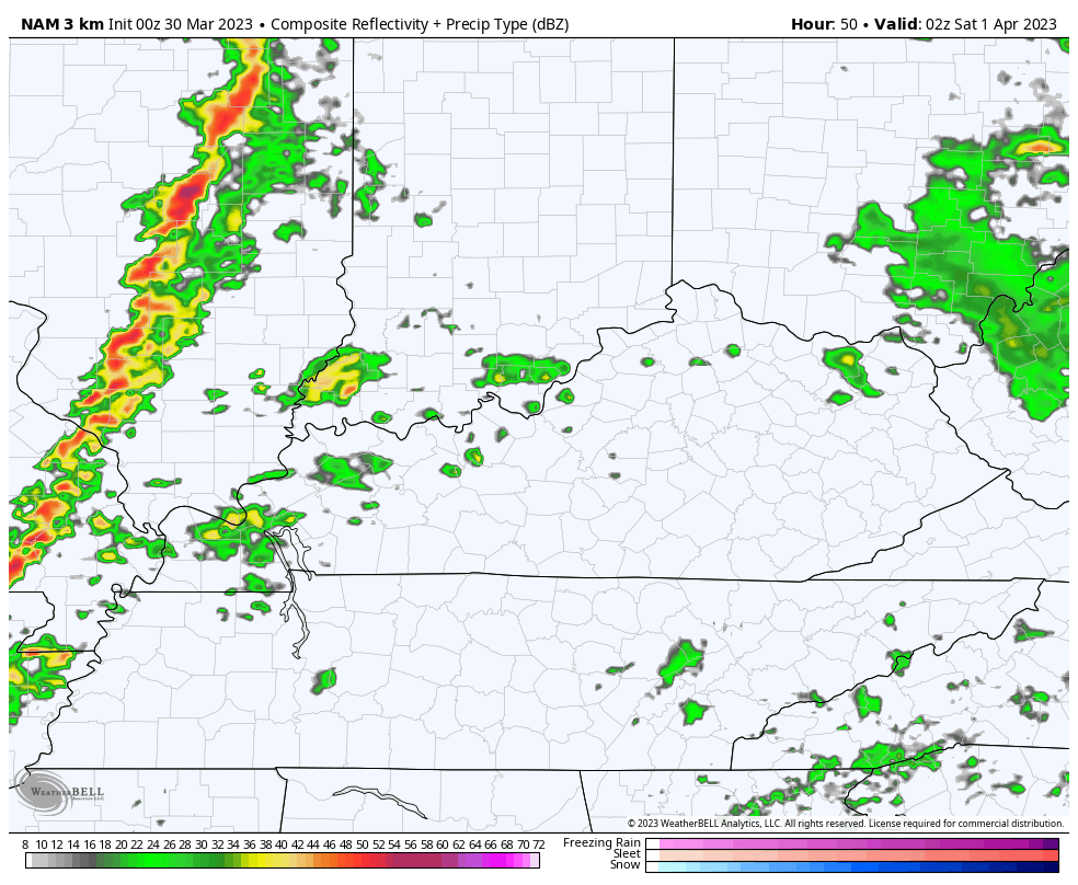
The Future Radar from the Hi Res NAM shows our squall line working across the state. This animation starts at 10pm Friday and ends at 8am Saturday…
Chilly winds take control Saturday afternoon and continue into early Sunday before switching around quickly. Sunday looks like a good one.
Temps and humidity levels quickly rise into early next week with waves of showers and thunderstorms kicking in. Severe weather is a good possibility through the middle of the week as this system spins through…
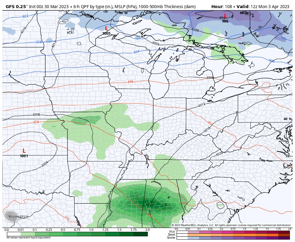
Temps during the first half of the week can really take off. Check out some of the highs from the GFS…

I will return for another update later today. Until then, have a good one and take care.

Thanks Chris, for the update on this potentially dangerous storm. Now, some areas to my West are in the ” Moderate ” category. Very scary. Everyone keep tuned to the weather for further updates !!!
I want some blowtorch weather soon. 😉
We may have a ” Blowtorch ” Summer if the Bermuda High pressure system remains strong and farther west than it usually is.
Another weekend of Hurricane Force Winds.
The weekly high wind events will remain as long as the long playing weather pattern continues.
The entire state of IL is in the Enhanced Risk area of severe weather on Friday into Friday night. This is the first time that I have ever seen the whole state in the Enhanced Risk area.
It will be interesting to see how low the barometric pressure gets as that strong low pressure approaches on Friday.
And NW IL has been upgraded to a Moderate Risk of severe weather for Friday and Friday night.
Stay safe Mike.