Good evening, folks. My time is limited as we continue to track a large severe weather outbreak into western Kentucky. The severe threat will decrease the farther east you live across Kentucky, but the high wind threat will increase into Saturday.
The Storm Prediction Center currently has this area highlighted for the Severe Weather Outlook…

A few tornadoes are possible across the western half of the state. This line of storms racing from west to east will also have damaging winds with it and that may hold together into the east through the wee hours of Saturday.
High Winds follow this up on Saturday with gusts of 50mph-60mph a good bet. A HIGH WIND WARNING is out for much of eastern Kentucky…
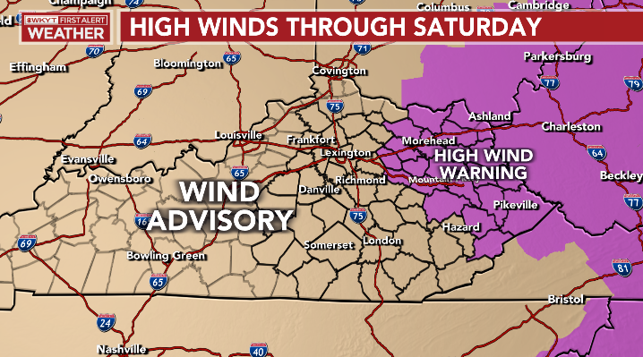
That may easily get expanded a bit farther west as the models are showing some big time wind gusts…

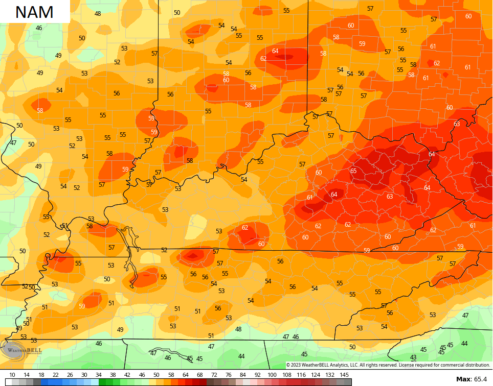
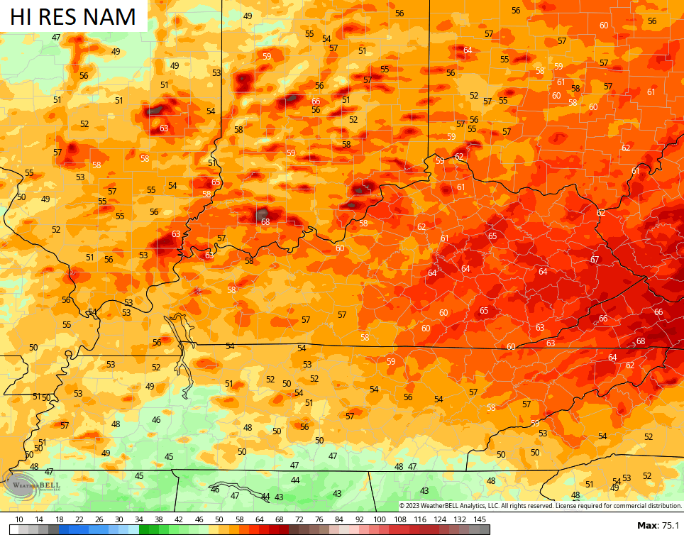
The models have been really good with the previous high wind events, but let’s hope they are overdone for this one.
I’ll have the latest on WKYT-TV. As always, I leave you with your severe weather tracking tools…

Current watches

Possible Watch Areas

Have a good evening and take care.

Thanks for the update Chris.
The sun has came out in Louisville.
But it is late in the day. (minimize instability atmosphere) .
I hope the storm will not be as bad as advertised.
Stay safe everyone!
Numerous Tornado Warnings and Severe Thunderstorm Warnings are in effect for Northern IL with this second wave of severe weather that’s moving toward the Chicago area.
A Severe Thunderstorm Warning has been issued for basically the entire Chicago Metro Area for the next hour, and the NWS has categorized this as a life-threatening situation with 90 MPH winds and 2-inch diameter hail expected.
Wow Mike that’s a lot hope you are safe.