Good Saturday, everyone. High winds are blowing across the Bluegrass State today and will likely cause additional issues. A quick shot of cold comes in behind it before we turn our attention toward another severe storms threat next week.
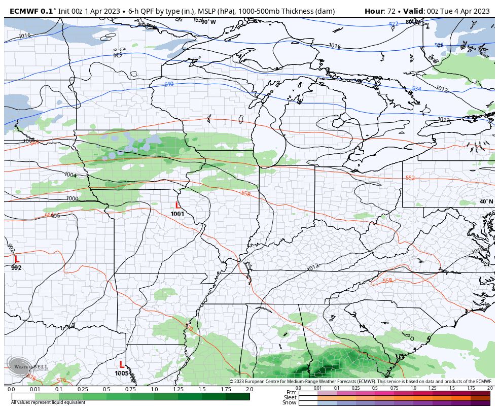
April isn’t fooling around as we are starting things off with a line of strong and severe storms racing out of eastern Kentucky before daybreak. Here are your radars to follow along…

This will be followed by a mix of sun and clouds with winds cranking. Gusts of 50mph-60mph will be possible through early this afternoon in central and eastern Kentucky. Wind damage and power outages are a good bet.
A shower or two drops into northern Kentucky this afternoon and evening and this may brush the rest of central and eastern Kentucky. There’s also an outside chance for a snowflake to show up in the north or east this evening.
Temps by Sunday morning drop into the 20s for another hard freeze. Sunday afternoon makes up for it with sunshine and temps ranging from the upper 50s to middle 60s across the state.
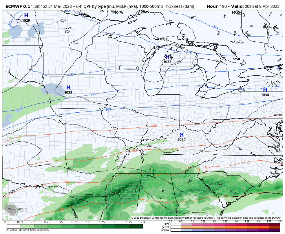
Temps really spike early next week and may flirt with 80 by Tuesday and Wednesday. That’s ahead of another system that can bring strong to severe storms back into the area…
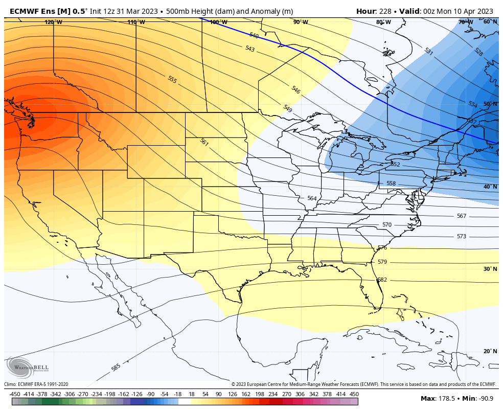
A seasonable chill follows that up for Thursday and Friday with another system trying to target us for Easter Weekend. The EURO is seeing some cold air available for this system on Easter Sunday…
Please… No.
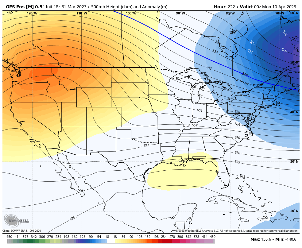
The Ensembles have been pointing toward another shot of cold around this time and continue to do so, but they suggest a flat ridge taking over into the following week…
EURO ENSEMBLES
GFS ENSEMBLES
I’ll throw you another update later today. Have a great Saturday and take care.

Having a downpour this morning. I dread the wind more than anything. Chris do you see a time in the near future when we warm up and stay that way?? Then I guess we will be complaining of the heat or humidity lol Stay safe everyone.
We had a real loud thunderstorm around midnight or there after with heavy rain and wind. Then it calmed down, but now we wait for that predicted high winds. Hoping we don’t loose power like we did a few weekends back ?
Here’s yesterday’s storm report from the SPC : WOW !!!
https://www.spc.noaa.gov/climo/reports/yesterday.html
The SPC is forecasting an increased flow of air next weekfrom off of the Pacific coast, into the great plains. With that abnormally cold pool of Pacific ocean water holding firm off the west coast, the generation of potent impulses will continue to impact our area for the foreseeable future.
I think NOAA ” jump the gun ” by declaring that La Nina is over ?
I don’t think they did, Schroeder, since the dominant factor in determining La Niña, El Niño or El Neutral() are below or above normal water temperature anomalies in the eastern Pacific off of South America. The presence of abnormally cold water off the west coast of North America is a true anomaly, in terms of ENSO. But there is no question in my mind that that cold water is having a major impact on our Spring severe weather!
It may be Joe. If the colder water is still there this coming July, NOAA may have some information to report in the late Summer about what Phase of ENSO we may be in this Fall and Winter. I’ll wait till they decide on issuing an El Nino Watch. By the way, the PDO is still strongly negative.
The amount of Snow that has accumulated in the Sierra Nevada’s is more than record breaking. Some areas of the Mountains receiving over 83 feet !!! The weight of the Snow has caved in a lot of roofs and buried homes and cause Earth quakes along the major faultline in California.
Four to eight day outlook on the predicted storm next week. No surprise that the area coverage is almost identical to this weekend storm.
https://www.spc.noaa.gov/products/exper/day4-8/
I was amazed when I saw that! Dew points are predicted to be higher than they were on Friday here, which could lead to another major severe weather outbreak. We’ll see how it all plays out.
Most of us complain when the computer models mess up on a forecast (especially when it comes to snow), but they really nailed this last outbreak spot-on, alerting everyone in the target zone four days in advance of the severe weather.
According to the Kentucky Mesonet we received 0.66 inches of rain and a wind gust of 56 mph since midnight or thereafter. Still a Sunny and very windy day. Hoping the power holds up ?
Here is the link for the summary of the major severe weather outbreak that hit Northern IL and the Chicago Metro Area on Friday afternoon into the evening.
https://weather,gov/lot/2023_03_31_SevereStorms
My power was knocked out just after 8 PM due to the strong winds from the storms. It remained out for nearly three hours. On the block next to mine, there was a large tree that had been blown down into several power lines. On my way home from work this morning, there were several power company trucks working on removing the tree and fixing the downed lines.
Sorry about the bad link, here’s the correct one:
https://weather.gov/lot/2023_03_31_SevereStorms
Very scary Storm. That water vapor image is interesting. Next week’s Storm is taking the same path as this previous one. Another anxiety producer, but will find out by Thursday or Friday when it is expected to clear out of here. Thanks for sharing Mike.
According to my PWS, yesterday’s storms dumped 2.15″ of rain over a 24 hour period, and our peak wind gust since midnight has been 48mph.
We had a storm total of 2.23 inches of rain in a 48 hour period. We had wind gust this afternoon around 52 mph. Power is still on. I can’t believe it. Lucky this time around I hope.