Good evening, everyone. High winds are finally slowing down after causing more damage and power outages across Kentucky. As much colder air crashes in behind this tonight, our focus turns to the next severe threat early next week.
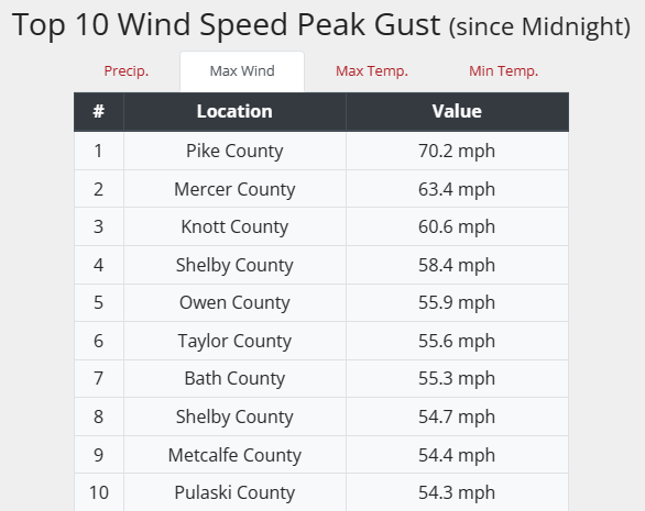
Non-thunderstorm wind gusts hit the 50mph-60mph range for many today with a few spots topping 60mph. The highest gust of the day was at the Kentucky Mesonet site in Pike County at 70mph…
Colder winds settle in this evening and may bring a shower or two into the north and east…

Overnight lows drop into the upper 20s and low 30s for many. Sunday afternoon looks good with temps ranging from the upper 50s to middle 60s.
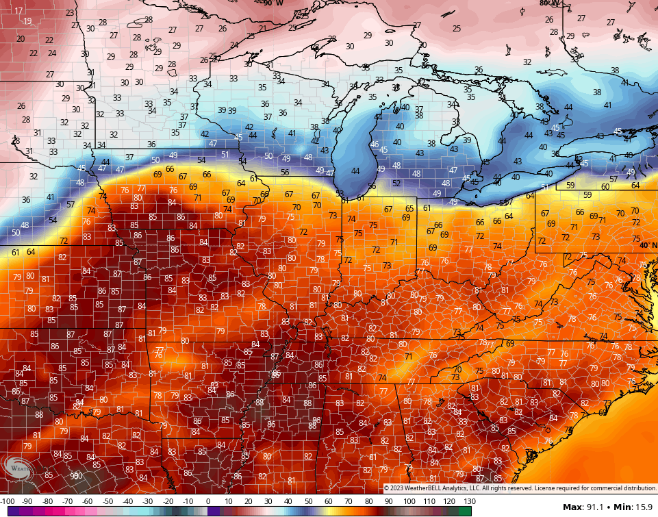
Our numbers really jump early next week and make reach 80 or a little better by Tuesday…
That’s ahead of a storm system rolling in that brings the potential for strong and severe storms as early as Tuesday, with the greatest risk coming Wednesday…
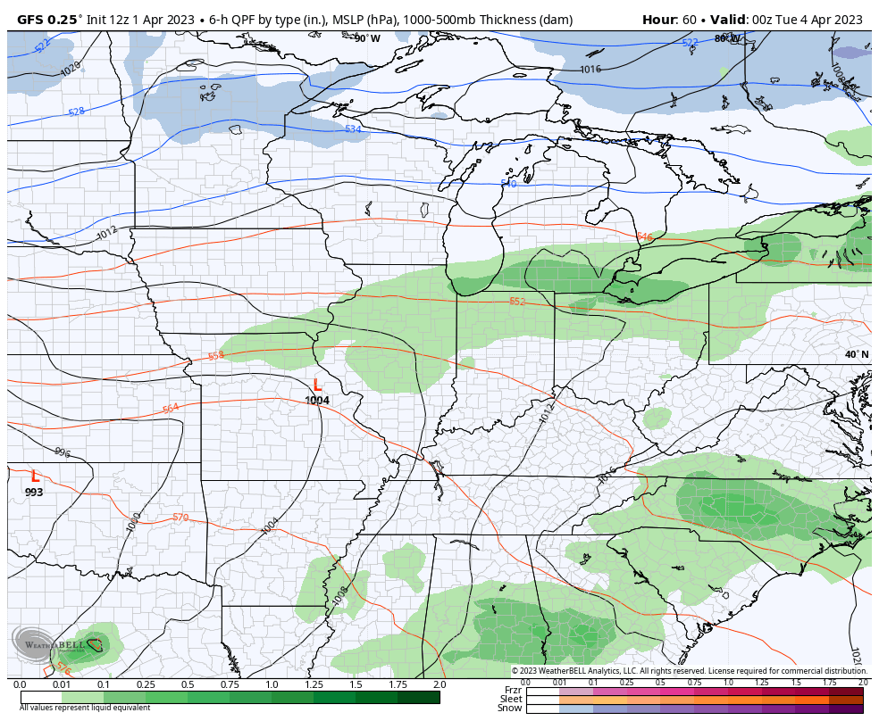
Currently, the Storm Prediction Center is focused on the Tuesday threat…

Enjoy the rest of your Saturday and take care.

Thanks Chris. It’s been a very busy Spring for Meteorologist. I appreciate all your hard work. Lets hope that Mother Nature gives everyone a break on the storm system next week and that we may all enjoy a pleasant Easter weekend.
Chris I believe that wind gust in Pikeville or Pike County it’s been some of the worst wind gust I can remember. I also just saw where a building collapsed in Prestonsburg about 30 minutes from me if that. They don’t know if anyone was inside. I hope not but they were reporting some apartments in the building.but don’t know if anyone was in there.