Good afternoon, folks. After a cold start, our day is ending on a very nice note with even warmer air on the way. This warm up to start the week will bring some thunderstorms along for the ride, and could even give us another severe threat.
Let’s break down the week ahead.
Monday features a mix of sun and clouds with milder winds coming in from the southwest. Temps hit the 70s for the entire region.
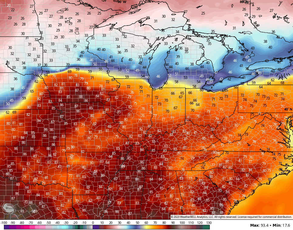
Tuesday is the day when temps take off. Highs reach the 80-85 degree range for many…
A storm or two will show up with the greatest risk to our west. The Storm Prediction Center is now adjusting to the slower movement of another potent storm system to our west. This brings a low-end risk for severe storms into western Kentucky later Tuesday…

That threat may progress eastward into the rest of the area for Wednesday. That’s when our storm heads toward the Great Lakes and drags a cold front in here…

Chilly air will come in behind that for Thursday with temps in the 50s for highs.
Near normal temps are with us as we start Easter Weekend, but there’s still the threat for a storm system to bring a few showers for Easter with colder air to follow early next week…

The models will jump around with the timing of the rain, so expect some adjustments in the Easter forecast as we get closer.
I’ll look into May and the summer with my overnight update. Make it a good one and take care.

The other day I mentioned attending an Advanced Spotter Training webinar. NWS – Louisville has posted the session on their YouTube page, and I’ve included a link to the session below. The session itself is approximately 2 hours, plus nearly 2 hours of questions from attendees!
https://youtu.be/ZX0NXiURmv8
Thanks for sharing Joe. I didn’t listen to it all, but it was extremely interesting information. Brian of the NWS service also a fellow Hoosier did a great job outlining in detail the course of becoming an Advance Storm Spotter. I’ll go back to the presentation latter.
Thanks Chris. Hoping no one receives the storms mid week. This is a pattern I’ve never seen before and I been following the weather for over 50 years. I hope it stabilizes after Easter and we receive calmer Spring weather. Looking forward to your forecast and discussion for Summer.