Good evening, folks. We are putting an end to a gorgeous day across the region with even warmer temps on the way for the next few days. This will come with an increasing threat for more rounds of strong to severe storms.
Preceding that severe threat will be temps that can reach 80-85 for much of the region on Tuesday. Take a look at the highs…

As mentioned, the main severe storms threat for Tuesday is well to our west and northwest. There’s a low-end threat for some of these storms to get into the west by Tuesday night…

This whole system then targets the rest of the area for Wednesday, especially during the afternoon and evening hours. The Storm Prediction Center is painting much of Kentucky in the Slight Risk…

I would expect some of that to be upgraded at some point.
Here’s a look at our system…
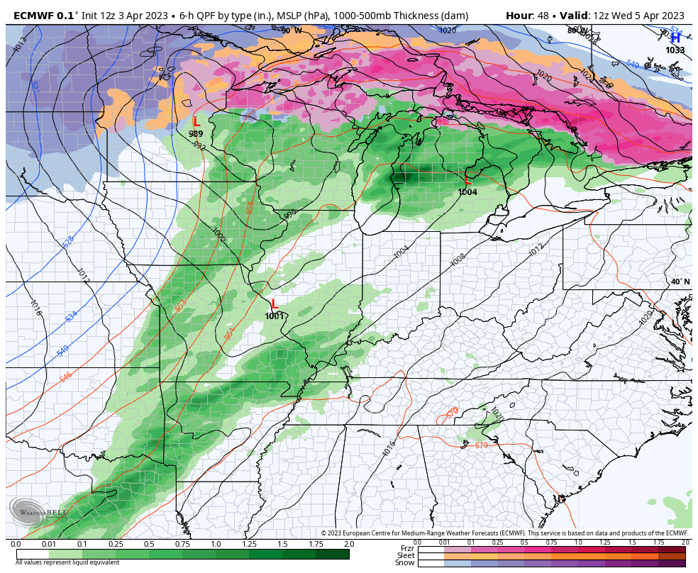
That has a blizzard on the northwest side of the low and another tornado outbreak ahead of it.
Non-thunderstorm winds won’t be as gusty with this one, but gusts of 40mph-50mph will be possible from Tuesday night into Wednesday…

Did you expect anything less?
Chilly winds blow on Thursday with showers lingering in the east. The numbers slowly bounce back on Friday then really rebound into Easter weekend. Temps make a run at 70 for Easter Sunday with a mix of sun and clouds.
The next system drops in after that into early next week. This may turn into a closed off low somewhere across the eastern half of the country…

Areas under that will see damp and chilly weather, so here’s hoping it avoids us.
Enjoy the evening and take care.
