Good Wednesday to one and all. Our severe weather producing thunderstorm maker is now gone and it’s being replaced by a comfy brand of air. We are seeing some really nice weather blowing in today, but I’m tracking another cold front to start the upcoming weekend.
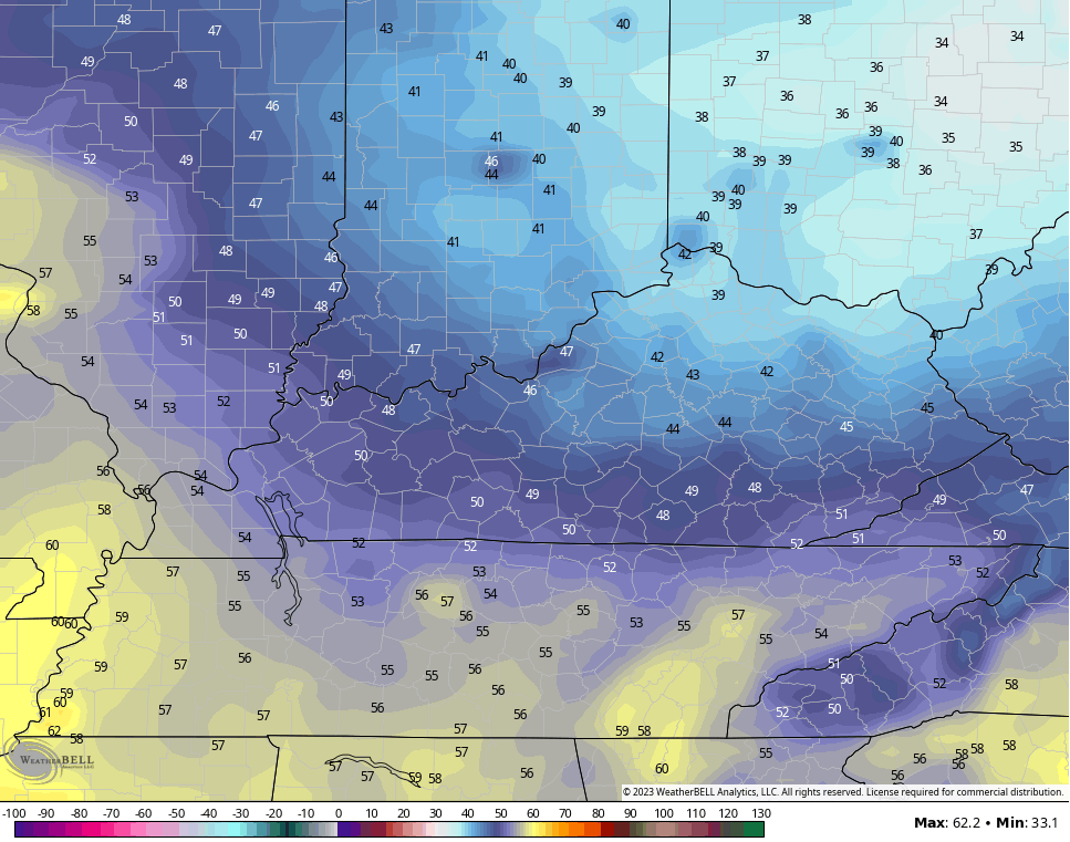
A mix of sun and clouds will be noted today and it looks really good. Highs are in the 70s with much lower humidity. That drier air will allow overnight temps drop deep into the 40s for the parts of central and eastern Kentucky Thursday morning. The GFS even sees an upper 30 in the far north…
Thursday is another nice looking and feeling day with just a small chance for a shower or storm to go up in the afternoon and evening hours. The best chance for that is across the south and east.
Friday is a windy and warm day as we wait for another cold front to drop in from the northwest. This arrives with a line of showers and storms along it Friday night and early Saturday…

Another blast of awesome air comes in behind that for Sunday and Monday. Lows may make another run at the 40 degree mark by Sunday.
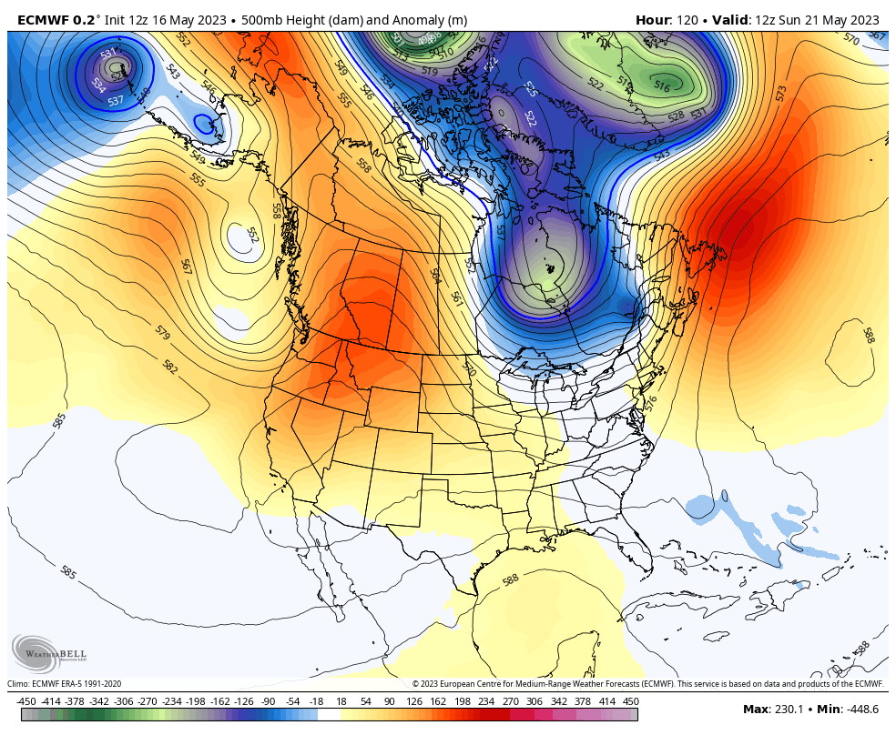
The overall setup next week may feature a cutoff low trying to get established across the east or southeastern. Here’s the EURO…
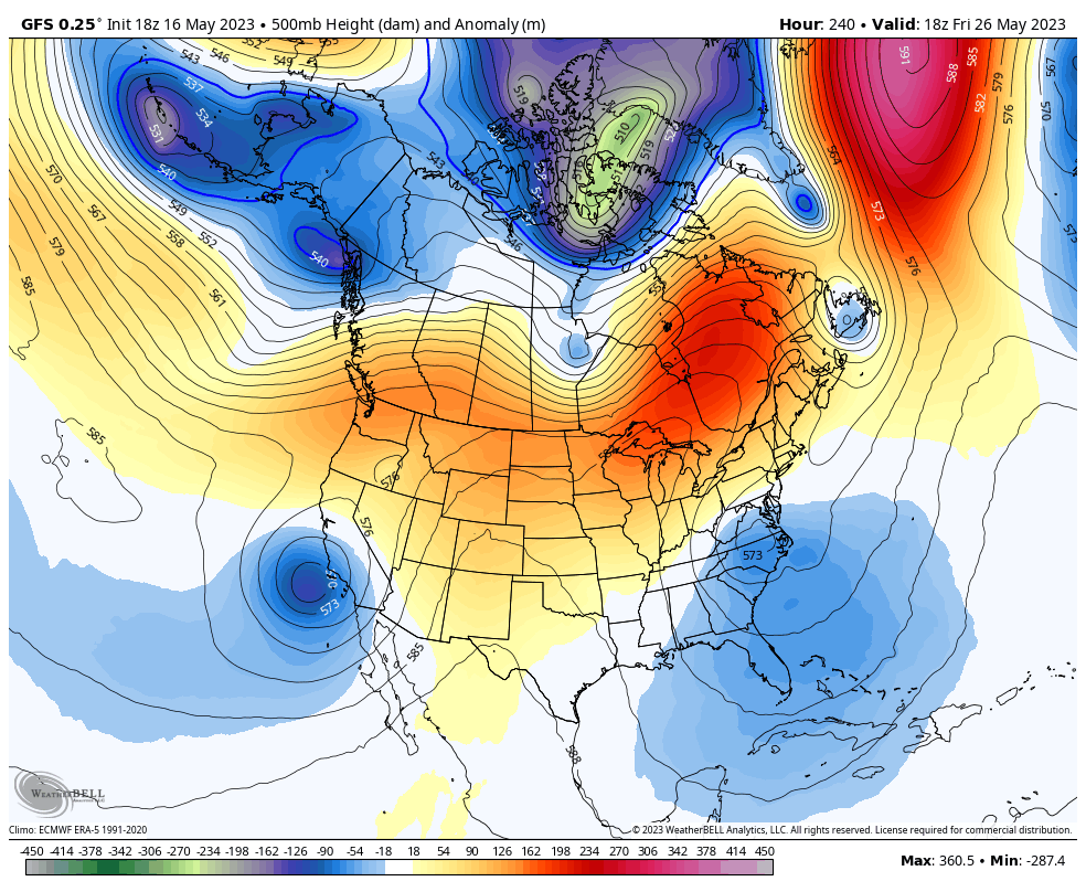
The GFS has that same solution and keeps that upper low spinning across the east through Memorial Day Weekend…
Have a wonderful Wednesday and take care.

Thanks Chris. Only recorded 0.14 inches of rain in my area of Taylor county. I’m concerned that this lack of precipitation in my area will continue through the growing season. Right now it looks to be a beautiful late Spring day.
Our Tempest PWS recorded .77 inches of rain yesterday. We are fortunate. The plants are clearly affected – positively. Much weeding needs to be done before things get out of hand. Maybe a shower will push up your way tomorrow afternoon, Schroeder.
I sure hope so.