Good Friday to one and all. We have a mainly dry day and warm day out there as we wait for a cold front to crash in here tonight and early Saturday. This brings some showers and storms with it, but it gets out of town fast enough to give us a pretty darn good weekend for the most part.
Beyond all this comes the potential for an upper level low to impact us as we get into next week and Memorial Day weekend. Wait… are we already to this point in the year? Slow down, 2023!!
Let’s start this party with what’s happening out there today. Highs are 75-80 in most areas with just an isolated shower or thunderstorm going up. Most areas stay dry until this evening with a line of showers and storms approach from the west and northwest.
Here are your radars…

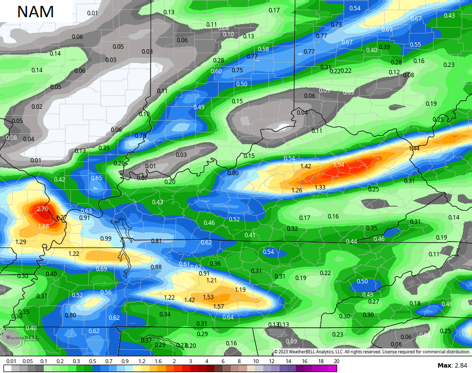
This line moves through overnight and early Saturday with some decent rains for much of the region. Several models are showing the potential for an inch or better of rain for parts of the state…
Temps on Saturday reach the upper 60s and low 70s for many and that’s cooler than normal. Sunday will start in the 40s and end with temps staying cooler than normal for highs.
The numbers are cooler than normal early next week but should rebound quickly by the middle of the week. 80 degree temps are a good bet, but can we keep those rolling into Memorial Day Weekend? That depends on what happens with an upper level low spinning in the southeast.
The EURO keeps this thing across the deep south…
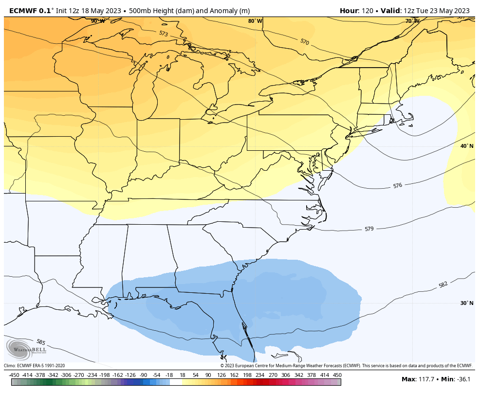
If that’s the case, we are warm and dry into the holiday weekend. I have my doubts on the EURO because it can have some serious issues with closed lows like that.
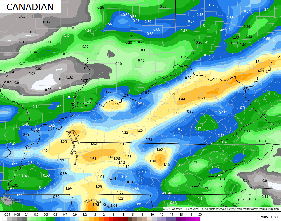
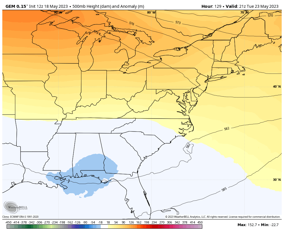
The Canadian brings that system all the way into our region during the same time period…
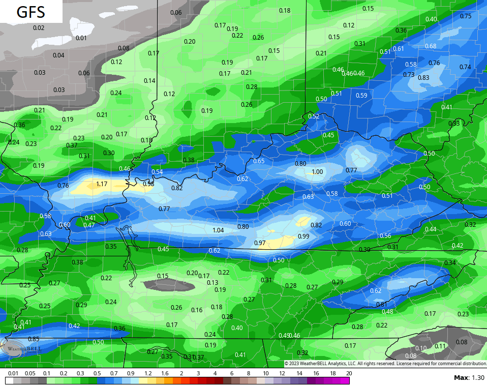
The GFS is similar to the Canadian…
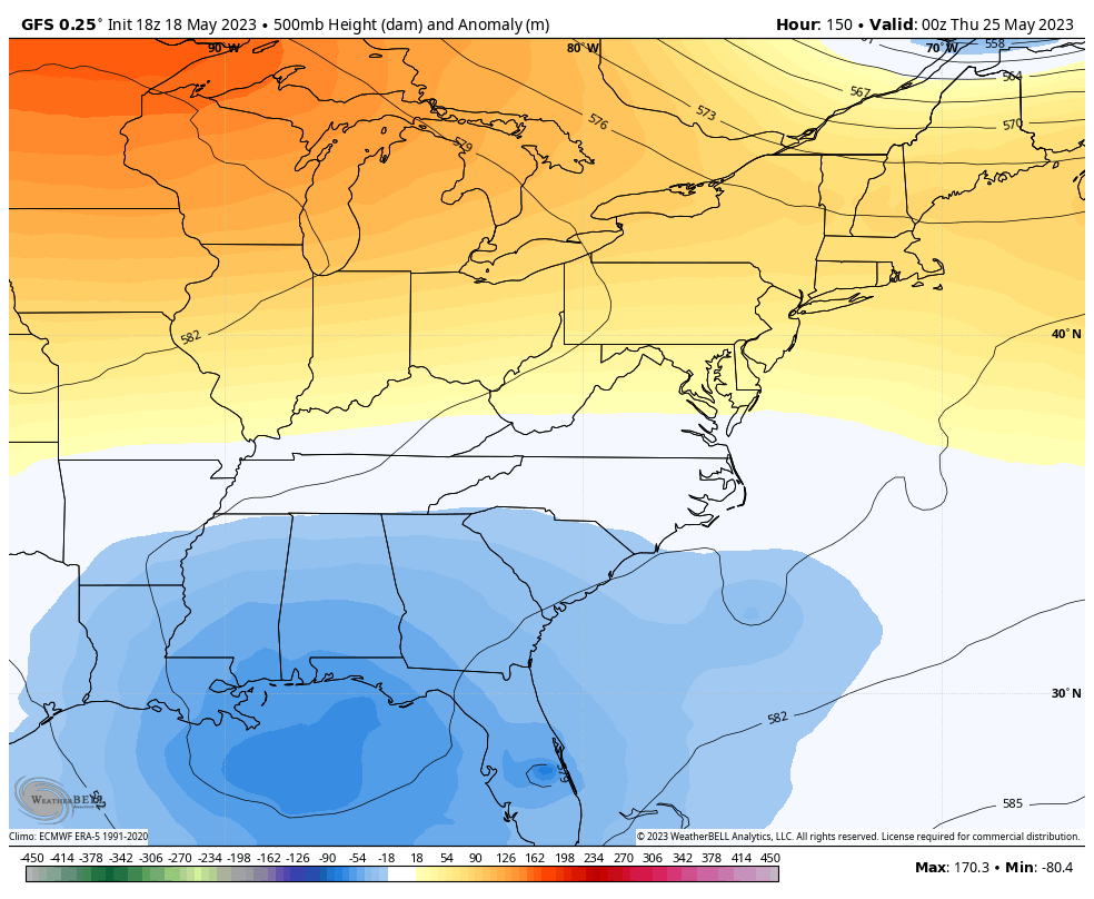
That would take out temps down some and introduce a few showers and storms into the equation. I’m favoring this solution right now, but it’s close.
Enjoy your Friday and take care.

Thanks Chris. Hoping we receive some Rain. The closed low to our south looks interesting.
I fear that rain may be in short supply, Schroeder, at least for the next week to ten days. Beyond that, the ensembles are not showing much action for the next month or so, which is bad news for agriculture. The extended potential for frost this Spring meant that farmers were delayed sowing corn in my area, which is why seedlings in local fields are barely 4 to 5 inches tall.
The establishment of El Niño has the potential to present us with a more “normal” Winter, but the influence of our steadily warming climate means that we may be facing a hot, dry Summer, although tropical activity in the Gulf could supply some relief.
It appears we will have a small dry spell next week it’s my hope that the Saturday front produces a decent amount of rain.