Good Sunday to one and all. It’s a gorgeous weather day across Kentucky and this is a sign of things to come. We are kicking off a string of gorgeous days across our part of the world, but can we keep that rolling through Memorial Day Weekend? I do see some cooler changes showing up.
Readings start out the day with temps in the 40s with a touch of fog. Temps out there this afternoon are generally in the 70-75 degree range for highs under mostly sunny skies.
Monday looks good with more sun and 75-80 degrees.
Highs Tuesday and Wednesday generally reach the lower 80s in most areas. While much of this time is dry, there’s the chance for a shower or thunderstorm to bubble up.
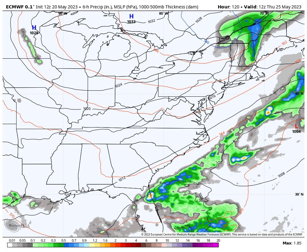
From here, we see some changes showing up. A backdoor cold front looks to drop in from the north and northeast by Wednesday night and early Thursday. This happens as our big upper level low spins across the southeast. Watch how the models hook these two up and bring that upper low up the east coast over Memorial Day Weekend…

That type of scenario keeps our temps much cooler than normal with just a slight chance for a shower or storm. Look at this storm system rolling up the eastern seaboard…
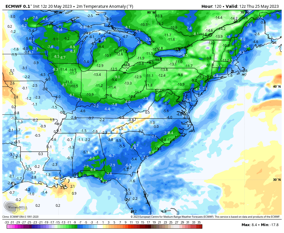
As mentioned, this is a much cooler than normal setup that’s showing up stronger and stronger as we get closer. The EURO has temps solidly below normal from Thursday into the unofficial kickoff to summer…
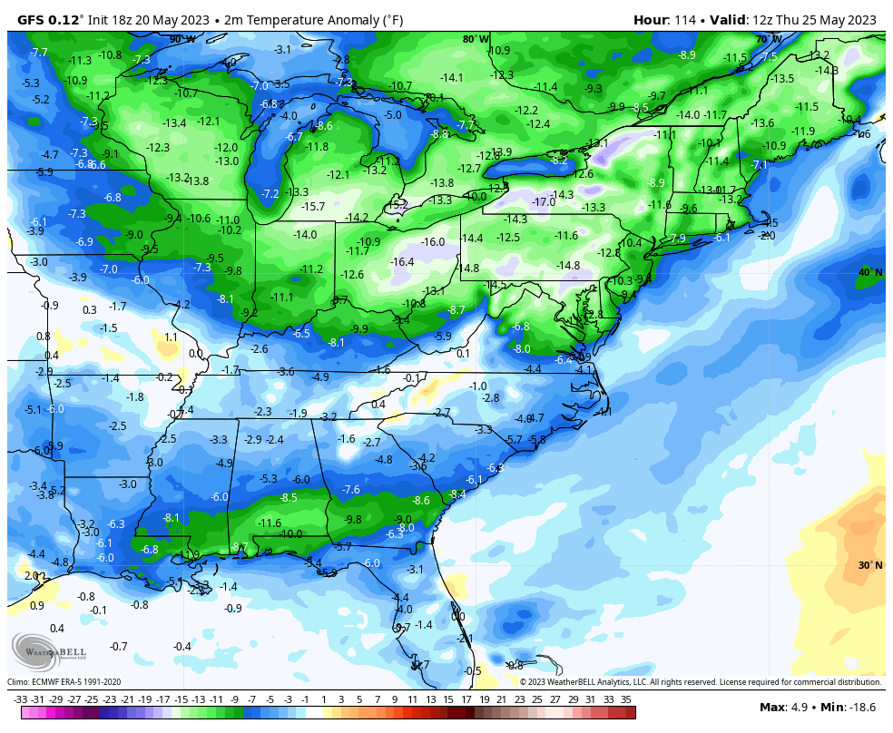
The GFS is doing the same thing now…
Recent runs of the GFS even take overnight lows to the upper 30s and low 40s to start the holiday weekend…
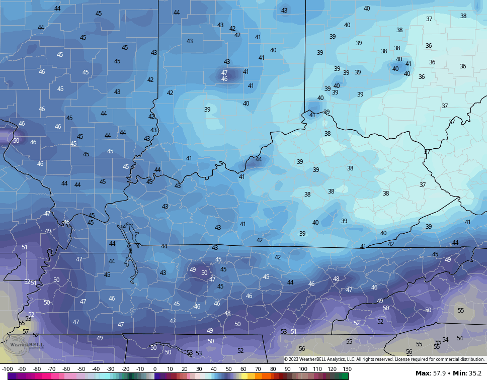
That’s probably overdone, but it gives you an idea of the cool setup we are likely looking at.
The longer range trend from the GFS Extended is for a continuation of the overall cooler look through mid June…
Make it a sensational Sunday and take care.

Yeah it’s not going to be all that cool.
Yup, everything is relative. If normal temperature is 85°, then cooler than normal might be 80°. Not a problem.
I am presuming that there will be a lot of overcast skies next weekend. If it is cooler than normal.
Interesting Chris. We’ll see if that scenario pans out.
It will be interesting too to see if Memorial Day is hot as I usually remember it being. I always take flowers to the cemetery and it has always felt each Memorial Day was hot sometimes uncomfortable hot I would like a comfortable one. I enjoy the cooler then normal weather.