Good Tuesday to one and all. We have a touch of moisture feeding into the region on an otherwise early summer feeling day in Kentucky. This summer feel will soon give way to some issues for the holiday weekend as a big upper low likely impacts the region.
Temps out there today and Wednesday generally range from 80-85. We will see the chance for a stray shower or storm going up this afternoon and evening, especially across the south and west.
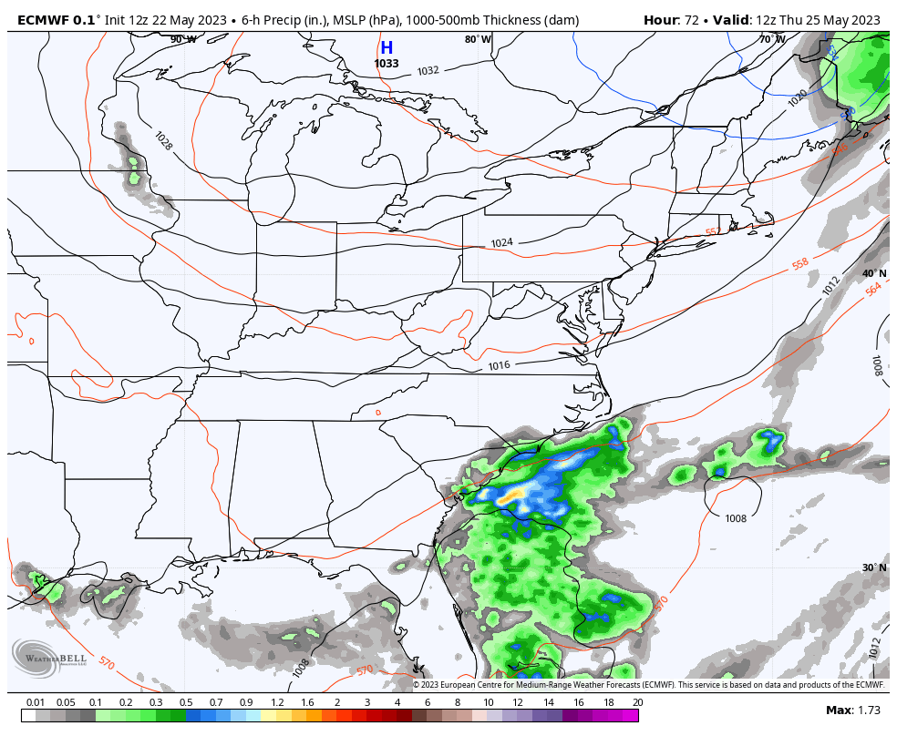
The Hi Res NAM is most emphatic with this and actually shows a few downpours…
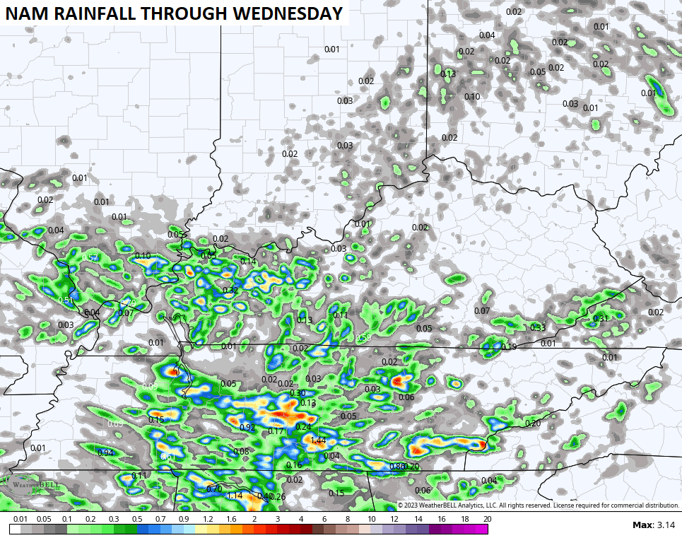
Here are your radars to follow any shower or storm going up out there today…

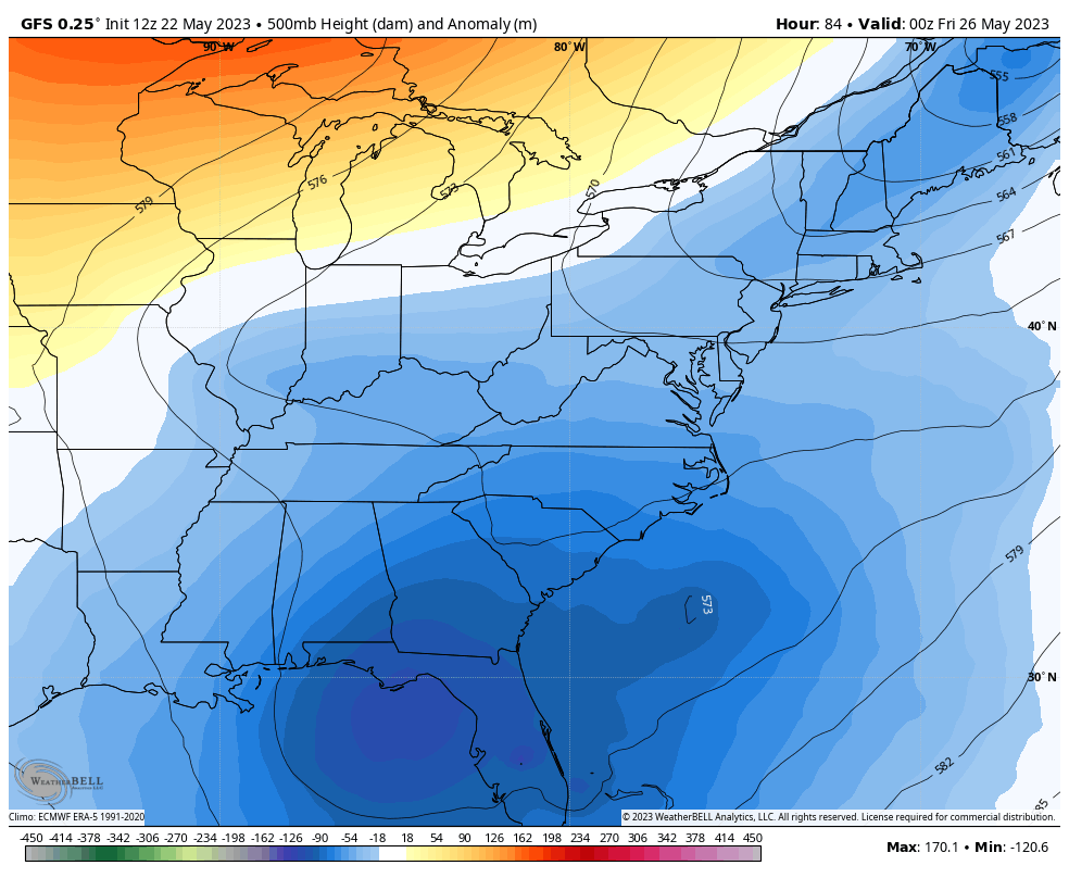
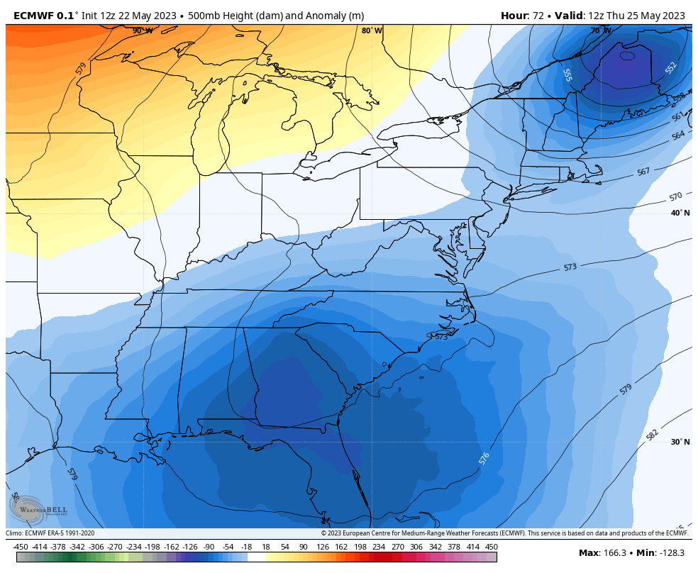
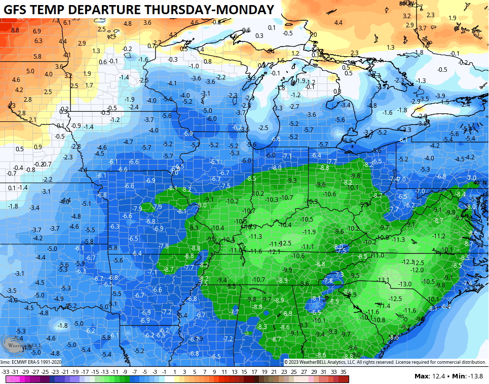
For nearly a week now, I’ve talked about a big upper low spinning in the southeast for Memorial Day Weekend. This upper low likely spins our way as we get into the holiday weekend and we are see the models agree with this.
GFS
EURO
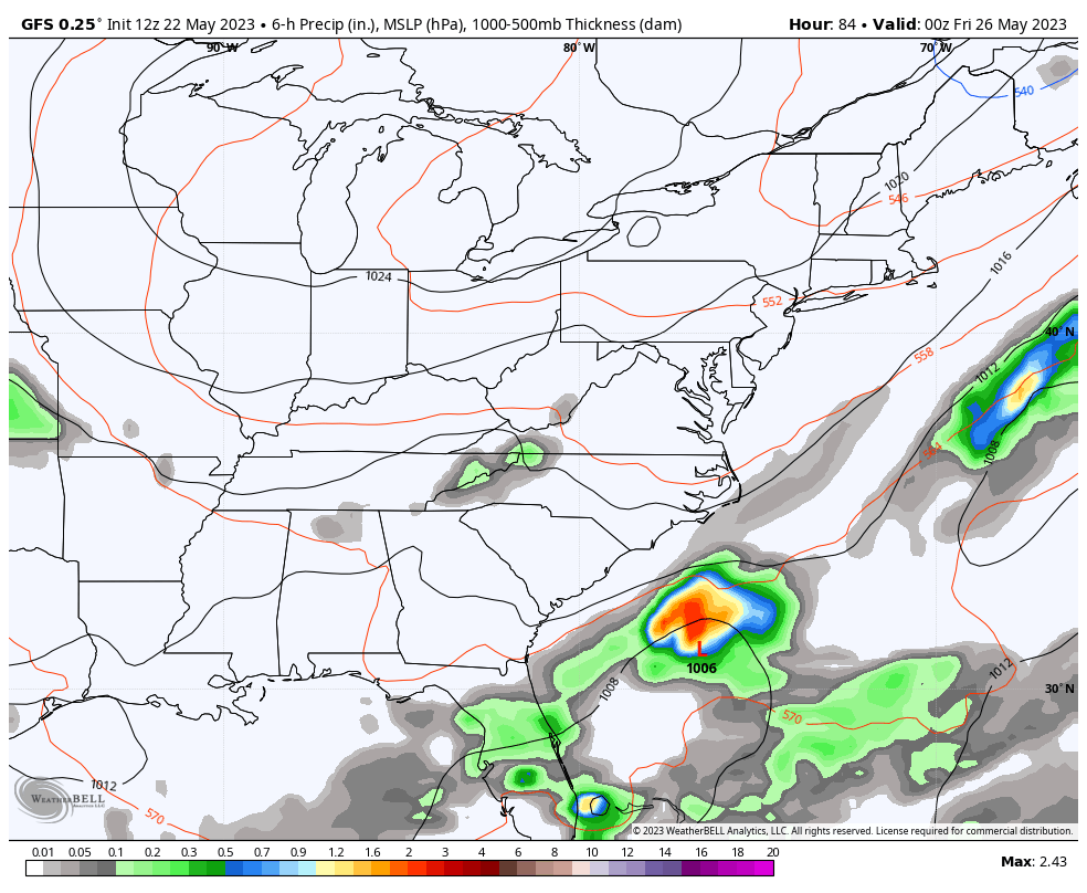
That setup means we have to watch the eastern and southeastern skies for some showers and storms going in reverse. Yep, we are watching Myrtle Beach for the increasing threat for some rain coming at us from that direction.
Here’s the GFS through Memorial Day…
The EURO has a similar idea…
This kind of setup means temps would run cooler than normal in our part of the world for this big weekend…
Ugh.
Have a great day and take care.

If it’s going to be overcast I would like to see a little rain.
Thanks Chris. Great forecast. No complaints here. Very interesting upper level pattern setting up for the beginning of Summer.
Yesterday the NOAA were saying most of the country will have a scorcher summer this year meaning temps will run above normal for the most part. It be interesting how this plains out. I’m not buying it, everything that mother nature does they blame it on warmer climate. No one knows how the climate was back in 300 years ago or even 200 years ago that was bother me about the so call warmer climate theory.
I don’t believe in this so called ” Climate Change. ” It’s more logical to believe in Climate Cycles of the Earth. NOAA does have a good track record on their probability forecast in the long term. For instance, in the Fall of 1976 NOAA came out with their Fall and Winter forecast. It read like this ” A Colder Fall and Winter ” 1976 – 77. Winter Lover you know how that Fall and Winter turned out.
Yes I do Schroeder
Not a drop of rain is in the forecast for at least the next six days for the Chicago Metro Area. After temps in the mid-80s today, it will be significantly cooler for two days with highs only in the 60s thanks to a stiff NE wind off Lake Michigan. But a big warmup is on tap here by Sunday and next week.
At least the severe weather has taken an indefinite break during this dry spell. It’s also nice that we are no longer getting those ferocious wind gusts over 40 or 50 MPH once or twice a week like what was happening from February through April.