Good Tuesday, everyone. Warm temps are starting to flex on the region as we get set to close May and kick off the month of June. With the warmth comes the threat for a few showers and thunderstorms getting into the mix over the next several days.
Let’s start with where we are today and roll forward. Highs are generally 80-85 for many with a mix of sun and clouds and isolated showers and storms going up. Most look to stay dry, but our radars will be able to find whatever is out there…

Temps for Wednesday and Thursday range from the low 80s to the upper 80s with a few storms on the move. The GFS continues to advertise the best coverage of these storms…
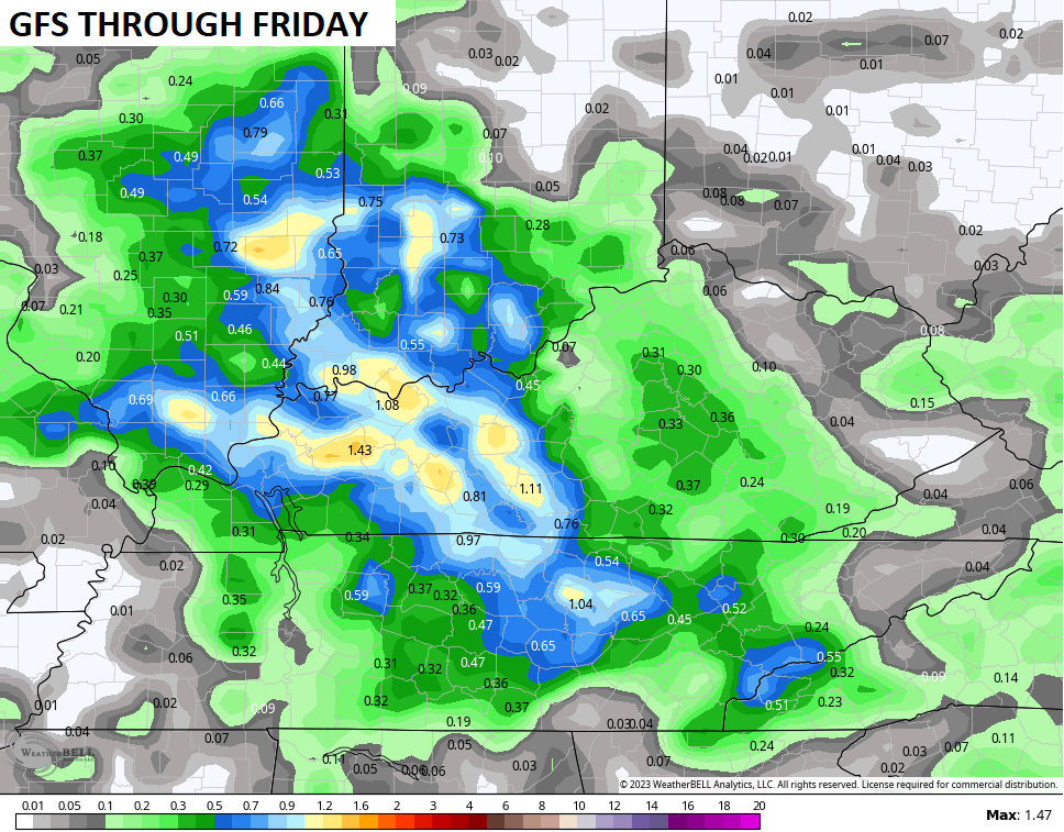
The EURO had no storms up until a few days ago and appears to be trending toward the EURO with the coverage…
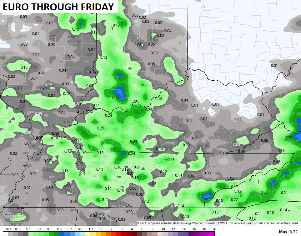
Obviously, you can clearly see the best storm chances across the western half of the state.
Our weekend looks mainly dry and that’s when temps can really take off. Highs in the 85-90 degree range should be common with the toastiest numbers in the north and west.
Once again, the EURO and GFS are at total odds with the highs. Let’s take a look at their respective forecasts for Saturday:
The EURO continues to be a flamethrower with temps well into the 90s for the entire region…
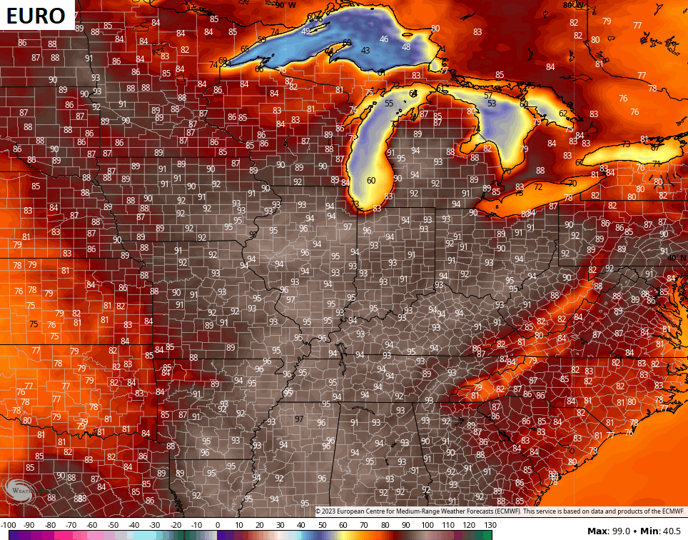
You know my thoughts on the EURO temps.
The GFS looks too cool with highs mainly in the 80s for the entire area…
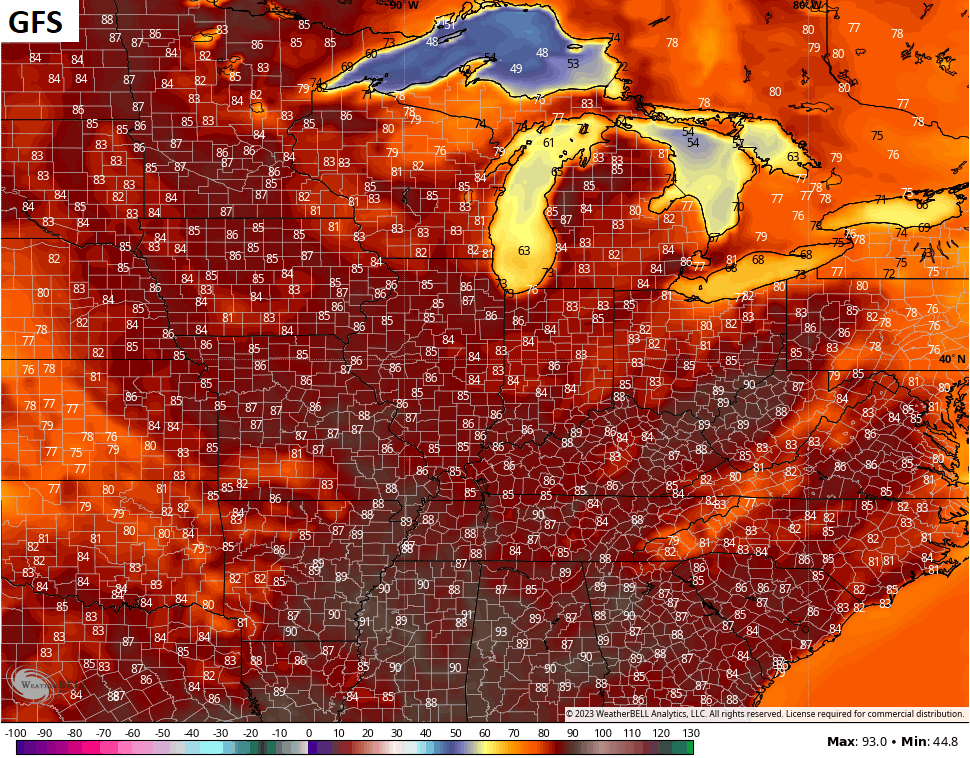
The Canadian continues to be a decent compromise…
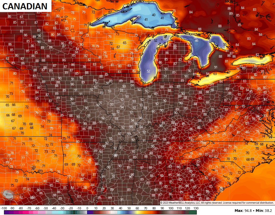
Again… 85-90 looks common with areas of the west maybe ticking a degree or two above 90.
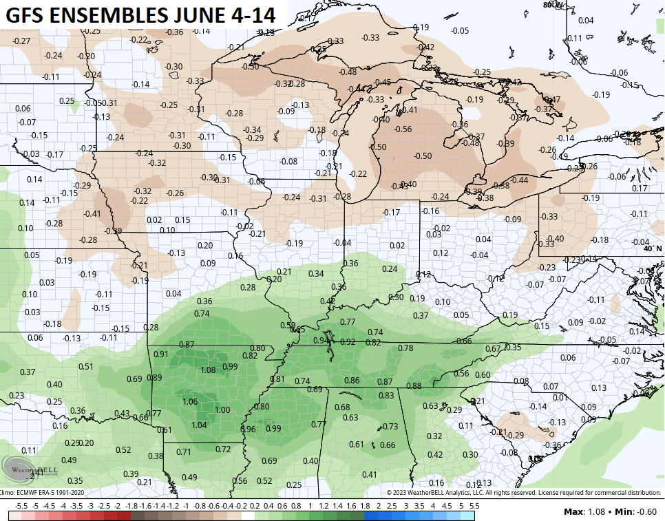
The pattern will trend cooler after the weekend and the GFS Ensembles are also going with a slightly wetter look…
Have a terrific Tuesday and take care.

Bring on Summer, and hope it doesn’t last into our Autumn. Maybe some showers later this afternoon. We are really below normal on precipitation.
I hope my area is fortunate to be under a pop up storm sometime this week.