Good Wednesday to one and all. The month of May is wrapping up on a seasonably warm note across the Bluegrass state. This warm air will turn toasty as we head into the first few days of June with temps making a run at the 90 degree mark for many.
Let’s kick things off with this last day of May. Highs are mainly low to middle 80s for most of the state with a mix of sun and clouds. The threat for a few showers and storms is with us, especially during the afternoon and evening. The greatest concentration of these storms is across the western half of the state.
Here are your radars to keep you company today…

Similar skies will be noted on Thursday as June kicks off. Those numbers continue to climb into the upcoming weekend with 85-90 degree temps still looking fairly common across the state. A 90+ degree day or two will be possible in the north and west, especially. Throw in some humidity and we feel even toastier.
June 1st is also the start of the Atlantic Hurricane Season and we do have a system worth watching down in the Gulf of Mexico…

That system is forecast to cross Florida in the coming days and the NHC gives it a small chance to develop over the next week…

Tropical systems can sometimes alter the overall pattern across the country so that’s something to watch.
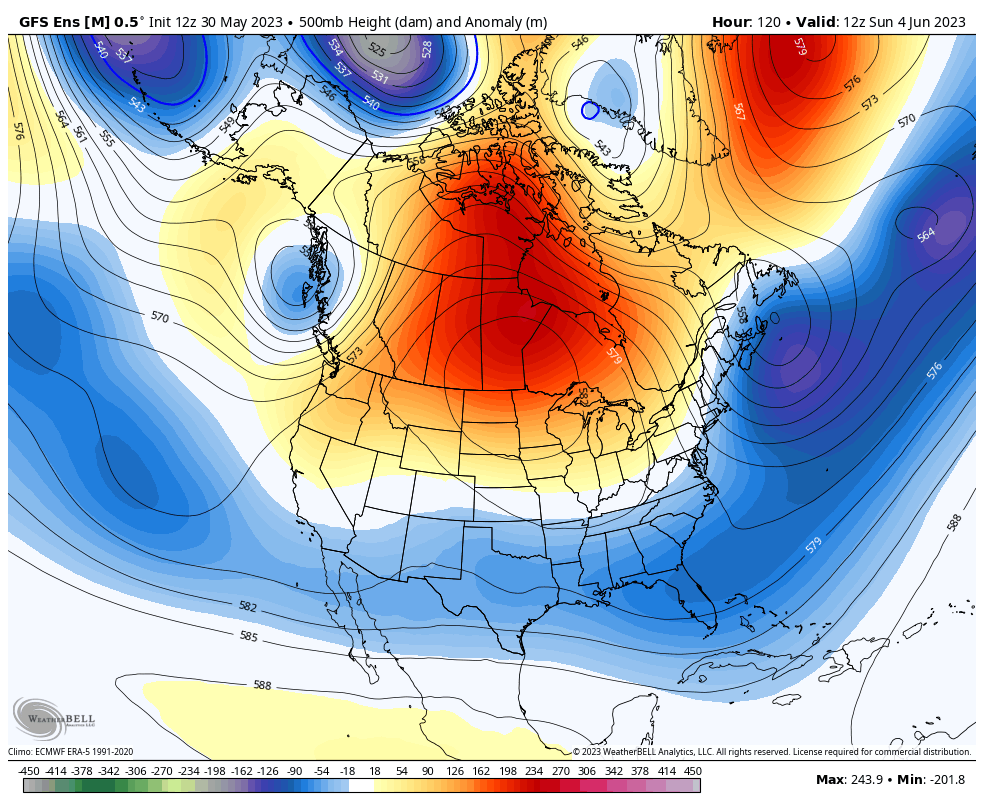
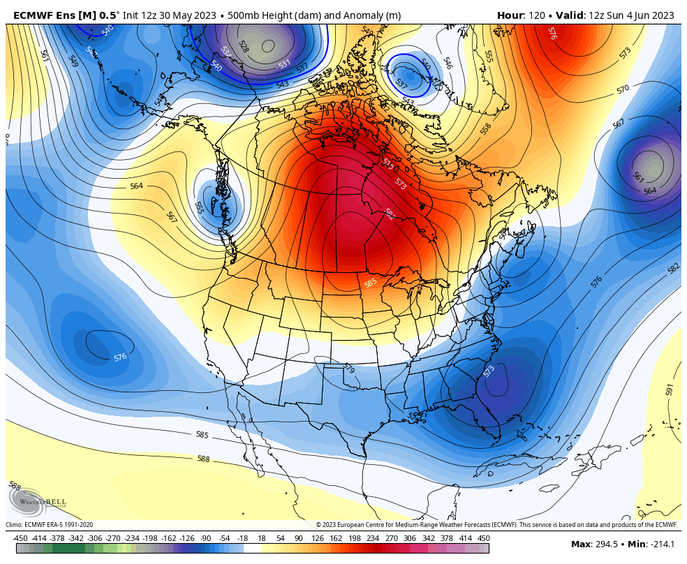
The Ensembles continue to advertise a trough digging into the region and the eastern half of the country next week…
GFS ENSEMBLES
EURO ENSEMBLES
Have a wonderful Wednesday and take care.

Thanks Chris. A major change will take place. When that will happen remains a mystery. Watch what takes place in the Tropical Pacific this Summer with ENSO. When the Pacific turns positive and the Atlantic negative, Hurricanes / Typhoons will be more common off the South Pacific coast.
The word drought came up in the NWS service discussion this morning. An area from Iowa to Ohio is likely to develop a drought in and around the 6th of June. Did not mention any drought here in Kentucky, but we have an ongoing ‘ pocket drought ‘ here in Taylor County. Hopefully, we will receive some relief in the coming days with afternoon / evening thundershower development.
bout time wkyt stepped up, alexa and carlyn killing it!!!!!!!!!!!!!!!! carlyn a beauty to see of a morning as a intern .