Good Friday to one and all. We have a toasty weekend taking shape but the higher numbers aren’t settling in for the long haul. As a matter of fact, temps will likely go below normal again for much of next week.
As usual, we start with today and roll forward. Highs on this Friday reach the low and middle 80s in the south and southeast with 85-90 in the north and west. Skies look mainly dry with fairly low humidity levels.
Those nice humidity levels hang tough this weekend as temps continue largely in the 85-90 degree range with the occasional low 90 in the north and west.
I’m adding the threat for a scattered shower or storm to the weekend forecast as a weak system moves in from northeast to southwest Saturday night and Sunday. This looks just strong enough to touch off some action…
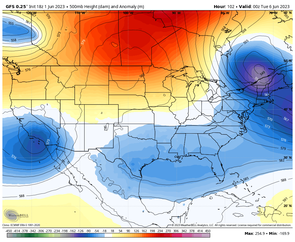
Temps will come down some during this time and this is part of a much larger change for next week as the pattern does what we’ve been talking about it doing for more than a week now. The heat ridge in the upper Midwest retrogrades to the northwest into Canada and Alaska. At the same time, a deepening trough develops across the eastern part of the country and also works back toward the west.
The models are spitting out one big cutoff system in the east…
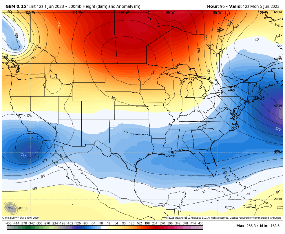
The Canadian has a similar look…
The end result is a really cool pattern with the threat for some showers and storms pushing through…
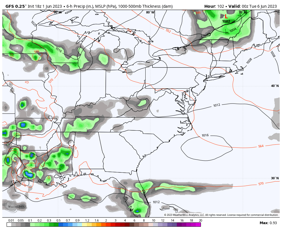
The GFS has some 40s for lows…
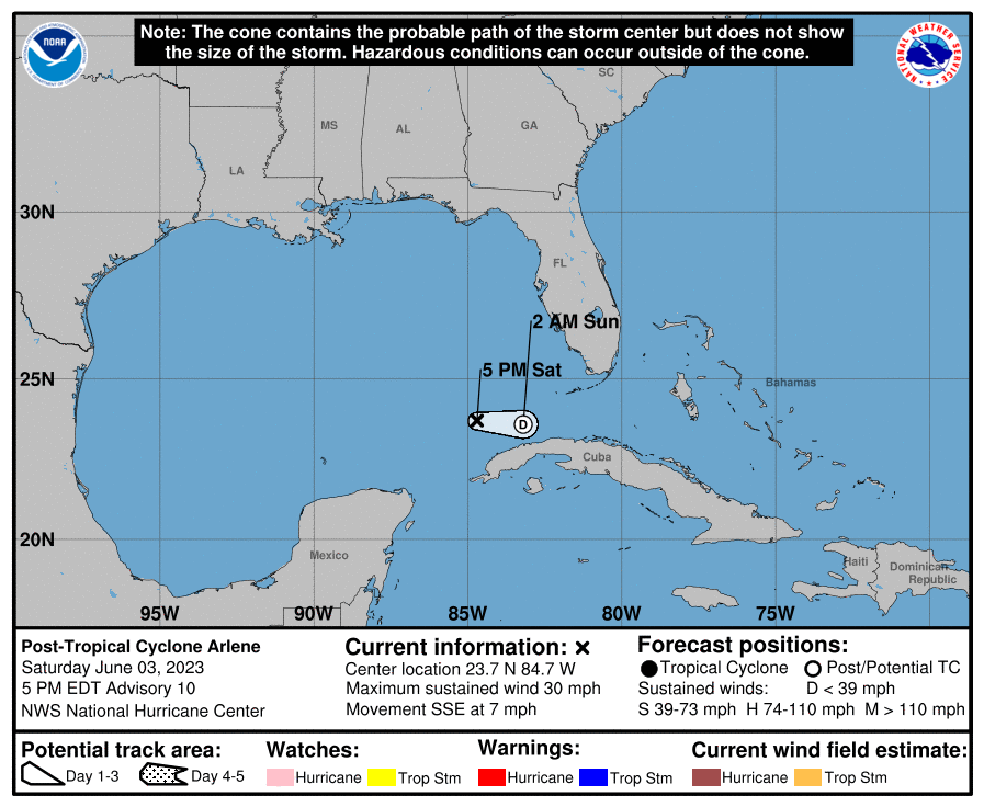
By the way, a Tropical Depression formed in the Gulf of Mexico Thursday…

The official track on this looks to keep it well away from Florida…
Enjoy your Friday and take care.

Thanks Chris. The Tropical depression is forecast to become a Tropical storm. Will it be named ? Glad it’s not going in Florida’s direction at this time, but it will be watched. The Tropical action is causing our weather to move from east to west. Temperatures are not that uncomfortable. The only factor that’s in the negative is the lack of precipitation. Hope this changes with the cooler weather next week.
Thanks Chris. The Tropical depression is forecast to become a Tropical storm. Will it be named ? Glad it’s not going in Florida’s direction at this time, but it will be watched. The Tropical action is causing our weather to move from east to west. Temperatures are not that uncomfortable. The only factor that’s in the negative is the lack of precipitation. Hope this changes with the cooler weather next week.
Sorry for the double click Chris. It’s early.
Sorry for the double click Chris. It’s early.
My PWS near Bowling Green finally recorded the first rain in eleven days on Thursday.
It totalled 0.01 inches.
Not exactly what I’d call rainFALL!
In spite of the splotches of green the models are painting, it looks dry. Cooler is fine, but good, steady rainfall is needed. Our weather guy will pooh-pooh any concerns until the Drought index puts us in D3 or more. Drought.gov has graphics that show central Kentucky is drier than normal and no real relief is in sight.
Yeah, I am becoming concerned.
Back in the late 1980’s we had a prolong drought in Indiana that lasted from 1987 to 1990. I was well into the nursery business at that time. All I did was water 24 / 7. I have hopes that the current dry spell will end when tropical activity ceases. As we get closer to having a full blown El Nino this will happen.
Tropical Depression Two is likely to become a remnant low sometime on Saturday. Lots of windshere in the Southern Gulf.
We now have a named Tropical Storm Arlene. Moving south towards the Caribbean Sea where she will hopefully encounter windshere.
spelling correction : windshear