Good Saturday to one and all. It’s a toasty day in the Commonwealth as we track an increasing threat for a few storms coming at us against the grain. This leads the charge toward a much cooler pattern taking shape for the upcoming week.
Temps today range from the mid 80s to the low 90s across the state with the southeast being a little cooler than the north and west. Humidity levels are still low, so we aren’t worried about any kind of heat index at all.
A touch of moisture drops in from the northeast later today and into Sunday. This may touch off a scattered shower or thunderstorm for parts of the region, but most should stay dry.
Here’s your daily dose of storm tracking radars…

The numbers start to come down from the northeast to the southwest early next week as our pattern undergoes a significant change. This is something we started talking about nearly 10 days ago when we showed how the Ensembles were forecasting things to go in reverse once again. Well, here we are and the operational models are all on board with this exact pattern.
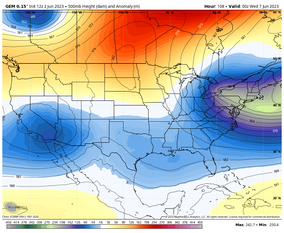
Watch how the ridge across the northern part of the country gets pushes west and north into Canada while a deepening trough digs into the east…
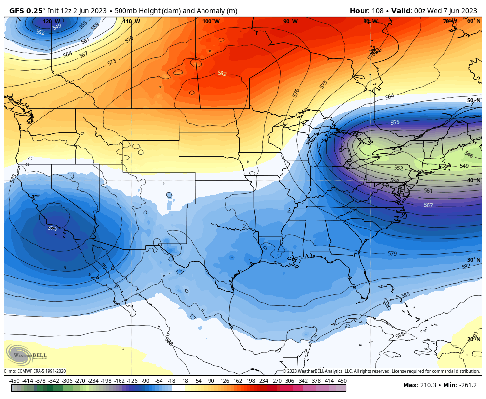
The GFS was the first operational model to pick up on this change and it’s doubling down with a second big push coming the following weekend. The GFS now has some besties in the EURO and the Canadian…
EURO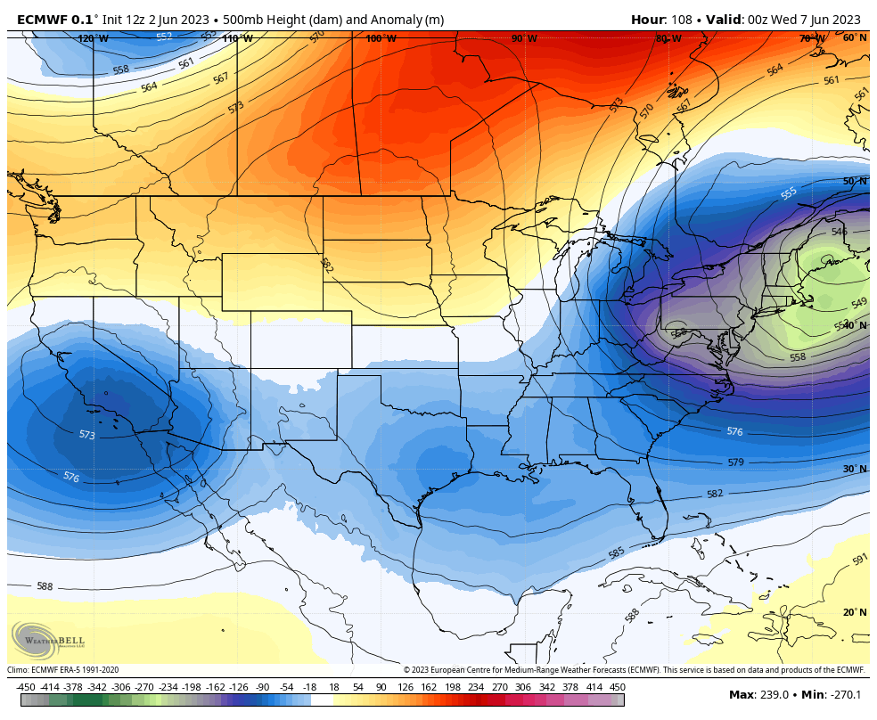
CANADIAN
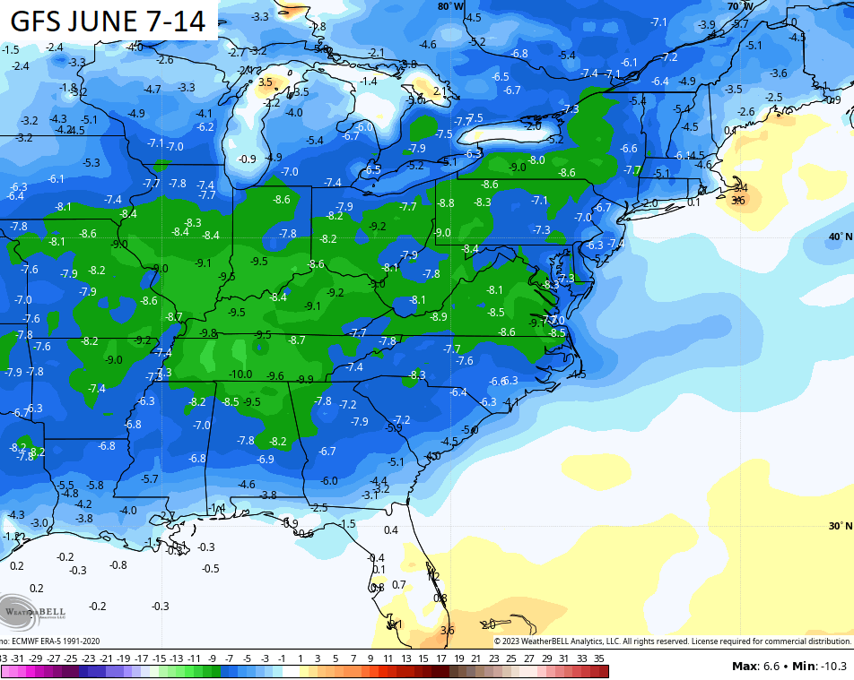
Check out the GFS temp departures for the second week of the month…
Enjoy your Saturday and take care.

Thanks Chris. As long as the high temperature doesn’t exceed 95 degrees with dewpoints in the 60’s, I’ll be fine with that. I will be liking the cooler mornings next week along with the mild afternoon temperatures, but the chances for Rain look slim for my area.
It looks to be another mainly dry week ahead of us.
I do love the forecasted temperatures.
Please send a nice gentle rain to NKY. My garden needs it! 🙂
A dip to the upper 70s isn’t much of a cool spell.
A monthly perspective.
Cooler than normal.
Still pleasant which is what matters. We do need some rain, though.
Agree
The long distance forecast model I am looking at is showing next Sunday at the next best chance.(Only 50% chance)
I think the rainy periods will start before the 15th of the month. NOAA on their 3 month extended is calling for near normal temperatures and above normal precipitation in our area of the World. Looking like a tame Summer. I hope.
Here’s NOAA’s extended outlook for ( June – July – August. ) Hoping the forecast holds :
https://www.cpc.ncep.noaa.gov/products/predictions/long_range/seasonal.php?lead=1
We are having a nice downpour but how long it last is another question. I have been getting storm alerts. I always have loved to watch a storm start be outside in the wind. My Dad use to also. He would take his coffee and sit on the porch while it stormed.
crystal, me and my wife always sit on the porch and watch the storm come in. absolutely love it! im in coal run and we sure got a heavy downpour and some pea sized hail too. the whole thing lasted about 30 minutes here. when i was little my dad and grandparents would all sit on the porch while it stormed. nice memories.