Good Friday to one and all. We’re kicking off the weekend with smokey skies and very pleasant temps. This nice weather runs through much of Sunday before some storms crash back in. These storms kick off a period of unsettled weather for much of next week.
Today starts with a weak front dropping in from the north and it may have an isolated shower or storm with it. Most will stay dry, but your radars are on duty just to be safe…

Highs this afternoon will be in the upper 70s for much of central and eastern Kentucky with 80-85 west. The air will be very comfy but some smoke will still be showing up.
Saturday looks wonderful with a mostly sunny sky. Temps range from the upper 70s to middle 80s from east to west. Humidity is still low with a mostly sunny sky. This is a REALLY good day, folks.
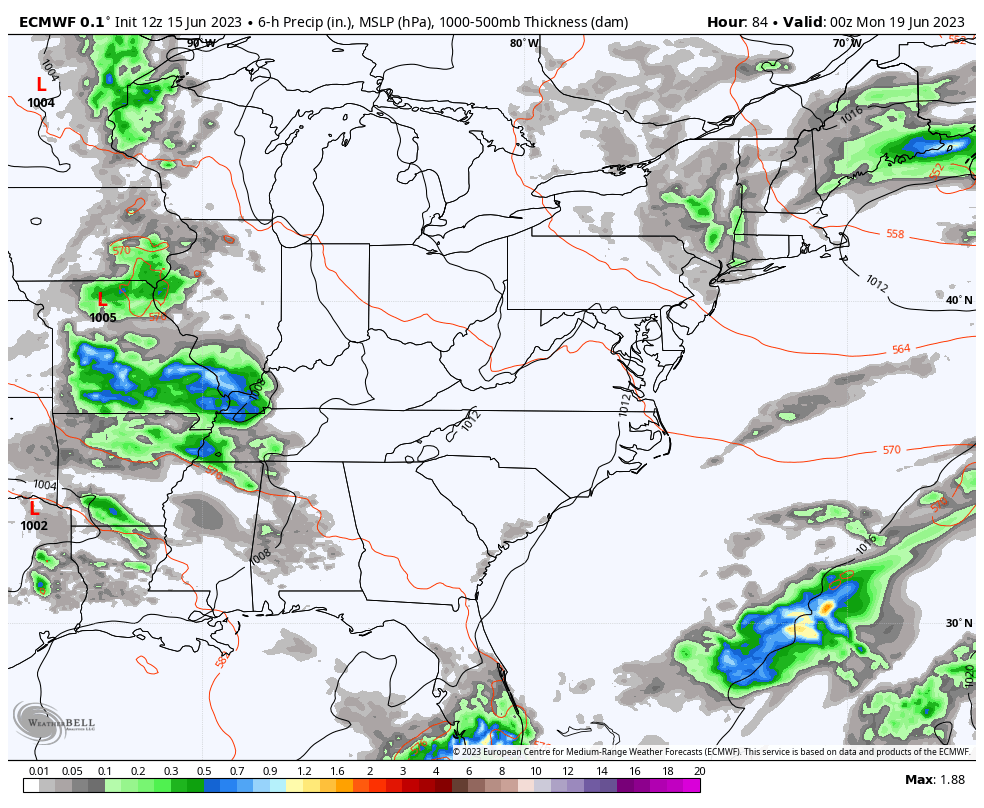
Clouds increase Sunday with some showers and storms arriving in the west. This is ahead of a big upper level system that looks to cut off near the region early next week. This may hang around through much of the week as the EURO suggests…
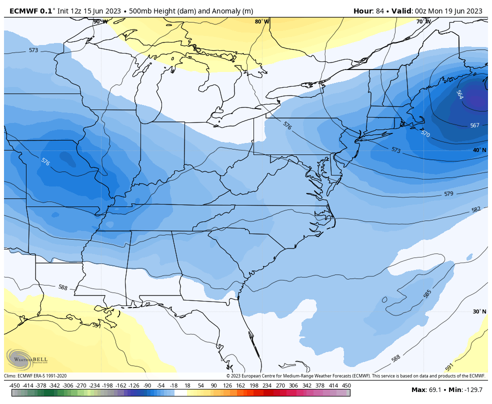
This scenario would keep rounds of showers and storms spiraling across our region and points south and east…
That’s the EURO and it’s the slowest with getting that system out of here.
The Canadian is similar into the middle of next week but then takes the upper low away before the week is over…
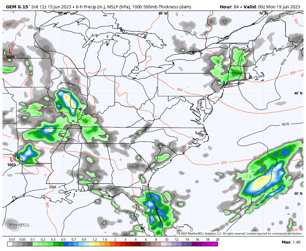
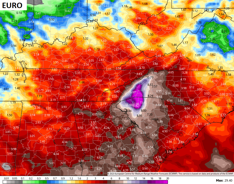
Some good rains may very well impact much of our region. The EURO is the soggiest…
A few things to watch with this setup:
- There is the chance for a few strong to severe storms in the west Sunday and Sunday night.
- I can’t rule out a few stronger storms farther east into early next week.
- We will have to watch to see where that upper low spins because it may produce a spiraling band of very heavy rain around it. That could cause some issues if it does set up on our region.
The tropics are also springing to life. I still think we have to watch the Carribbean over the next week and the National Hurricane Center is tracking a system coming off Africa that may develop in the coming days…

A system like that is VERY rare this early in the season, but the super warm waters would support development.
Have a great Friday and take care.

A ” Great ” day for recreation if you don’t have breathing problems. A bad day for the Corn Farmers / Agriculture. More important to mention. Now a Rex Block setting up ( High Pressure ) capping the Atmosphere. Means very little chances for Rain / Showers. Hope this changes soon to a more Humid / wetter pattern.
Tropical Storm Arlene has already happened. The disturbance off the coast of Africa currently has a zero chance for further development. That’s good thing, but would not rule out it’s development. NOAA is forecasting a normal Tropical Atlantic Hurricane season. I fined that the Pacific has the best chance for Tropical Storm development this Summer with the developing El Nino.
https://weatherstreet.com/hurricane/2023/Hurricane-Atlantic-2023.htm
I liked to see some rain.
The long distance model I look at daily is not keen on rain chances over next 10 days.
Time will tell.
I wonder if this pattern will hold for the entire summer?
I certainly hope not. What worries me is that parts of Kentucky are in an ongoing Drought. Mostly the North and Northeast counties. I hope this Drought ends soon.