Good evening and Happy Father’s Day to all the pops out there. Scattered showers and storms are rumbling across western Kentucky as we track a slow-moving storm system into the region. This brings heavy rain that can cause some high water issues.
I have no changes to the greatest risk for, at least, local flash flooding issues through Tuesday…

Spiraling bands of showers and storms can dump several inches of rain in a few spots and the models are picking up on this. Take a look at some of the totals they’re spitting out over the next few days…
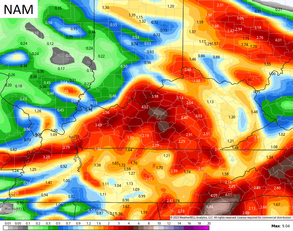
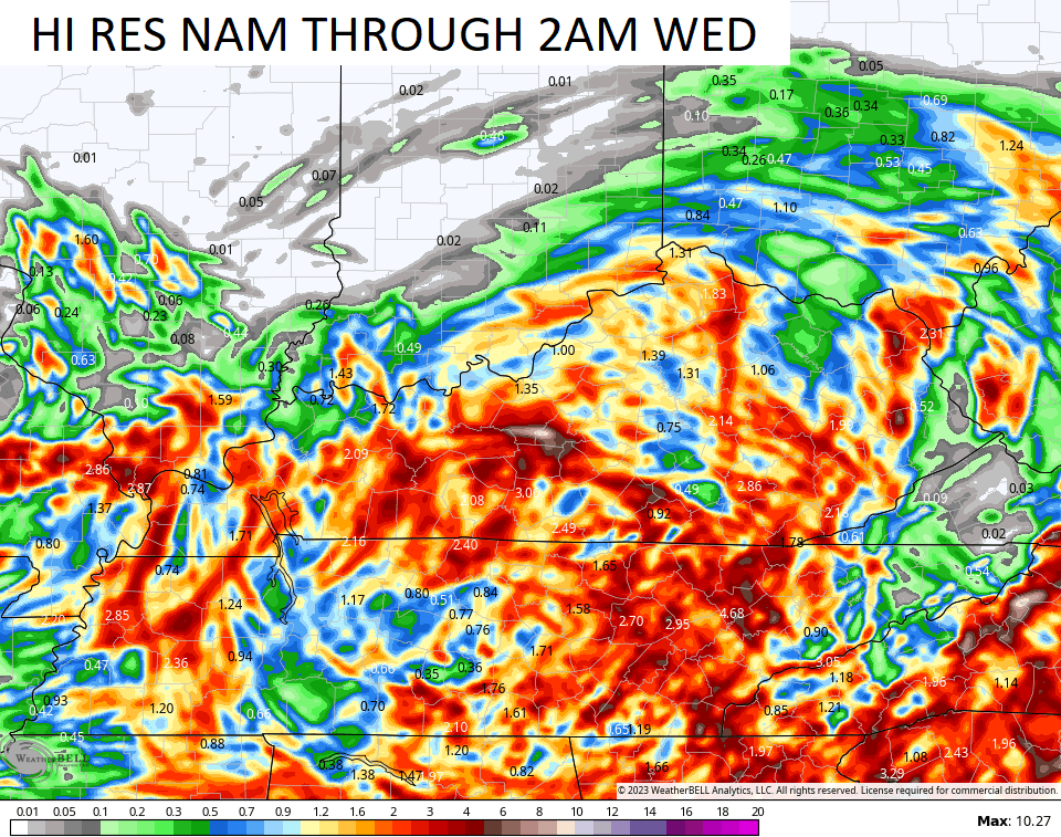
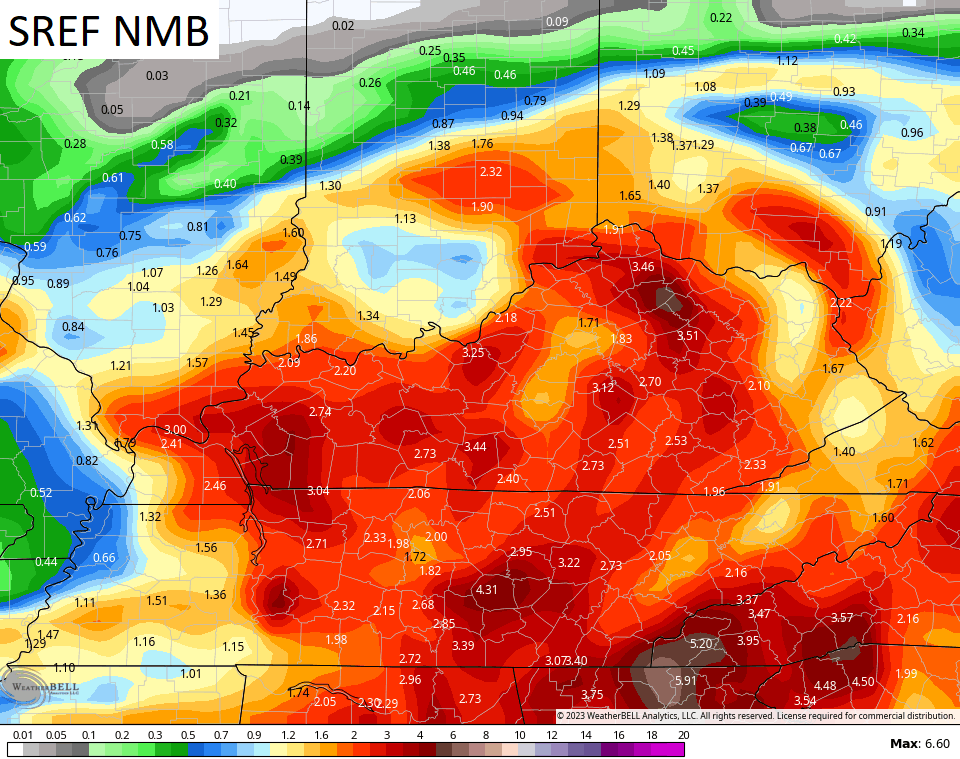
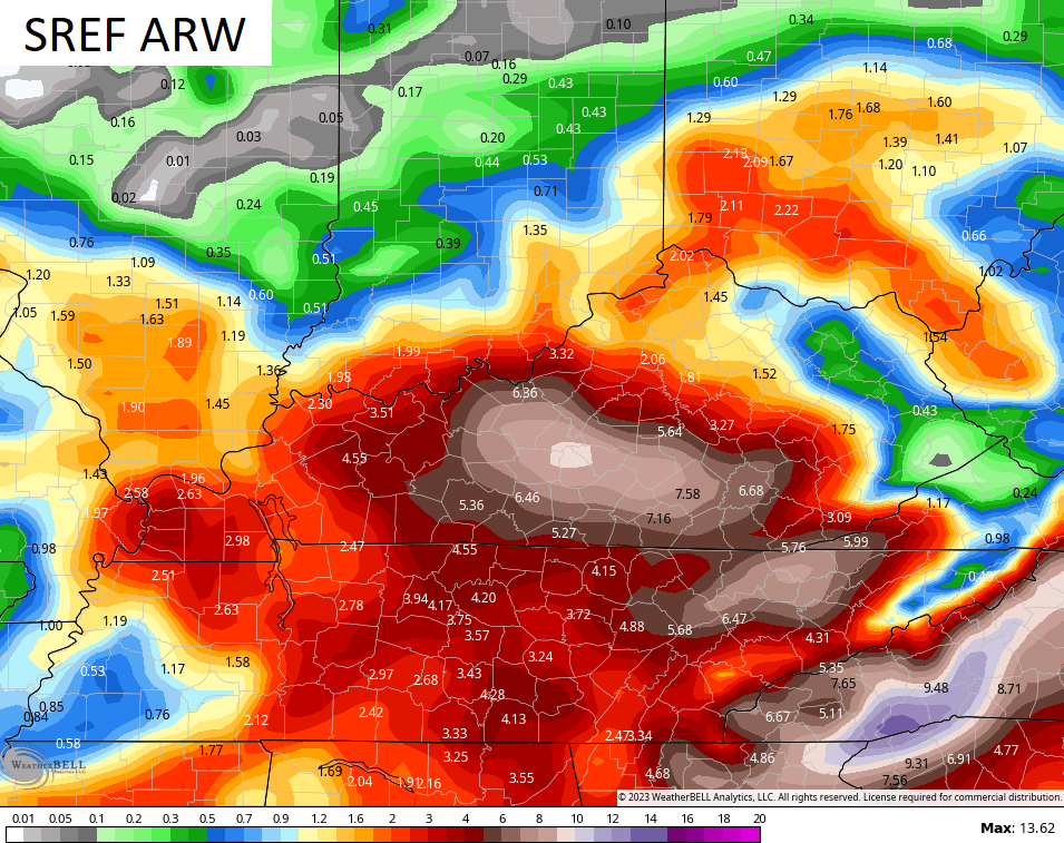
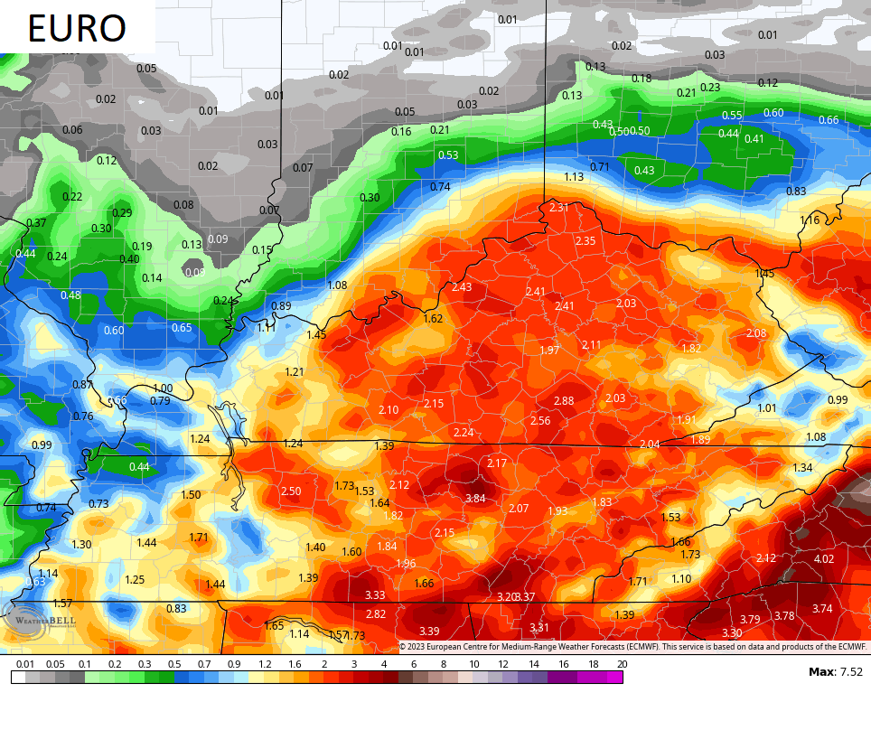
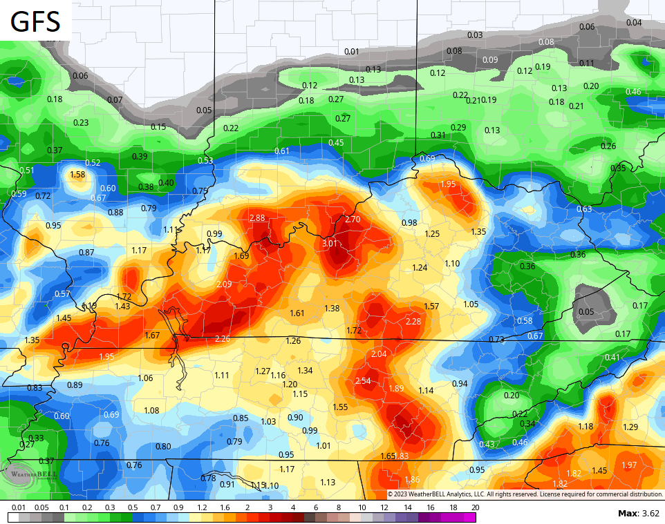
You can see the variation in totals and placement of the highest rainfall, but many of the models are pinpointing areas of central Kentucky for the heaviest.
I had hoped the NWS would have issued a Flood Watch to raise awareness of the potential, but the chance for flooding didn’t even get a mention in the Hazardous Weather Outlook. These are the things that must change with the NWS.
Here are your radars to track the rain and storms across the region…

Enjoy the rest of the day and take care.

First line of storms has split around central Warren County. Off to a great start…
Radar showing rain and storms currently over my area, but not reaching the ground ( Virga. ) The atmosphere is dry and needs more moisture to produce the model’s predicted rainfall totals. Maybe late tomorrow ?