Good Tuesday, everyone. The end of the week has some 2012 in it, but centered farther south and west. Heat will get into western Kentucky with the potential for high wind producing severe storms working around the edge of the heat. That means it’s going to get active around here.
Let’s begin with today and roll forward. Temps will be very pleasant for this time of year with the potential for isolated showers and storms to go up again across north and east…

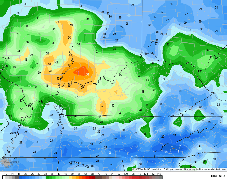
Heat builds into western Kentucky starting Wednesday and then kicks into high gear Thursday and Friday. 100 degree temperatures are a good possibility with humidity levels making it feel even hotter.
Temps won’t be nearly as hot across central and eastern Kentucky, but will still be very steamy.
With this Texas heat wave flexing north late this week and weekend, it puts much of Kentucky in the line of fire for repeat thunderstorm clusters dropping in from the west and northwest…
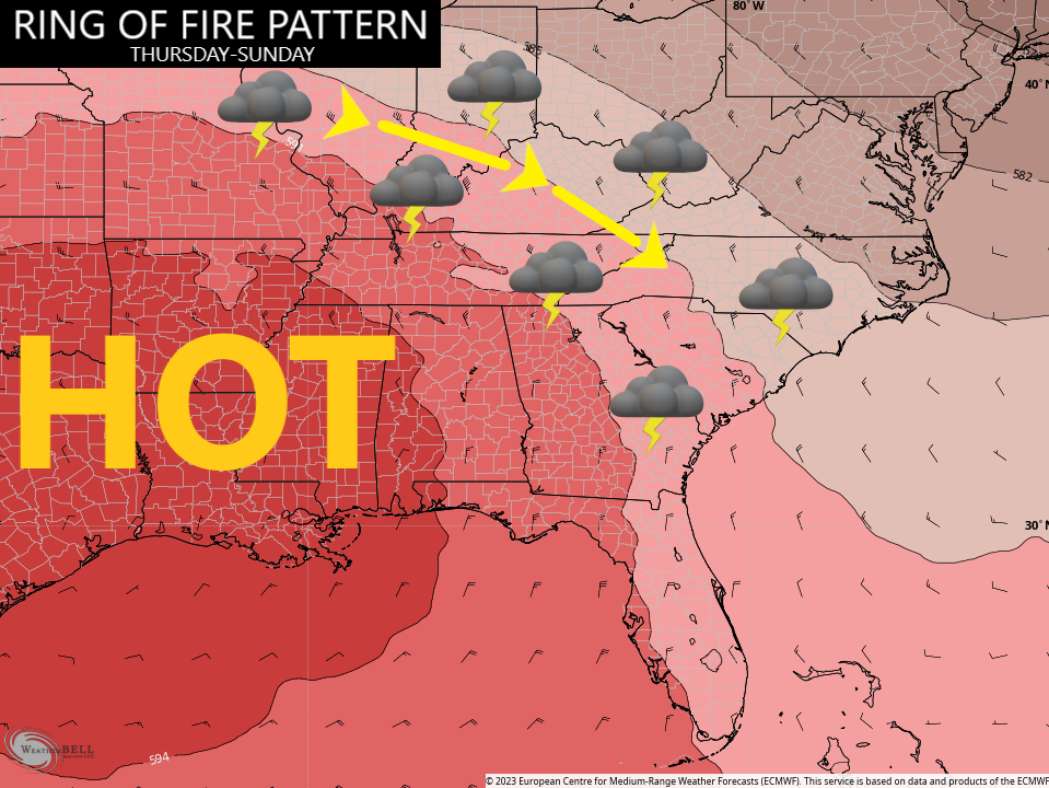
This kind of setup produces major wind maker thunderstorm clusters and can occasionally spawn a derecho. This is a setup we will need to keep a very close eye on.
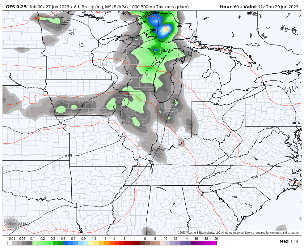
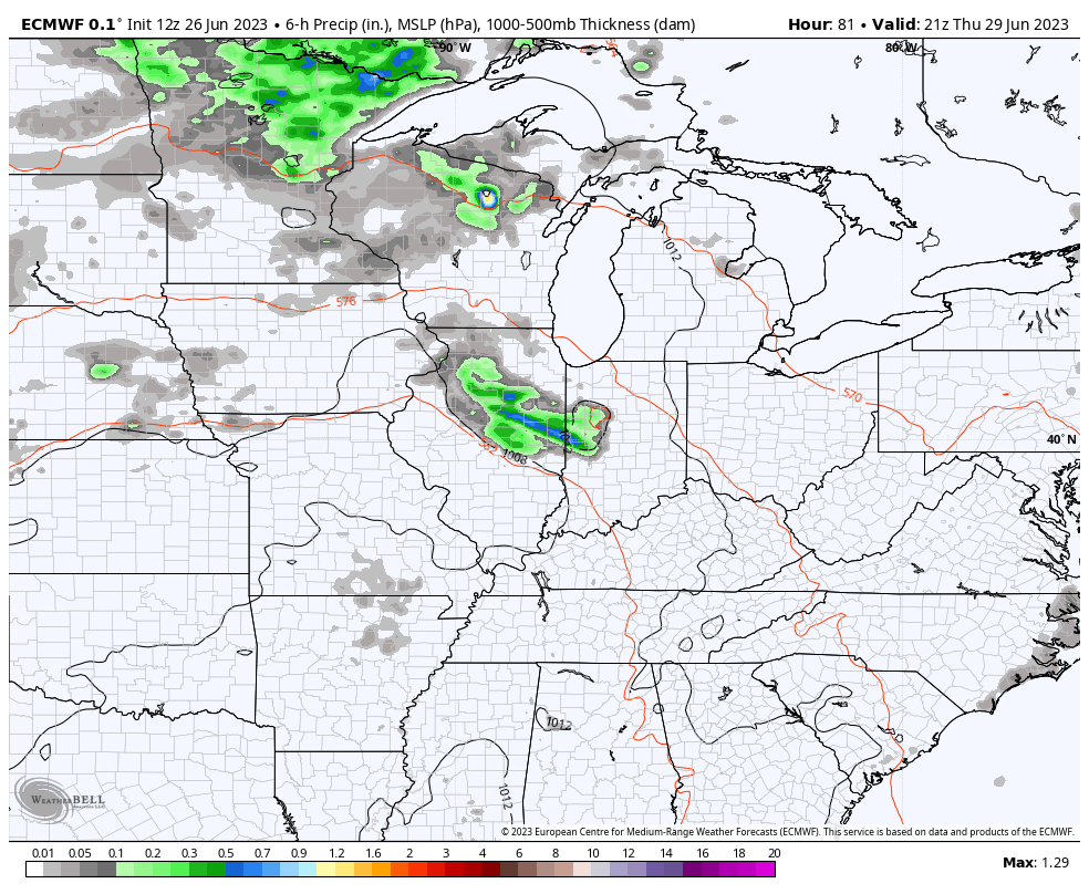
The forecast models are picking up on the potential for big storms rolling through here…
GFS
EURO
They are just now beginning to see the significant wind potential with these storms. Here are the last two wind gust forecasts from the GFS…
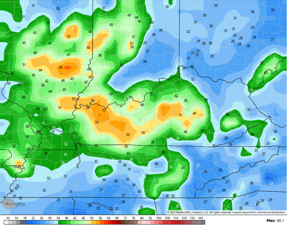
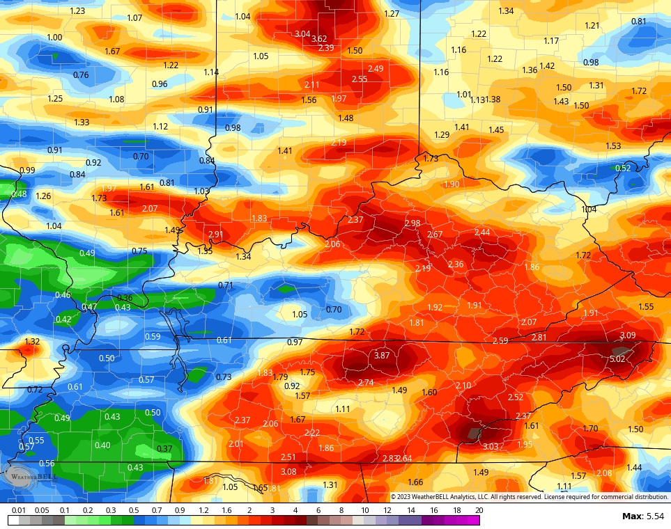
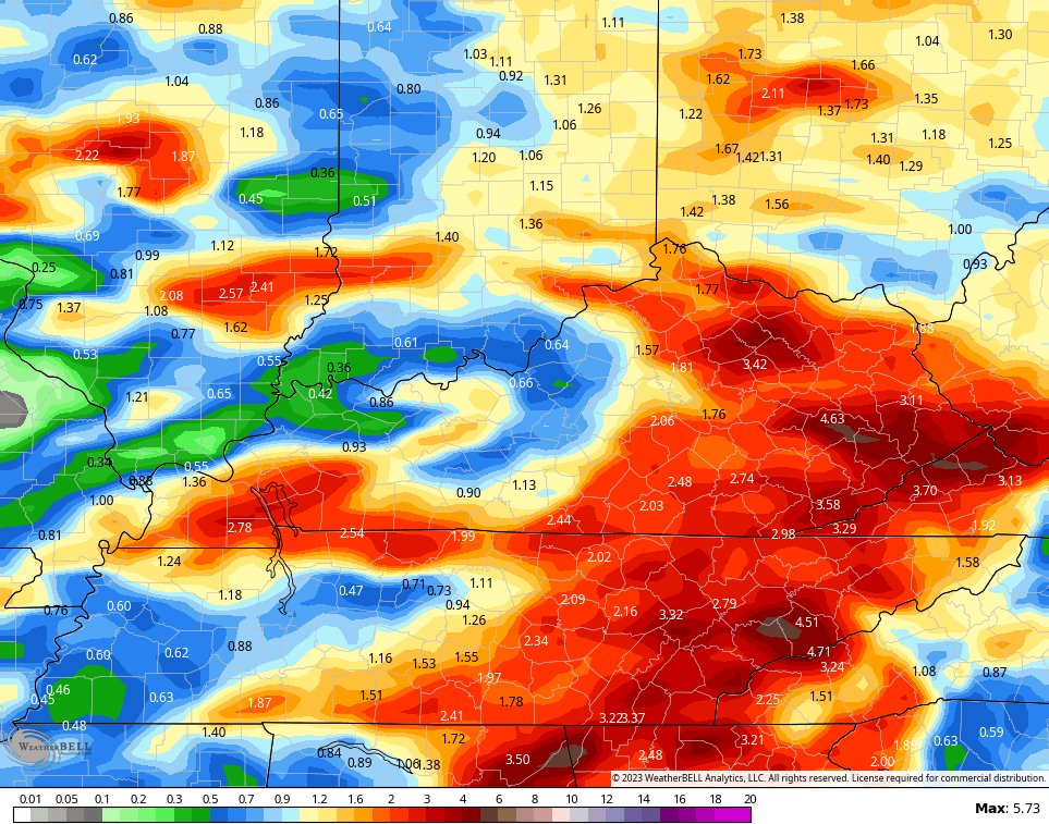
In addtion to the severe threat, these storms may be prolific lightning and rain producers. The signature for torrential rainfall is also showing up. The last two rainfall forecasts from the GFS…
I may throw you guys another update later today. Have a good one and take are.

Sounds terrible Chris.
It appears the nice temperatures are coming to an end.
“It was nice knowing you.”
Yeah, It was nice while it lasted, but Summer is suppose to be hot and humid or warm and humid, just depends on your elevation here in the state.
Wednesday looks like the best day to catch up on mowing, trimming, and weeding.
The heat in Bowling Green during 2012 was unforgettable, when new high temperature records were set during a brutal 4-day stretch:
June 28th – 106°, June 29th – 110°, June 30th – 108°, and July 1st – 105°!
Joe that is as hot as a firecracker on the Fourth of July. I remember the temperature on the Fourth of July back in 1977 in Vanderburgh county, Indiana at 103 degree high. The coolest was in 1964 or 65. The high temperature, if my memory serves was in the low 60’s.
I use to do that kind of work everyday. Then when I finish I started on my plant propagation of my Azaleas. It was always uncomfortable temperatures and humidity, but I didn’t mind as I really liked my job.
We generally are in the mid to upper upper 80’s here in the hills. I been living here for 14 years and don’t remember any Summer that featured temperatures over a 100 degrees.
Joe that was serious heat. I remember when that Derecho came through eastern Ky it was wild. I was outside but came in very fast we lost power for a few hours too! I remember it also being hot or very warm with no power that afternoon. I tried to post a link to a article about it don’t know if I did it right or not I don’t think I have ever tried to share a link so look over me if I didn’t do it right.
https://www.wtvq.com/2022-marks-ten-years-since-a-damaging-derecho-marched-across-eastern-kentucky/