Good Wednesday, everyone. Here we go again… Rounds of strong to severe storms are on the way to the region over the next several days. These storms are on the leading edge of a heat wave extending into western Kentucky and can really flex on us with big time winds.
Before we get into all that, the smoke is thick out there once again today. The Canadian wildfires continue to burn and they’re sending thick smoke back into our region through tonight. Those with breathing difficulties should take it easy and try to stay inside as much as possible today.
The threat for strong to severe storms runs from Thursday through Sunday and those storms will come at us in waves. Each of these waves may producing damaging winds, large hail and torrential rains…

We aren’t alone in the potential for severe weather. We’re likely to see these storms developing to our west and northwest and rolling toward the east and southeast.
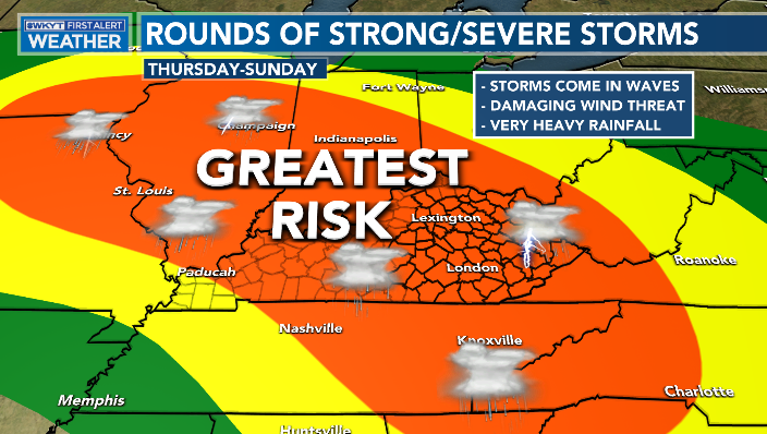
Here’s the area the Storm Prediction Center is focusing on for Thursday’s severe threat…
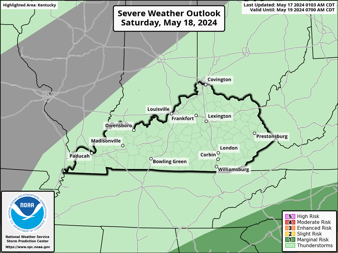
This threat then looks to increase on Friday…

Forecast models are going to have a tough go at it in trying to find these waves of thunderstorms, so keep that in mind going forward.
Temps across the west will likely reach 100 degrees at times from Thursday through Saturday. Heat index values will be in the danger category. As a matter of fact, this juicy air will send those heat index values close to 100 all the way into central Kentucky on any day where storms don’t fire during the peak heating.
As we get into 4th of July week, additional showers and storms look to target the region. This animation goes from Monday through Wednesday of next week…
The 4th is on that Tuesday so we may very well be dodging some showers and storms at times.
I will have another update later today. Until then, make it a good one and take care.

Thanks Chris. Hoping this scenario doesn’t play out through the extended period. I have breathing problems, so
I will have to stay indoors. Bummer.
I drove to St.Louis yesterday & back to Louisville. The sky was full of smoke both ways.
It really came noticeable near sunset.
I’ve heard that the Canadian wildfires are expected to rage throughout the Summer, which is bad news for those with respiratory conditions. This Summer is shaping up to be memorable for all the wrong reasons.
I never seen so much smoke in our atmosphere. Makes me think there is something unnatural going on besides the usual occurring wildfires we have during the Summer months.
Here’s an article that discusses another component of our atmosphere which,in addition to a strengthening El Niño, may have impact our weather during the coming Winter. Knowing whether that impact is positive or negative remains to be seen.
https://www.severe-weather.eu/long-range-2/winter-2023-2024-qbo-polar-vortex-el-nino-weather-impact-united-states-canada-europe-fa/
Very informative article on the QBO easterly winds along the Equator, But I though that in El Nino Fall and Winters the winds in the Pacific were westerly ? Kind of confusing. Last Winter we were under a moderate La Nina and the Polar Vortex was strong and it split about mid Winter. When this happened we had a very mild Winter here in the Southeast. Presently, in the Pacific we have a weak El Nino and at the sametime a very negative PDO, which still says that the atmosphere and the oceans are still influence by La Nina. El Nino will happen this Fall and Winter, but will not fully affect our atmosphere and oceans until the PDO goes way positive. I have my doubts that this will happen in 2023- 24. Maybe the year after ???
Thanks for sharing Joe. I would like to read your interpretation on how this will play out this Fall and Winter.
Joe interesting article now what does that mean for us maybe lol ??? I am talking about as in this winter? I guess it’s stay tuned and wait and see. It does seem we will have a better chance this year of a more productive winter than last year but what do i know lol
I don’t get the canada fires… the area the fires are in has seen rain…how are they still going?
I would REALLY like to know too Mark. All we get anymore out of the NEWS is more Lies !!!