Good evening, folks. A second wave of severe storms is blasting through the region right now and bringing some bit time winds. I wanted to freshen up the blog to get you some quick tracking tools.
A Severe Thunderstorm Watch is out until 9pm EDT for much of central and western Kentucky as what’s left of a derecho moves in…
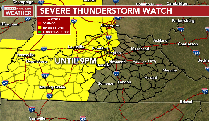
Damaging wind is the main threat with this line as it weakens moving southeast. Additional storms may fire behind this later this evening into tonight.
Here’s the current Severe Weather Outlook for today…

Here’s a breakdown of the individual threats we’re facing…
Damaging Wind

Large Hail

Tornado Threat

The threat for more rounds of strong to severe storms is with us for Friday and the Storm Prediction Center has most of the state in the Slight Risk…
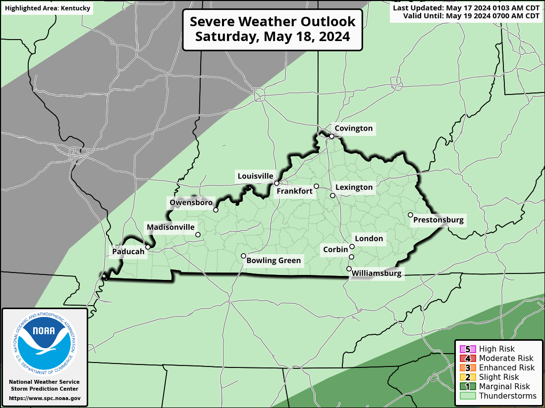
The severe threat for Saturday is pretty much the same…

I will update as needed and be on WKYT-TV as needed today. I leave you with your storm tracking tools…

Current watches

Possible Watch Areas

Have a great evening and take care.

We finally got some decent rain at my PWS near Bowling Green, with 1.25″ falling over the course of 2 storms, including a Tornado Warning around Noon CDT. Turns out it was radar-warned mesocyclone, with broad circulation. No touchdown, but we were buffeted by strong winds.
Speaking of strong winds, we had a moderate derecho blow through around 3:30pm CDT. Saw a nice shelf cloud and some mammatus clouds, as winds gusted over 45 mph.
Tomorrow, we’ll get a taste of the same.