Good evening, folks. Here we go again. Rounds of strong to severe storms are kicking back in and will be with us through the weekend. Damaging winds, large hail and flash flooding are the main threats to watch for.
Speaking of watching, a Severe Thunderstorm Watch has been issued for western Kentucky until 11pm CDT…

Storms that work across this region will bring damaging winds and large hail on there way to the rest of the state. Watch how additional strong and severe storms fire behind the main line. This animation goes from this evening through 9am Saturday…
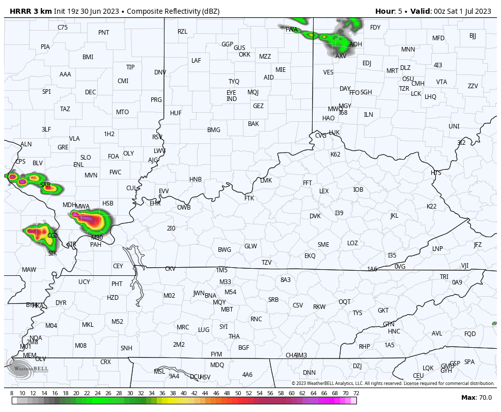
Flash flooding is also a good possibility with these storms that can put down a quick 2″-4″ of rain. The Lexington metro picked that up before sunrise this morning with Lexington recording the wettest final day of June in history with 2.57″ We even had high water rescues, but no Flash Flood Warning. The lack of warnings of all kinds coming from the NWS in Louisville is becoming a significant issue.
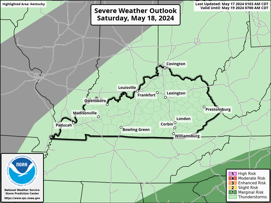
More waves of strong to severe storms will roll across the state Saturday and Sunday. The potential for some big time damaging winds is there and the SPC has an Enhanced Risk for Severe Storms for parts of the area on Saturday…
That threat continues through Sunday…

I leave you with your storm tracking tools…

Current watches

Possible Watch Areas

Have a great evening and take care.

That’s serious heat out west.
I wish these storm waves would cease fire. I hope we receive the rains though. Stay safe everyone.