Good Saturday and welcome to July! It may be a new month but it’s the same old weather pattern with rounds of strong to severe storms rolling across Kentucky. This action may actually become more impactful through Sunday.
Our Saturday features clusters of strong to severe storms to start the day with the possibility of additional flash flooding issues for some. We’re likely to break out into some steamy sunshine during the afternoon and this will help fuel the fire for more severe storms to develop to our west. Those will then sweep from west to east and may turn into a big time wind maker.
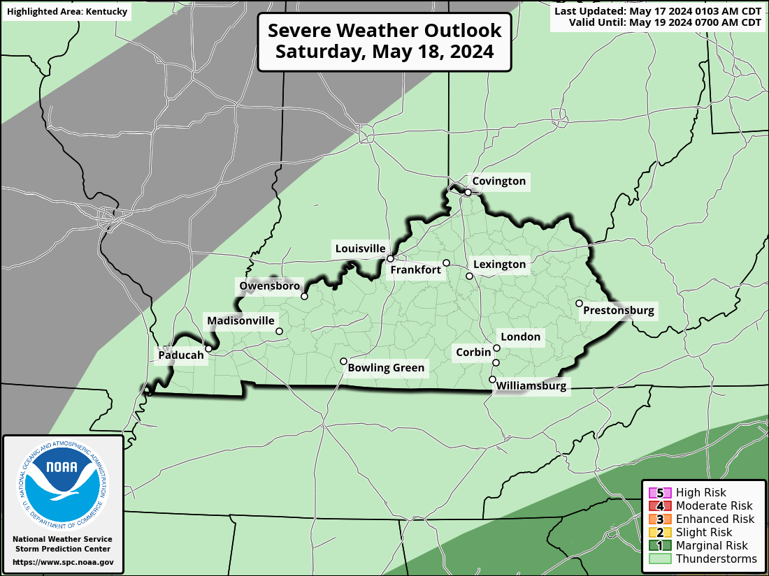
Here’s today’s Severe Weather Outlook from the Storm Prediction Center…

Here’s the breakdown of the individual threats we’re facing today…
The potential for damaging winds is higher than in recent days. Here’s the latest from the Storm Prediction Center…

Large Hail is also a real possibility…

The Tornado threat is fairly low, but it’s not zero…

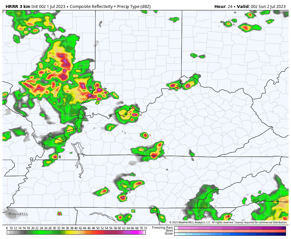
More rounds of strong to severe storms will then develop and roll from west to east tonight through Sunday. The models continue to have a difficult time in handling when and where these storms develop. The HRRR has had a decent handle on the setup. This animation goes from 8pm today through 8pm Sunday…
Here’s the latest Severe Weather Outlook from the Storm Prediction Center…
I will update as needed and be on WKYT-TV as needed today. I leave you with your storm tracking tools…

Current watches

Possible Watch Areas


OK the storm we are having right now in the MIDDLE OF THE NIGHT is a bit much for me. Constant lightning, torrential rains going sideways. I swear I feel like it’s already rained another inch at least
We had .77 at my house (SE Lexington). And the lightning was like a strobe light.
It’s been a very quiet night / early morning here in Maple. Hardly any rain has fallen this past week. Maybe that will change today and tomorrow ?
Received nearly 2.5″ in two days here in Clark Co (KY). Storms woke me up about the same time (4AM) each morning. On another note, today marks the 4th July 1 in a row that we’ve received rainfall. Also, the past couple of years, July has been a drought buster month:
July ’20: 0.69″
July ’21: 4.78″
July ’22: 0.54″
July ’23 (so far): 1.46″
*Fourth July 1 in a row
Yesterday was one of the most uncomfortable days in recent memory, and the numbers bear that out. Here were the readings from my PWS at 3:35 pm CDT
Temp: 97°F, Humidity: 69%, Dewpoint: 83.2°F, Heat Index: 124.5°F
We had zero rainfall, but a huge storm about 8 miles to the east produced more cloud to ground lightning strikes than I have observed in my 72 years on this planet!
I wish other areas would get rain. Ready for sunshine and heat.