Good Tuesday and Happy 4th of July! Temps are nearly normal on our Independence Day with just a few storms trying to develop. The scattered stuff is ahead of the potential for a few more strong to severe storms going up later Wednesday into Thursday.
Let’s kick off this holiday edition with what’s going on out there today. Highs are near normal in the 80s with a mix of sun and clouds. The atmosphere has enough juice in it to spit out a couple of showers and storms. Here’s hoping those don’t crasy any outdoor activities, but I have the radars on duty to help you out…

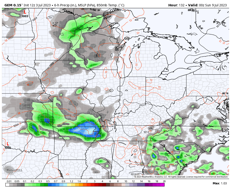
A cold front works toward the region late Wednesday and Thursday. This will fire off scattered showers and storms across the area on Wednesday with the greatest concentration across western Kentucky. This is where some of the storms could be strong or severe and the Storm Prediction Center has this area in the severe weather risk…

This threat may focus a little farthe east across the rest of the state for Thursday…

Some pleasant temps will then be noted by the time we get into Friday and early Saturday as we lower the storm risk.
That lower risk won’t last much longer as waves of showers and storms return to the region late Saturday and Sunday. This kicks off another active weather setup and we need to watch for an upper level low to cut off in the Great Lakes or Ohio Valley. The Canadian is the most aggressive model with this…
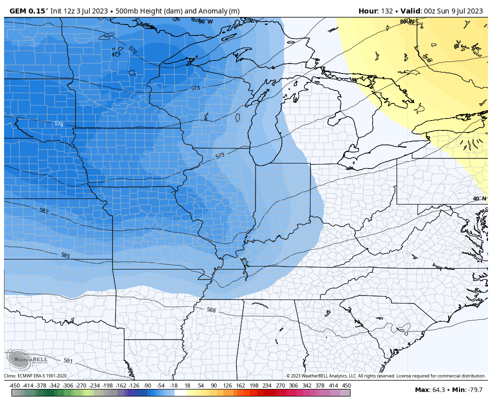
This system brings another cooler than normal week to the region as blocking goes up across Greenland and into western Canada. That forces the trough to dig into the eastern half of the country…
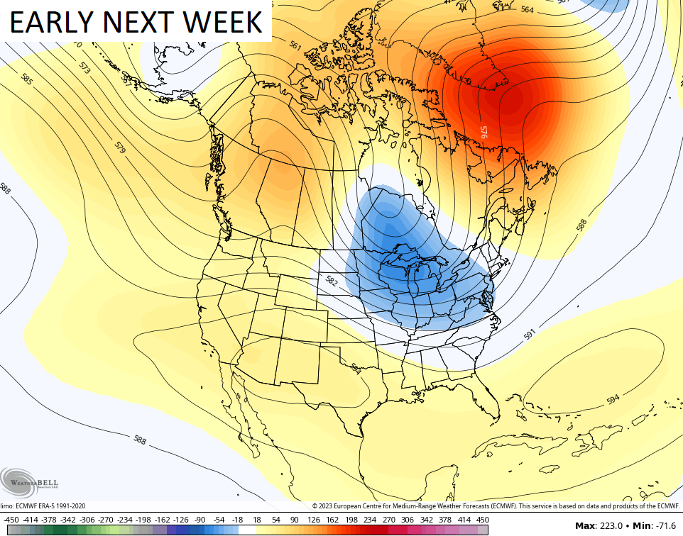
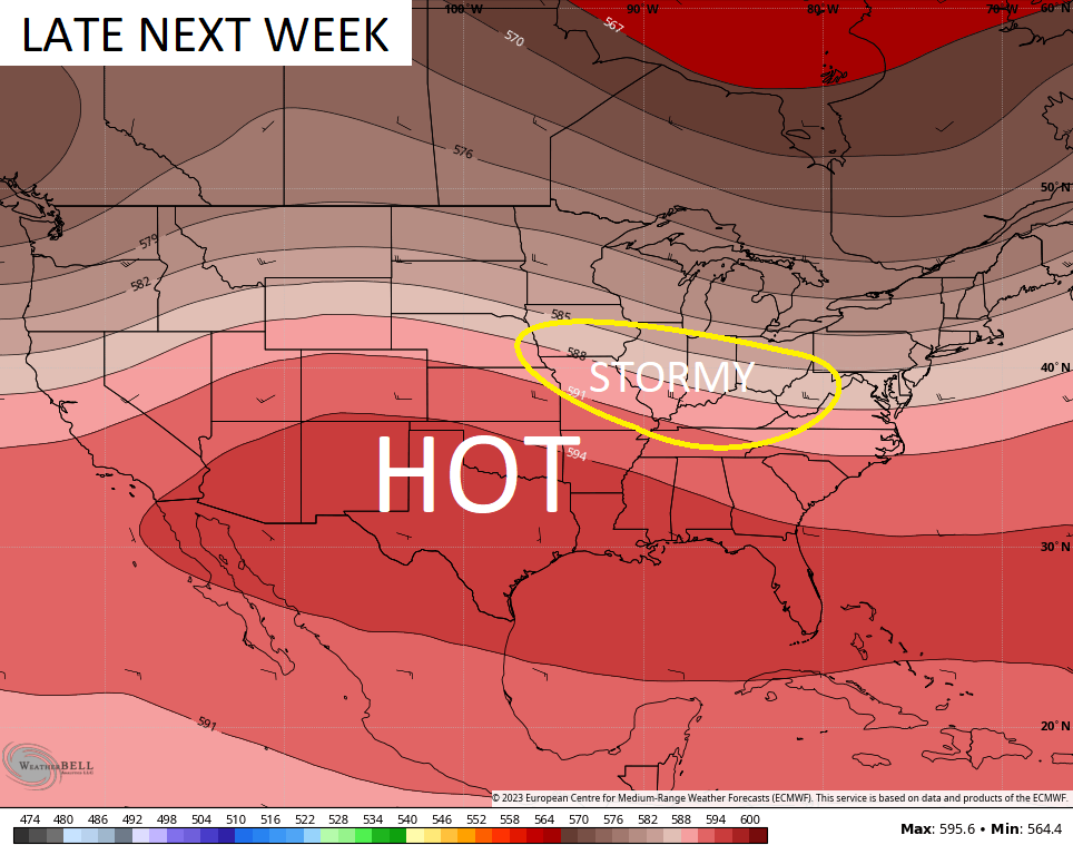
That’s similar to what we had in the middle and end of June. As that trough was lifting out, it left is caught in between heat across the south and southwest and the cooler air in the northeast. That’s what gave us the week long severe weather and heavy rain we just came out of. Well… this setup may try to develop again late next week into the following weekend…
Have a safe and wonderful 4th of July, everyone. Take care.

wouldn’t be surprised… whatever pattern we get in… it lasts for a while before it changes… I still can’t get over that storm Sunday…and the twitter videos…especially the Jacobson Park video…
Happy Birthday America !!! And many more. Looks like a normal ( temperature wise ) 4th of July. Everyone enjoy the Holiday and be Safe.
Sunday’s wind brought the neighbor’s huge cherry tree over our fence, shed, and patio. A couple of our dogwoods “caught” it and are toast. Our Clark County property has over 2 dozen large trees blown down, covering sheds, trails, and roads. It’ll take weeks to sort through. Could have been worse, of course. Fire, for instance . . .
With another trough digging in I imagine there will be a return of smoke from Canada.
I would prefer to see fireworks smoke.
It’s a very warm and sunny Fourth of July here in the Chicago area with light winds and temps in the upper 80s, with highs expected to reach around 90-91 degrees. Dewpoints are tolerable in the mid 60s.
Eighty six degrees with a humidity at 55% and a dew point reading of 68 degrees here in Maple. Along with partly Sunny skies. Very tolerable.
Current temperature in the Bowling Green are is 88°F, dewpoint is 75°F, and the heat index is 98°F.
Another oppressive day, this is getting old