Good Sunday to one and all. We have a few more storms impacting parts of the region today as a cold front pushes through. This brings some really nice weather to start the new week, but the end of the week looks to turn stormy once again.
Today’s showers and storms are scattered throughout central and eastern Kentucky with the greatest concentration the farther east and southeast you live. There’s still the small chance for a strong or severe storm going up and the Storm Prediction Center continues with the low-end severe threat in the far east…

Localized wind damage and large hail are the main threats…


Temps out there today may not get out of the 70s for some as clouds may and those scattered storms do some work on the temps.
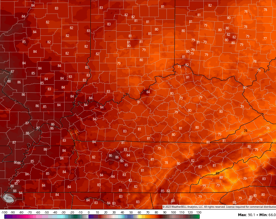
Monday looks AWESOME with temps in the upper 70s and low 80s across central and eastern Kentucky with low to mid 80s west…
Those numbers come up by Tuesday and turn seasonably toasty by Wednesday. This is ahead of a setup that will throw rounds of thunderstorms back into our part of the world..
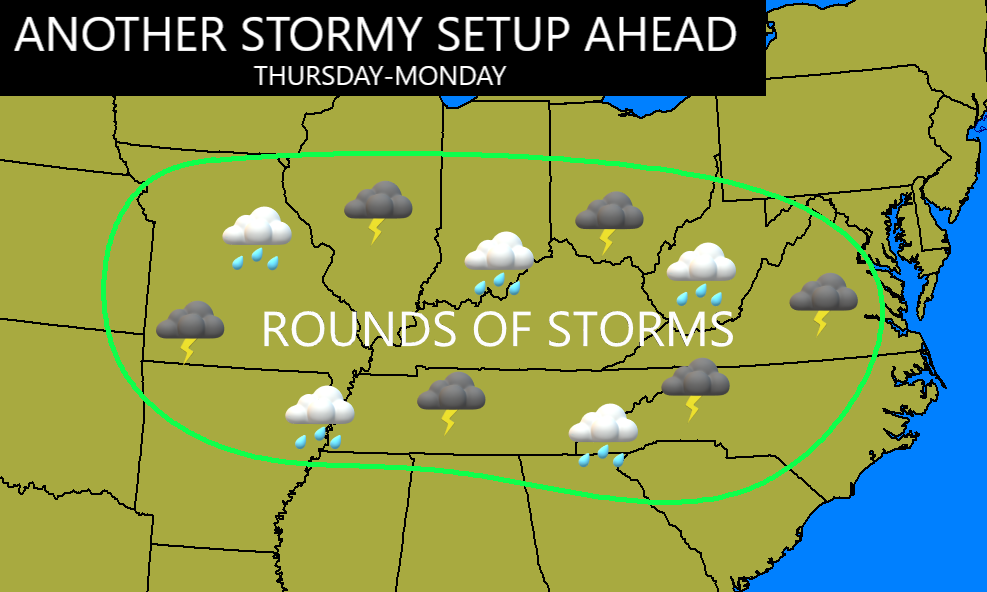
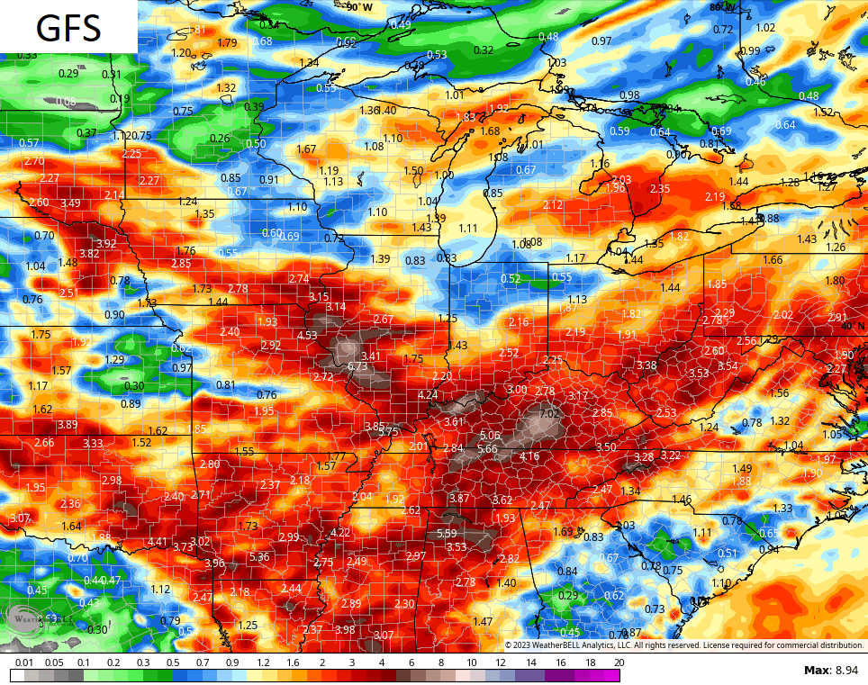
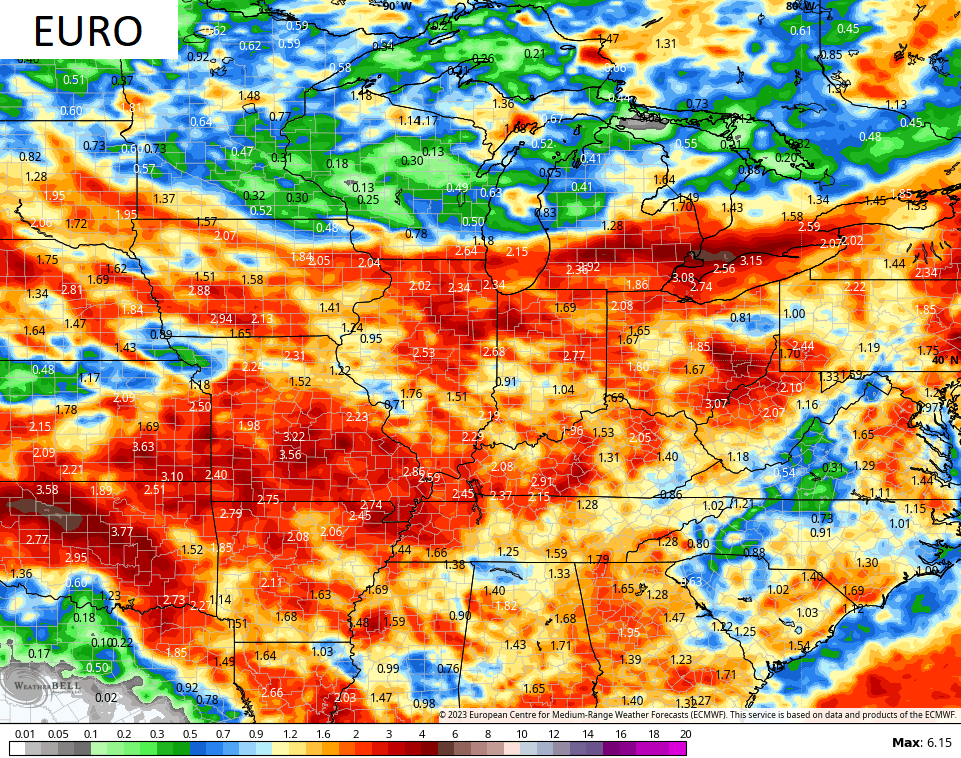
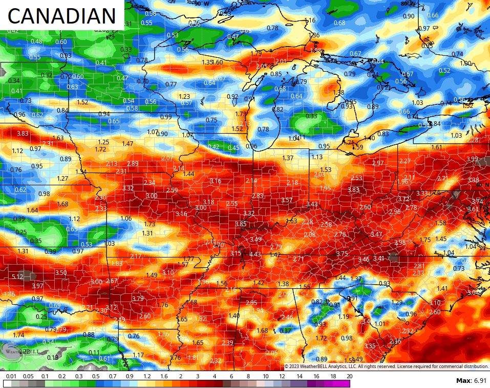
Strong to severe storms and torrential rains may cause issues during this time. Yes, this is the setup I first alluded to with this map one week ago today…
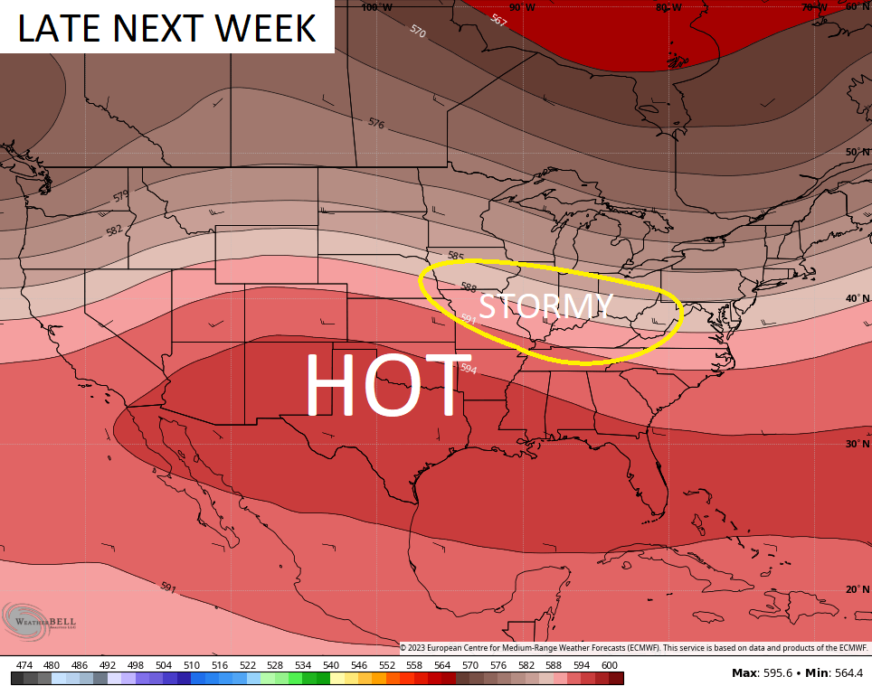
The various operational models are seeing the heavy rain potential, but differ in placement and intensity over the next week and change…
I’ll update things as needed later today. Until then, here are your storm tracking tools to wrap up the weekend…

Current watches

Possible Watch Areas

Have a great Sunday and take care.

It won’t rain that much.
Some places it will. Depends on the temperatures aloft. Here in Taylor county we only received 0.06 inches of rain / showers yesterday afternoon. I notice on the radar yesterday morning that most of the widespread rains were North of the Ohio River. The atmosphere remains as if La Nina is still present. The dew point front that went through yesterday late afternoon will make for a comfortable next couple of days. I might add that no severe weather was reported in the state yesterday.
El Nino still continues to struggle, as cold SST continue off the West Coast due to weak westerlies, and the Atlantic continues to be well above normal SST. A very negative PDO continues. Maybe all this will change before Fall and Winter if the Atlantic become negative and the Pacific becomes positive ???
Tomorrow looks to be the best day to be outside.
Comfortable temps with below normal humidity.
Chris Question : How come I can no longer read your twitter feed without joining twitter ? I really don’t care to join, but I was enjoying the post and all the others who can take photos. Beautiful Sunrises and Sunsets and in the Winter beautiful Snow scenes. I may quit the whole social media altogether. I have considered it.
I think it’s on your end.
His Twitter post is working on my browser.
I Googled Kentucky Weather Center Twitter.
I tried that. I must be blocked from Chris’s twitter. I decided to quit anyway. Good luck everyone and I hope it Snows big time this Winter.