Good Monday, everyone. It’s the middle of July and our tame temperature summer continues as we track more rounds of showers and storms into the region later this week and weekend. In addition to the shorter range, I’m also looking way down the weather road to… Wait for it… Wait for it… Winter.
Let’s begin with the awesome weather out there today. With a mix of sun and clouds, highs range from the upper 70s to low 80s for much of central and eastern Kentucky with low to middle 80s in the west.
Temps start to toast up a bit by Tuesday and Wednesday, but nothing we can’t handle. Rounds of showers and storms then roll at us by late Wednesday and will be with us through the upcoming weekend and early next week. I have no changes to this setup…
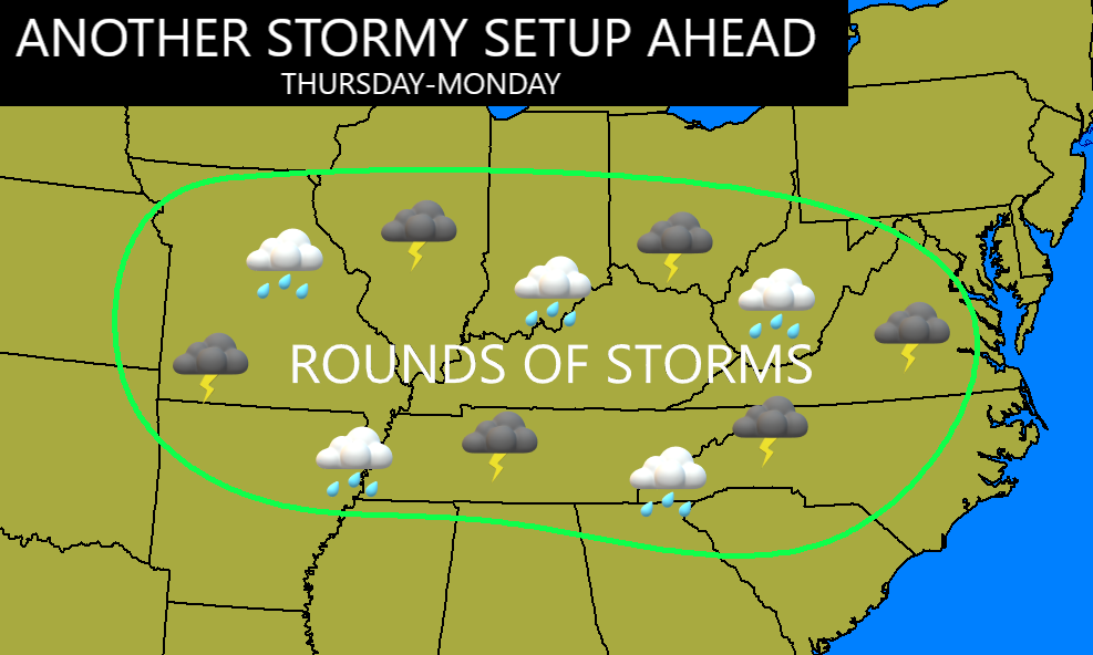
The overall pattern on many of the models is for a continuation of troughs digging into the eastern half of the country through next week. The operational GFS goes through July 25th and sees more troughs than ridges around here…

The Canadian doesn’t go out nearly as far, but shows troughs swinging in through July 19th…
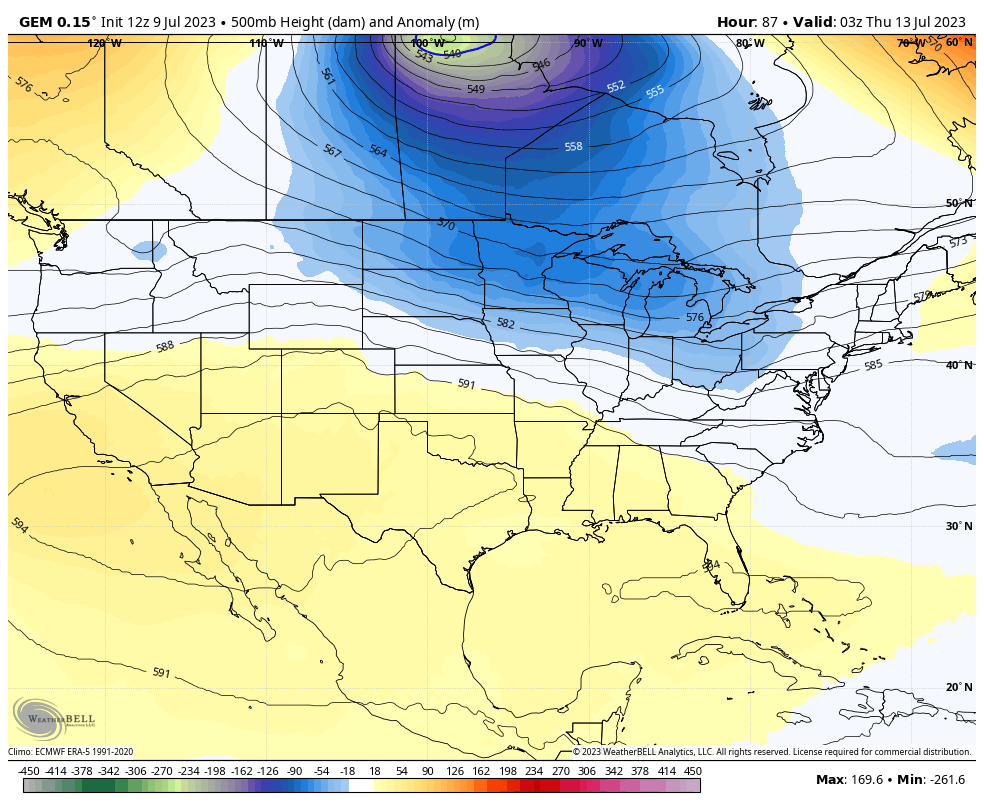
Obviously, both of those models would indicate a temperature pattern that’s cooler than normal to normal. Those same troughs would also bring frequent showers and storms into our part of the world.
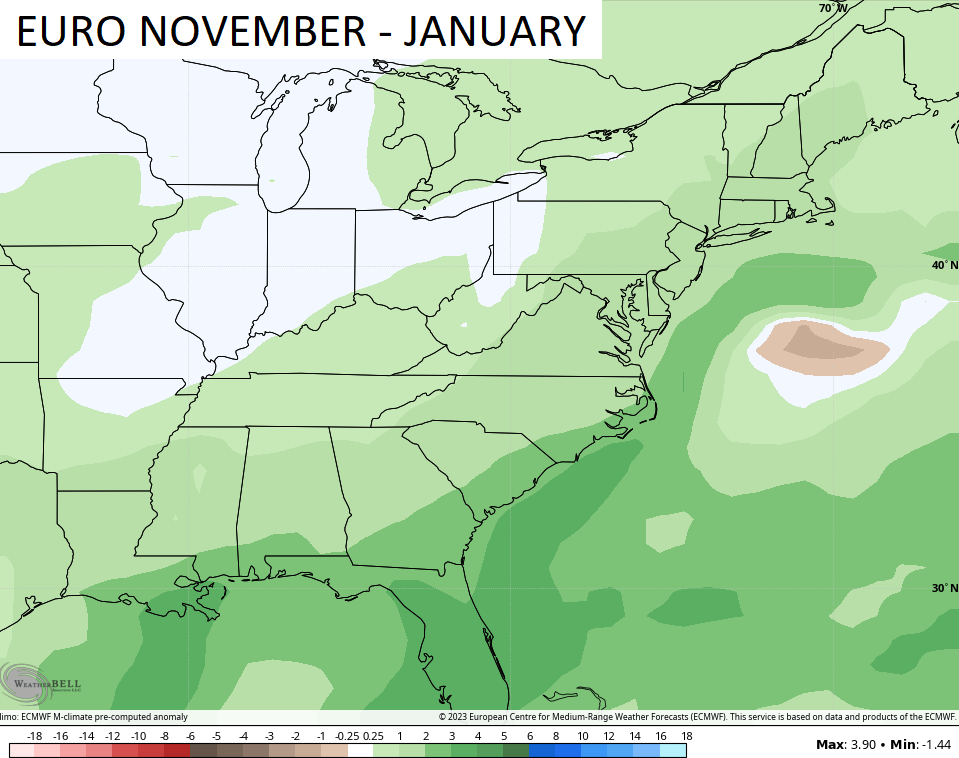
Some of the seasonal models are now getting into the range of the winter months so I thought I would break a few of those down. The latest EURO Monthlies is out and only goes through January so it doesn’t give us a full winter look.
It does give us a look at the November through January upper air pattern. It shows lower heights across much of the country with blocking over top in Canada…
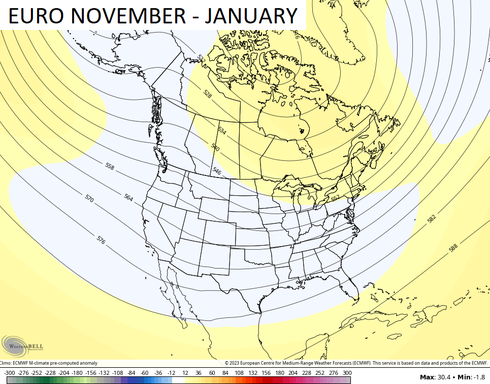
That would imply frequent shots of cold sliding into our part of the world with a storm track that may be more oriented toward the east coast. That shows up in the above normal precipitation forecast during the same time…
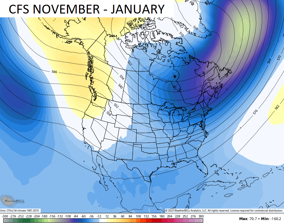
The CFS ensembles version doesn’t get into the winter months, but the control run of the model goes out much deeper in time. It runs 4 times a day, so you get some WILD swings. The latest run as of this writing is for a cold November-January for much of the country…
The main thing I’m looking at when it comes to this winter is how strong does this El Nino get. While I say that, it’s also important to note there really are no more true analogs left for seasonal forecasting. The warming globe and the insanely warm oceans have no precedent and that makes things extremely difficult for seasonal forecasting.
I’m going to throw a lot of fall and winter research at you in the coming weeks, so buckle up.
Make it a great day and take care.

The absence of valid analogs for seasonal forecasting doesn’t surprise me at all. This is apparent in the accuracy of long range forecasts, especially the Ensembles, where the increases in air temperatures, dewpoints, and the onset of what I anticipate to be a strong El Niño.
I’m quite certain that forecast model inaccuracy trends will continue into the coming Winter, as I do not anticipate that the various governments who control their particular Weather Bureaus, are willing to spring for revamping their forecasting system’s algorithms.
I am still confident in a backloaded summer. The current pattern cannot and won’t last.
I agree. With a tremendous amount of hot air in place over the Souuthwest, some of that heat will find its way into our region, once a SW flow gets reestablished. Probably early August into September.
Chris I caught your new post through the new Thread App. So far so good.