Good Wednesday to one and all. It’s a steamier day across the Commonwealth as we head into a rather steamy and stormy setup. This is locking in through the weekend and into early next week before another trough digs into the region.
Temps today make a run into the 85-90 degree range for much of the state with western Kentucky adding a few degrees on that. Humidity will also begin to slowly increase ahead of the first round of storms coming into play. This may not arrive until the evening or overnight with the greatest threat in the west.
This is where the Storm Prediction Center has a severe threat out for the day…

Here’s your breakdown of the individual threats for the day…
DAMAGING WIND

LARGE HAIL

TORNADO THREAT

Storms will be in clusters on Thursday and any of these may be strong or locally severe. The Storm Prediction Center has the entire area in the low-end risk to account for the potential…

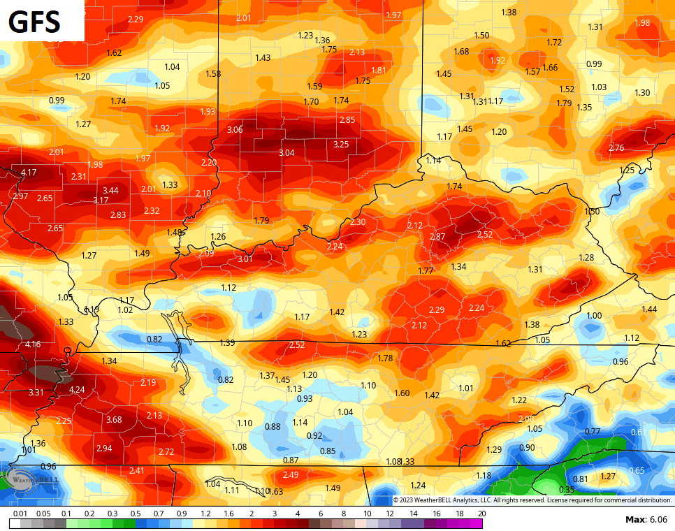
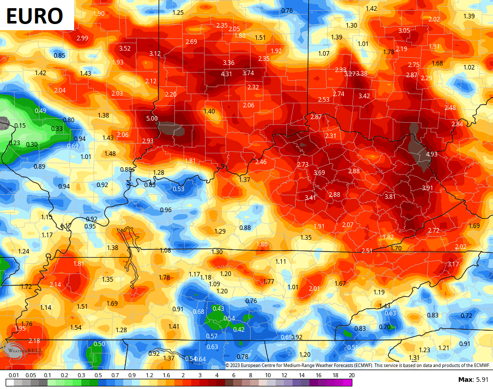
Additional rounds of showers and storms will be with us this weekend through the middle of next week. This is NOT all day stuff and you likely won’t see rain outside your house every day, but the pattern is set for some heavy rainfall when storms do hit.
The rainfall totals from the models don’t really account for individual thunderstorms, but they have some general 1″-3″ amounts through the first half of next week…
This comes as a deep trough works into the eastern half of the country this weekend and early next week…
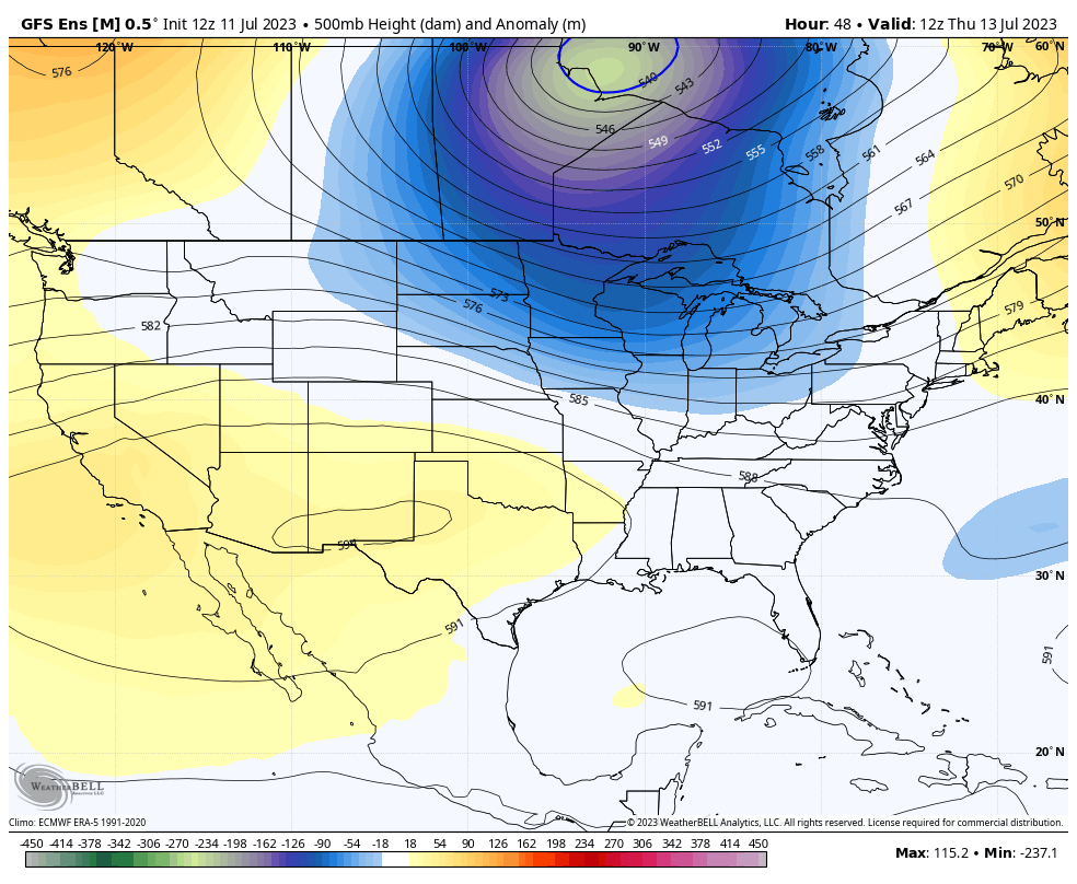
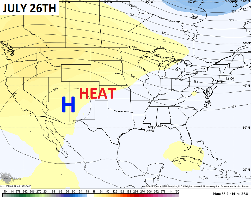
There’s a chance for a real deal stab of summer heat to follow that trough for the second half of next week, but the core of the heat remains to our west…
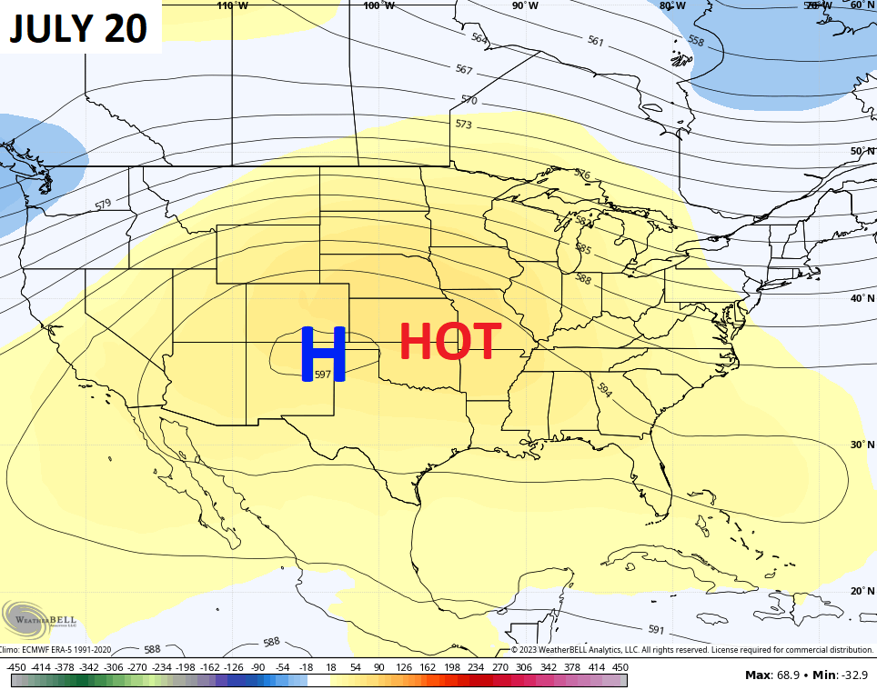
Guess what happens once again? That heat ridge migrates back to the west with troughing developing in the eastern half of the country…
That transition may also fire up more rounds of thunderstorms that would come sweeping in here from the northwest.
The pattern this summer has been pretty steady with the above normal rainfall and temps averaging normal to below.
I leave you with all your storm tracking tools for the day…

Current watches

Possible Watch Areas

Have a great Wednesday and take care.

I’m ready for the eventual backloaded heat to come. Hopefully not too dry, though.
Jeff we may have some hot days, but as long these troughs keep coming were not gonna experience the major core of the heat wave like the west is enduring or prolong long one as well.
I’m not expecting 100-plus.
Flood Watches are in effect for the entire Chicago Metro Area until early this evening as a large area of heavy rain and storms is currently moving through.
Nearly an inch of rain fell yesterday here in the SW Suburbs, and it looks like we could at least double that today, as the rain is just pouring down.
After the heavy rains of earlier this afternoon, a Tornado Watch is now in effect for Northern IL and the Chicago Metro Area until 10 PM, with an enhanced risk of severe weather across the Chicago area.
Numerous Tornado Warnings have been issued this early evening for the Chicago Metro Area, with one of the warnings just to the west of Chicago being categorized as a Particularly Dangerous Situation (PDS), with a large, extremely dangerous tornado on the ground.