Good Friday to one and all. We’ve made it to the end of the week with the first weekend of August about to begin. This weekend brings changes in here as we get set for a fairly anomalous looking pattern for early August.
Let’s start things out with what’s going on out there today then hit the fast-forward button.
Fog is likely to be an issue this morning for many areas and could be very dense for those who had rain on Thursday.
Western Kentucky is seeing more rounds of storms early today and this may lead to additional flash flooding, so keep that in mind. The rest of the state will see a mix of sun and clouds with temps in the 80s.
Here are your radars to follow along…

Temps on Saturday are steamy with 85-90 in many areas and that’s absolutely normal for the first weekend of August. Scattered storms will be noted across the west and those could put down additional heavy rains in those areas.
This is ahead of a slow-moving system rolling into the Ohio Valley by Sunday and Monday. This brings an increase in showers and storms for Sunday and Monday…
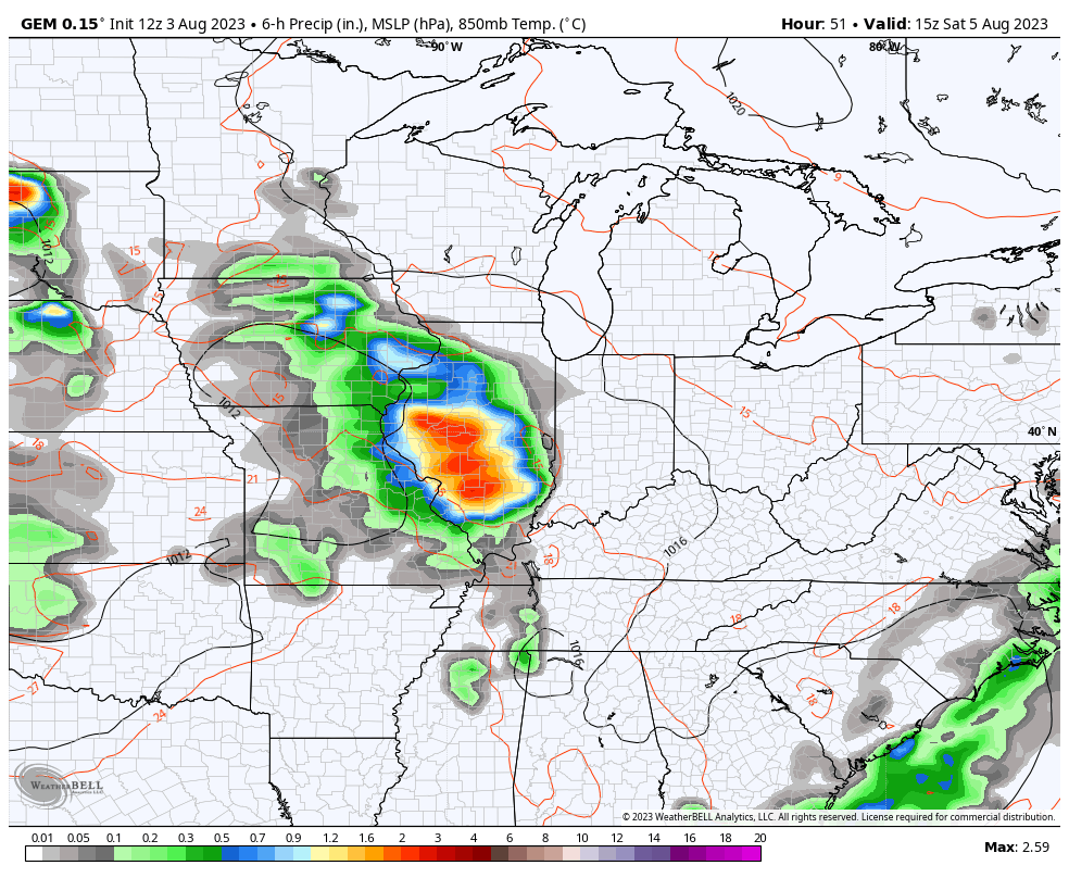
Locally heavy rains will be possible across the entire region during this time.
Pleasant temps will be noted with this system and right behind it into the middle of the week with another cold front due in by the end of the week. This one brings showers and storms in here for Thursday…
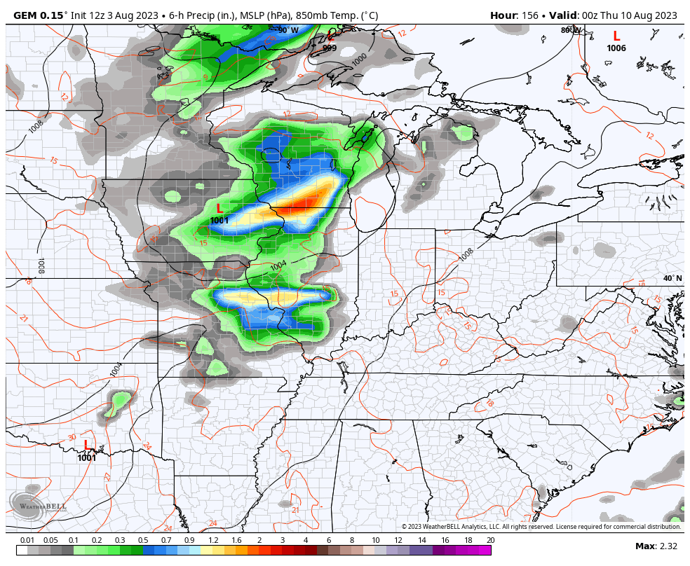
That’s two cold fronts in less than a week during the first full week of August. Both of those are pushed by some deep troughs…
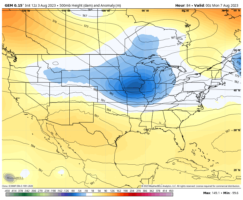
That doesn’t look much like August, now does it? This is honestly just a continuation of of the overall summer pattern that’s featured several deep troughs sweeping through our region, keeping us wet and cooler than normal.
Here are the temperature departures since early June…
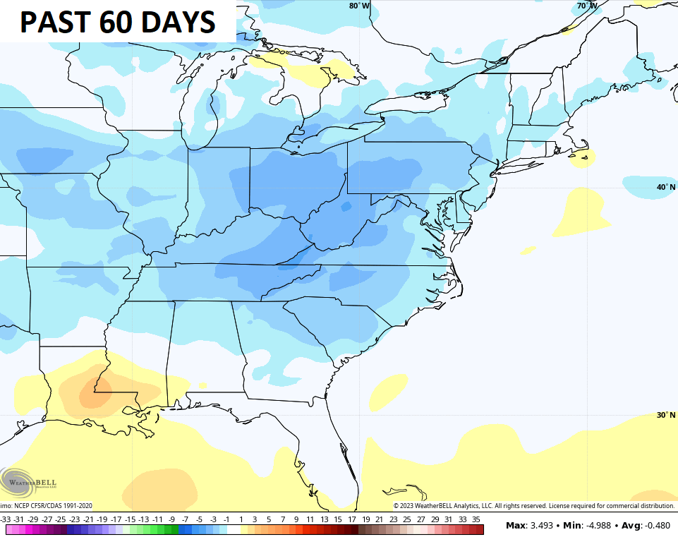
The heat and drought mongers tried to spin things, but Mother Nature always has the final say. Funny how that always seem to work out. 😁
I’m talking winter with my updates over the weekend!! ❄️🥶
Have a fantastic Friday and take care.

This pattern won’t last much longer.
Once we start thinking thoughts of Fall, Summer will slam us with a vengeance.
Seems like I remember the driest season around here is fall…. Obviously it doesn’t always work out that way as some falls can be wet…. but I think the reason of this has everything to do with the tropics… when the Atlantic has spinning hurricanes or fish storms, it puts our weather on hold… and you have endless days of boring dry weather…..if something happens in the gulf…then we get rain from that….
You just never know from year to year.
It also has to do with the Atlantic ( Atlantic Multidecadal Oscillation ) has been positive for a number of years. A negative ( AMO ) would change this. This may happen later this Winter, if El Nino completely forms. Some signs are beginning to show up in a warmer North Pacific and a colder North Atlantic. Will see.
It’s been raining here all morning here in far western ky. Looking forward the nice temps next week.
You are at the eastern edge of the high pressure to our west. The path of least resistance, is why your receiving the most rain this Summer.
It has been an exceptionally nice summer.
The only stressful time was the semi- drought we had at the beginning of it.
Kind of cloudy Summer is what I noticed.
Kind of cloudy Summer is what I noticed.
Sorry for the duplicate again. I think this new computer is defective.
Good slow steady rain almost all day yesterday, which amounted to 0.87. ” Looking forward to your thoughts on the upcoming Fall and Winter Chris.
This pattern has been with us for the majority of the summer…just look at how lush everything is
Usually the Yellow Popular trees this time of the year drop their Spring leaves.
Correction : Yellow Poplar trees.
El Niño is starting to make its presence know, especially in South America, where high temperature records are being broken across Chile, Paraguay and Argentina. We’re talking 90° temps in Winter! The latest Sea Surface Anomaly chart shows above normal water temps continue to deepen, while the northern Pacific, Atlantic and even the Arctic off of Siberia are much above normal.
https://www.ospo.noaa.gov/Products/ocean/sst/anomaly/
Joe, here’s the current SST of both the Atlantic and Pacific. What I go by, and not the Anomaly maps.
https://weatherstreet.com/hurricane/sea-surface-temperature-atl.htm
The anomaly maps are much better for predicting trends. Not as much for the surface temperature maps, which feature more day-by-day variability. This Summer’s anomaly charts have been in sync with the much above normal air temperatures in those specific areas. Global heat continues to dominate, with the exception of the Ohio/Tennessee Valley regions. These areas have benefited from the persistent ridge over Alaska, which is powered by the warmer than normal water in the northern Pacific.
Okay, thanks.