Good Saturday, everyone. A few storms are rumbling across the region today and this action will really pick up over the next few days. As a matter of fact, we are tracking the potential for strong to severe storms today through Monday.
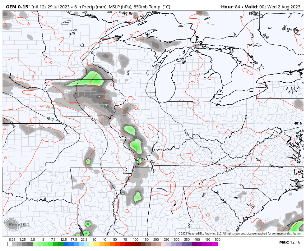
A few showers and storms will once again be impacting areas of western Kentucky today. Parts of far western Kentucky have picked up nearly 12″ of rain over the past couple of days, giving this region the second extreme rainfall event in a matter of weeks.
This same area may have another round of heavy rain this morning and that’s something we will keep a close eye on. The rest of the state sees only scattered showers and storms going up with a lot of dry weather a good bet.
Storms to our west will become much more numerous this afternoon and evening and can be strong or severe. Those will roll eastward across the region, and this has prompted the Storm Prediction Center to put our region in the risk for a few severe storms today…

Damaging wind is the main threat from any storm that goes up…
DAMAGING WIND

LARGE HAIL

TORNADO THREAT

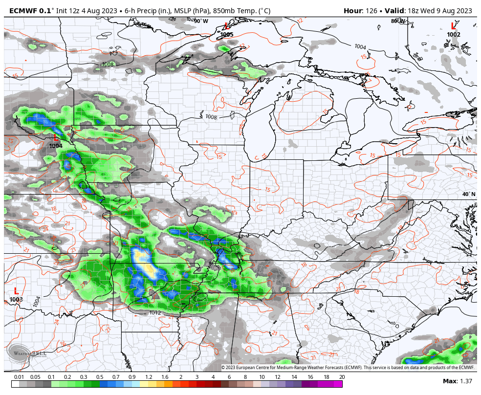
Rounds of storms then show up again tonight and Sunday ahead of a potent early August storm system. The severe weather threat continues…

Damaging wind is the primary threat, and this is showcased in the Severe Wind Outlook…

Large hail is also a possibility…

The tornado threat is pretty low…

The overall severe weather threat then shifts a bit farther east for Monday, but may still include the eastern half of the state…

As mentioned, this severe threat comes from a potent low pressure working through the Ohio Valley in the coming days. Watch how the showers and storms rotate around this low that throws some wraparound showers behind it Monday night and early Tuesday…
That’s not a very typical August looking setup and will be accompanied by much cooler than normal temps. Oh, it will also be followed up by another potent storm system arriving late Wednesday and Thursday. This may also bring a severe threat to the region and be followed by yet another system a few days later…
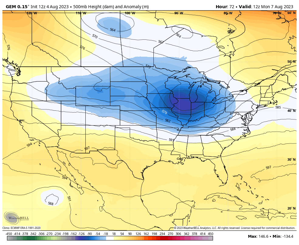
Watch these deep troughs working across the country over the next week…
I will drop by with another update later today. Until then, here are your storm tracking tools for the first Saturday in August…

Current watches

Possible Watch Areas

Have a sensational Saturday and take care.

Meh. A big heat spell will win soon.
I am not impress either Jeff. I just wish we could rid ourselves of this awful gloomy weather pattern, so we may focus on the coming Fall and Winter. When the anomaly maps ( I call the worse case scenario maps ) agree with the probalistics I will pay attention.
Correction : probabilistics. Can’t spell worth a darn anymore. I notices on the Sea Surface Temperature Map that the Atlantic and Pacific are at equal temperature except off the West Coast where a cold patch of water still remains. This contrast in temperature could be what causing the very heavy flooding rains in parts of West Kentucky. Don’t know. No contrast in temperatures between the Tropical Pacific and the Gulf of Mexico. No wonder there hasn’t been any Tropical Storm activity. Just speculating.
Maybe next summer..lol
Nope
Next Summer will be the Summer after an El Nino Winter. If memory serves in that Summer of 1977 it was very hot and dry, but changed in late August to cool and dry, followed by the Snowy Winter of 1977 -78.
Looks like it might be a soggy Fancy Farm this year!