Good Tuesday, everyone. We have a calmer and better weather day taking shape across the region but this won’t last long as another potent system is on the way. This arrives later Wednesday into Thursday with another one likely over the weekend.
Let’s kick things off with what’s going on out there today.
Our very atypical early August pattern is throwing some wraparound clouds and spotting showers and storms into the region on a cooler northwest flow. Highs today will be upper 70s to low 80s in the east with low and middle 80s west.
Here are you radars to follow whatever goes up out there today…

The next storm system will throw rounds of showers and storms into western Kentucky on Wednesday and across the rest of the region Wednesday night and Thursday.
The Storm Prediction Center has a low-end severe threat across the western half of the state on Wednesday…

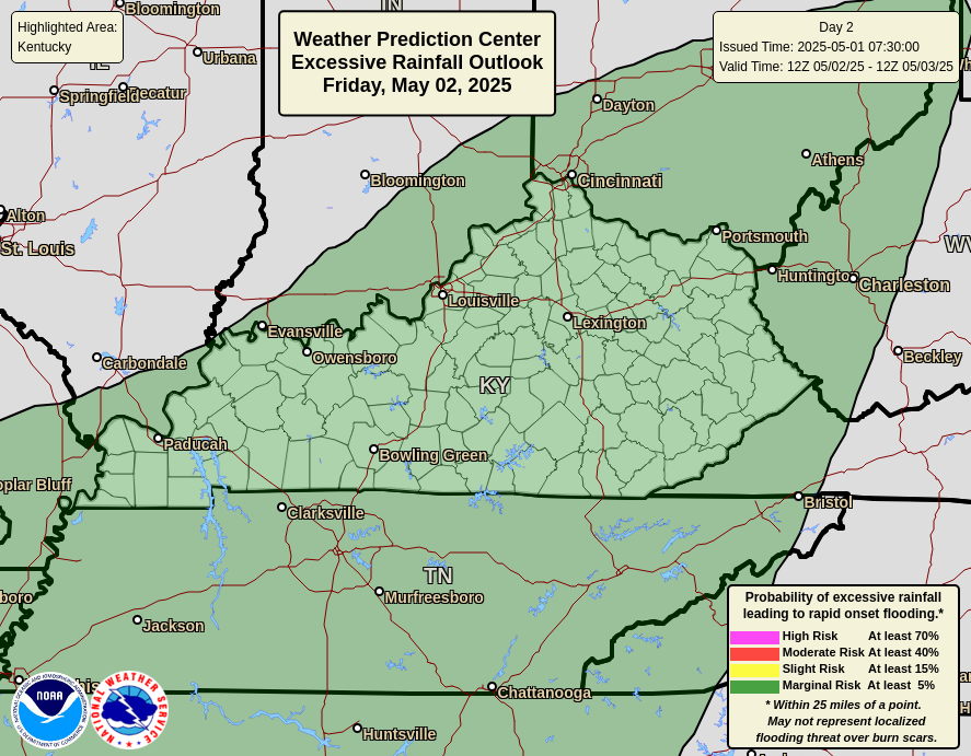
These storms may also put down enough rain to cause local high water concerns for some areas. Here’s the Excessive Rainfall Outlook from the Weather Prediction Center for Wednesday…
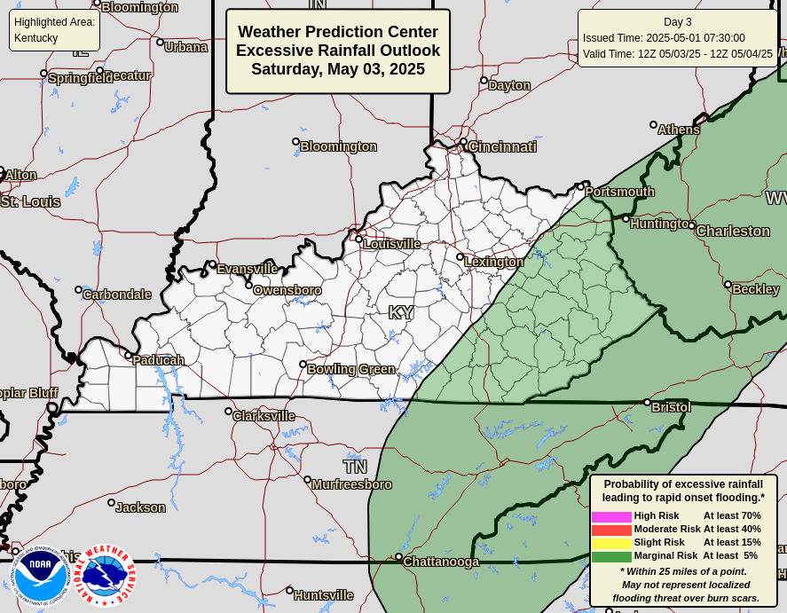
Here’s the same outlook for Thursday…
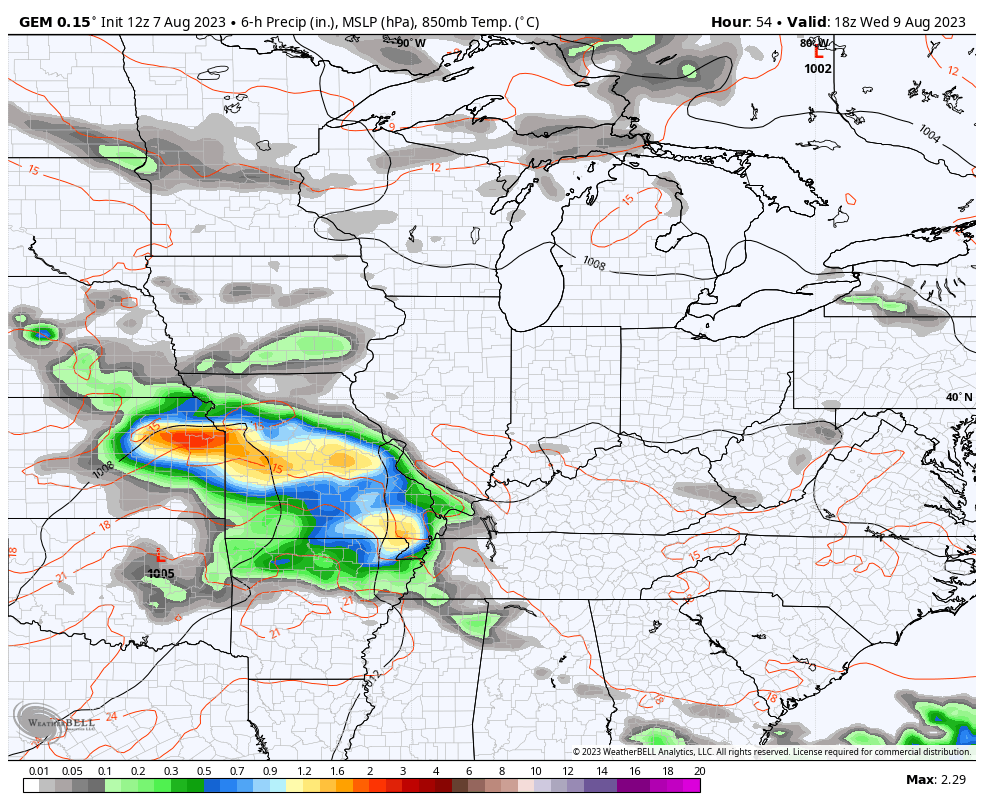
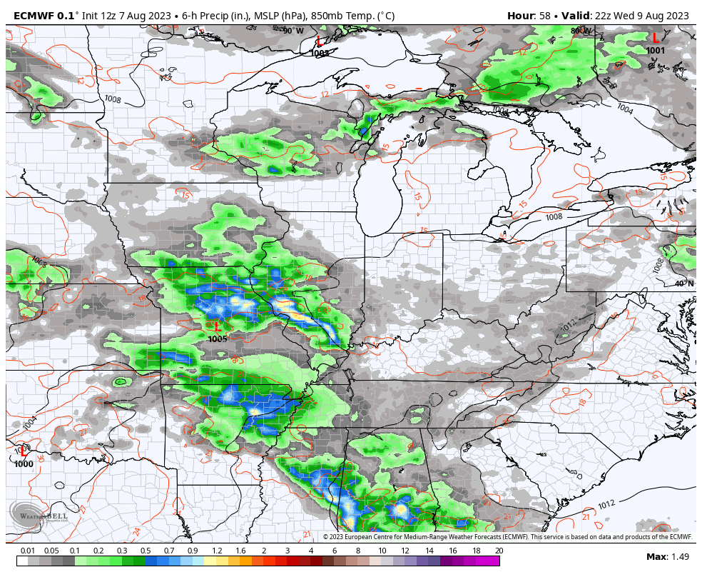
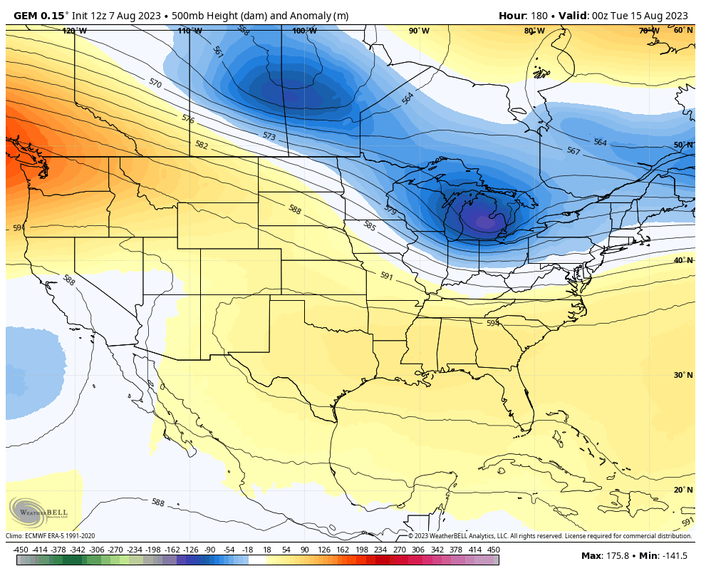
As mentioned, this system will be followed up by another system later this weekend and early next week. The EURO and Canadian models show both of these systems very well…
CANADIAN
EURO
Both models see the various troughs digging into the eastern half of the country through next week…
CANADIAN
EURO
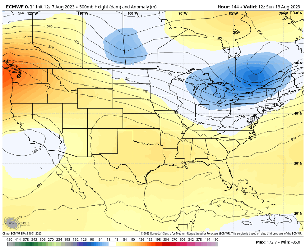
At the same time, we find the GFS doing exactly what I said it was doing in promoting phantom historic heat waves around here. Temps pushing 110 on the run from the same exact time the other models are showing cooler troughs…
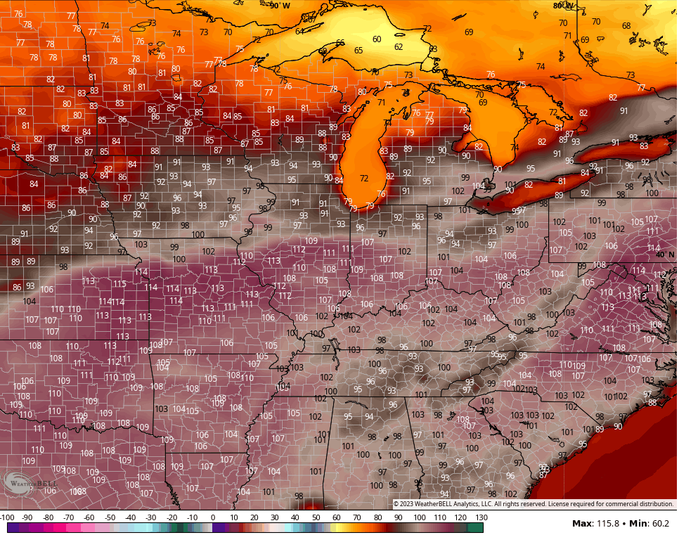
NOAA has got to get control of this model because the constant phantom heat is killing the model. Unfortunately, this is what most weather apps and walking, talking human weather apps regurgitate.
I will talk about winter with the next update. Woot!
Have a good one and take care.

We didn’t get much rain… but I think we got enough to keep things green
The GFS has been as useless as the ensembles lately, yet, as Chris mentions, it has been the “standard” for radio and TV in South Central Kentucky for far too long. The HRRR has been the most stable, reliable model over the past few months, but its forecast period is rather short.
NOAA is not the same as it use to be. Those troughs predicted anomaly have never panned out. I think I’m going back to the Old Farmers Almanac for my monthly forecast and visual observation. This month of August should give us a clue as to what our Fall and Winter will be.
The political, social, and economic talking points have finally made their way into the models. I wish the GFS wasn’t so woke in there ‘global warming’ nonsense.
I very much agree it’s getting too political for my liking.
You could not have ordered a better day. I love it. Looking forward to what Chris will say about winter this year.
Farmers Almanac says cold and Snowy, but doesn’t say where.