Good Friday to one and all. It’s likely the hottest day of the week and summer for much of Kentucky as we also watch for some booming thunderstorms. Temps will come way down this weekend as a pattern changing cold front arrives.
Let’s talk about today:
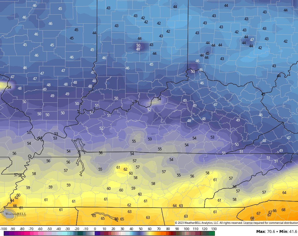
- Temps are low to middle 90s for most of Kentucky. The east is a little cooler than everyone else and may only reach the low 90s.
- Humidity levels are off the charts and more typical of the deep tropics.
- This will cause heat index values to soar well above 100 for many.
- Western Kentucky hits 110-115 in many areas.
- Central Kentucky hits 100-108.
- Eastern Kentucky will range from 98-105
- The threat for thunderstorms will be with us. There’s a small chance to start the day, with much of the storm clusters waiting until late afternoon and evening to go up.
Some of the storms may be strong or severe and the Storm Prediction Center has our region in the Low-end risk for severe storms…

Damaging wind is the main threat from any storm that goes up.
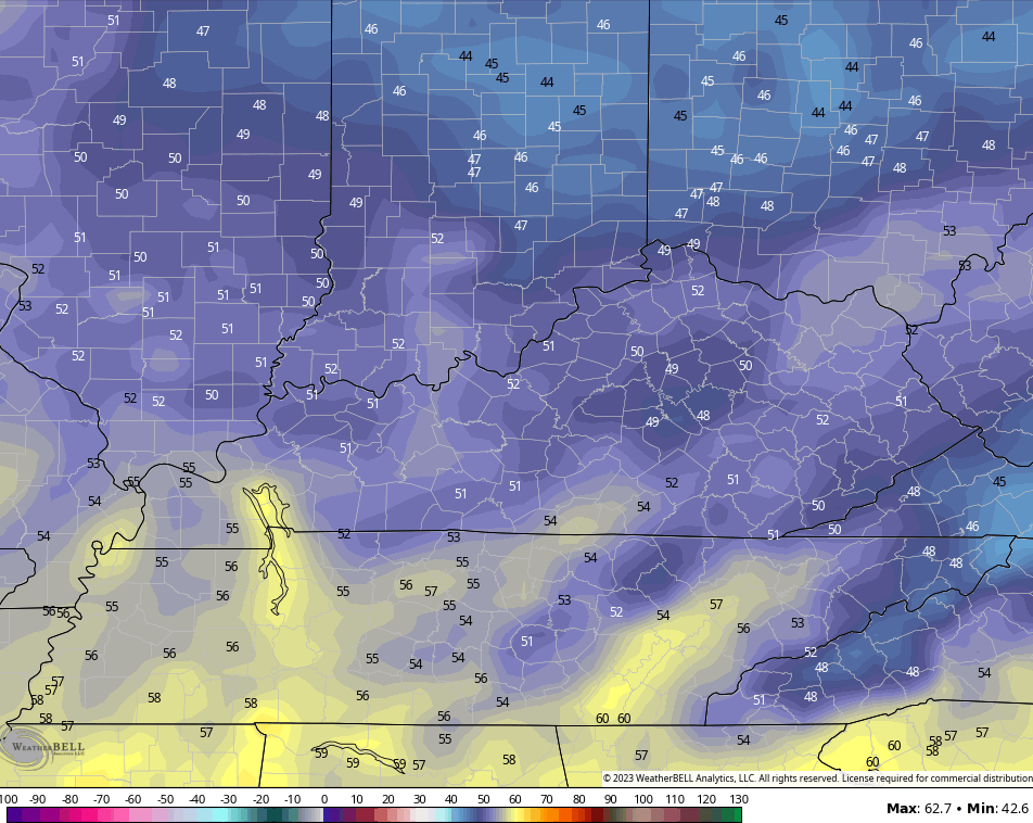
Our cold front slowly presses through here on Saturday and that means a big north to south temp swing. The southern half of the state is still quite toasty and may hit 90 once again. Some showers and storms will then come sweeping in through the day and some of that lingers into Sunday as temps come down…

The setup for next week will feature some really pleasant temps around here as another deep trough swings in later Tuesday and Wednesday.
At the same time, we may be tracking a tropical system in the eastern Gulf of Mexico that crosses Florida and then turns up along or just off the east coast. This system is actually crossing from the Pacific into the Caribbean right now and the National Hurricane Center is highlighting this for development as it heads into the Gulf…

The models show Franklin holding well off the east coast with the system coming in behind it from the Gulf. The Canadian continues to trend the strongest with the storm and the overall setup…

The GFS is playing catch up on the Gulf system, but it’s starting to find it…

For us, the above scenarios would bring scattered showers and storms late Monday and Tuesday with a blast of fall air behind it. Could we see our first taste of upper 40s by Wednesday or Thursday mornings? That’s a possibility and there’s model support for this…
GFS
CANADIAN
Too early for Chili? Asking for a friend. 😜
I will update if needed today, so check back in. As usual, I have all your storm tracking tools for the day…

Current watches

Possible Watch Areas

Have a great Friday and take care.

Never too early for chili.
IKR… I eat hot soups or chili throughout the year.. Also hot cocoa.
Since it’s going to be the hottest day and the absolute worst part of the day is like 2pm to 6pm… let’s hope clouds start bubbling up blocking the sun and storms happen during the hottest part of the day.
August is definitely my least favorite weather month.
At least August ends with cool mornings.
I love Chili too can eat it about anytime but it just taste better in fall and winter lol. MarkLex I agree my least favorite month too. Sounds like my area may have another hot one tomorrow too.
Yesterday at 2:00 pm CDT my PWS just south of Bowling Green reported a temperature of 99°F, a dewpoint of 80.5°F, and a stifling heat index of 121.5°F. That is flat-out tropical.
It looks like El Niño’s affect on the trade winds is strengthening, as most of the Atlantic storms have been stopped cold, and Franklin is being pushed due north. The Gulf and western Caribbean will be where the action is.
Definitely not a tame summer.
Our PWS is showing 79.5 degrees, a dew point of 75 degrees, and a humidity of 97%. Walking around outside involves breathing water. I retreated back inside.
75.9 degrees. Must be dyslexia.
Bring on the much cooler air. Scheroder hope you are ok, notice you haven’t been on here last 2-3 days
93 with a heat index of 109 in Richmond. Not much of a tame summer. 😉
It’s still humid this afternoon across the Chicago Metro Area, but temperatures, dew points, and heat indices are way down compared to the last few days. At 1 PM CDT, it was only 80 degrees at O’Hare Airport with a dew point of 68 and a heat index of 83. Heat indices are only in the 80s this afternoon across the area instead of around 115 like they were the last few days.
Here is the link to the summary of the record-breaking hot weather of the last few days across the Chicago Metro Area, along with some amazing fun facts. https://weather.gov/lot/2023_08_23-24_Heat
Temps have dropped 20 degrees in less than two hours with this storm action.