Good Saturday, everybody. Labor Day Weekend is in full swing and we have some decent, but very warm, weather across the Commonwealth. This looks to hang around into the middle of next week before wetter and cooler changes blow in.
Before we move ahead, I wanted to take another look at the below normal summer we just had. Here’s a better view of the cooler than normal numbers for our region…
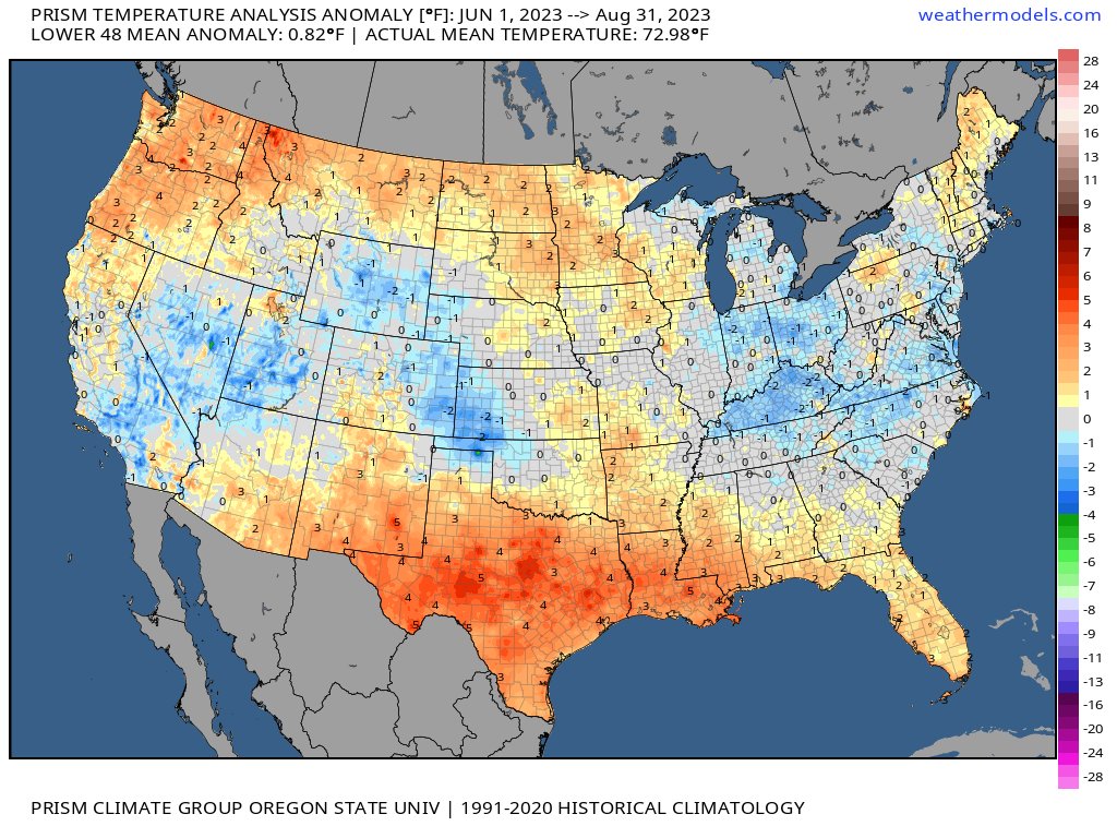
As you can clearly see, much of Kentucky was right around a full 2 degrees cooler than normal for June through August.
This helps give me a starting point in looking ahead toward the winter forecast… A wetter and cooler than normal summer as we transition from a 3 year La Nina into what looks to become a strong El Nino. We will soon start digging into all this here on KWC. Y’all ready?
Let’s get back to the weather of the weekend.
Highs today are into the 80s with an increase in humidity levels. Some clouds will be floating around and there’s the chance for a few showers to go up across western and central Kentucky. Those look few and far between, though.
Your friendly radars are on duty to follow whatever shows up…

Very warm temps then continue for Sunday and Labor Day and we should roll that into Tuesday. By Wednesday, some changes start to show up as the pattern gets ready to go back toward a familiar pattern of a trough in the eastern part of the country.
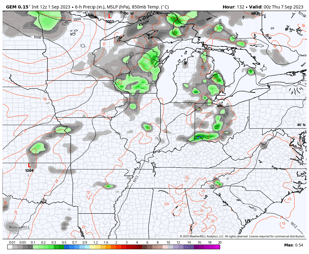
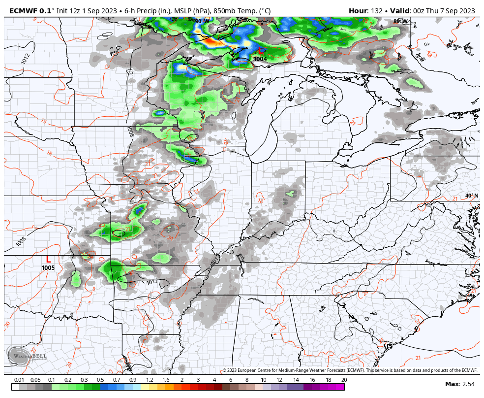
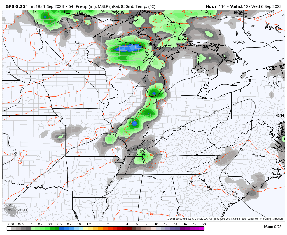
Showers and some thunderstorms increase from the west and northwest Wednesday with a few clusters of showers and storms then hanging around into the end of the week and maybe even into next weekend.
The models are in pretty decent agreement with this setup…
CANADIAN
EUROPEAN
GFS
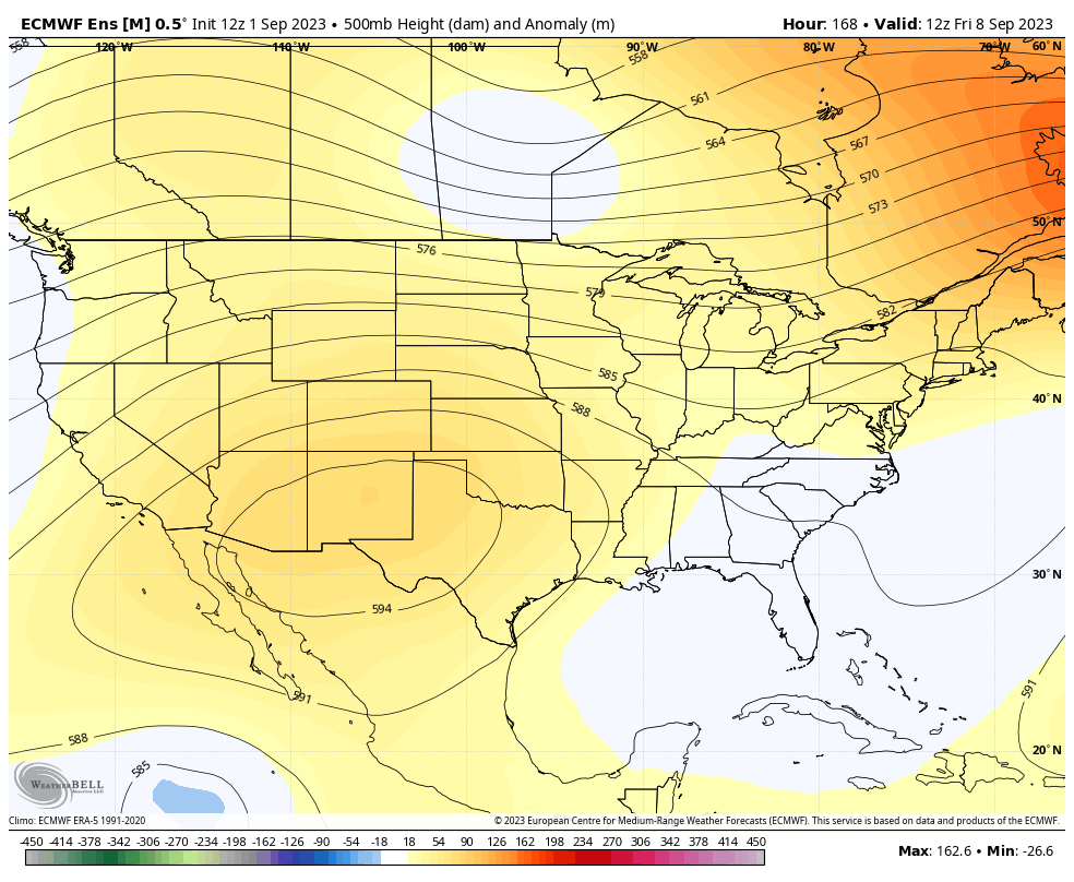
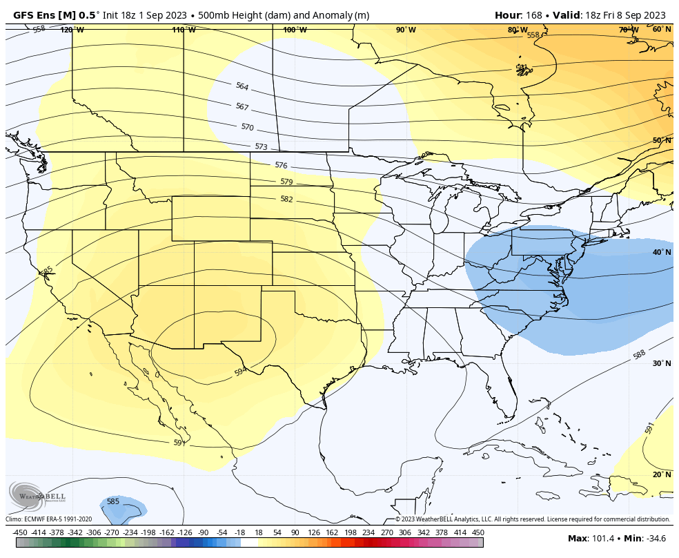
That trough digging in later next week into the following weekend looks to deepen even more the following week. Watch how the ensembles go toward a big ridge up the west coast and that trough into the east…
EURO ENSEMBLES
GFS ENSEMBLES
Have a great Saturday and take care.

Only slightly cooler than average and somewhat above average rainfall, but getting dryer and warmer at the end.
The Summer temperatures were not that much below normal. Not to notice that they were. What I did notice was the number of cloudy days this Summer. May be the reason for the below normal readings. Rainfall was below normal in my area, and now it seems to suggest that is continuing.
Yes, I’m ready to discuss what’s up for the coming Fall and Winter. El Nino looks strong on the anomaly maps, but on the current SST map looks weak. Still shows a cold patch off the West Coast. The Atlantic looks warmer than the Pacific. Still a negative PDO.
Here’s the Summer Summary from my local NWS link :
https://www.weather.gov/lmk/summer_2023_summary