Good Monday and Happy Labor Day. It’s the unofficial end to summertime and the weather is certainly feeling the part of summer. Some steams and western scattered storms are with us today before we change it up over the next few days.
These changes include a much greater risk for showers and storms to go along with much cooler temps.
Let’s kick things off with our Labor Day.
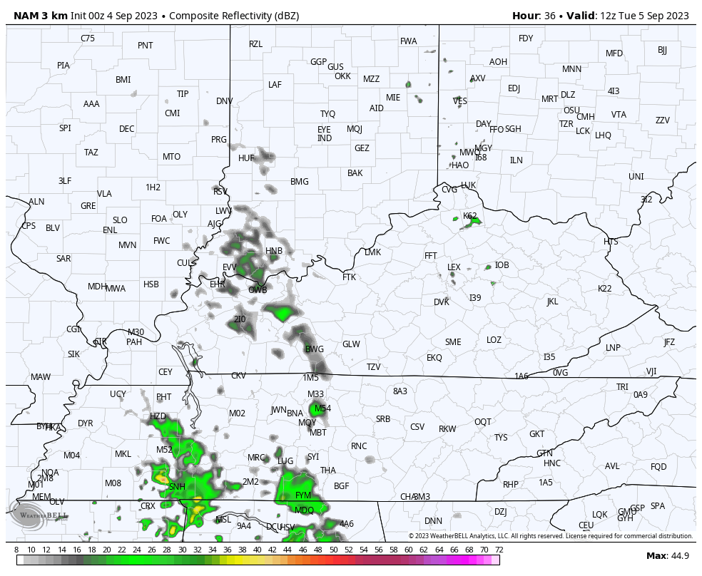
Highs are in the 85-90 degree range for most of the state. You will notice a little more clouds out there today and there’s a chance for a few showers and storms going up in the west. Here are your radars to follow along…

The threat for scattered showers and thunderstorms increases across the western half of the state on Tuesday. Some of these may stray into central Kentucky at some point…
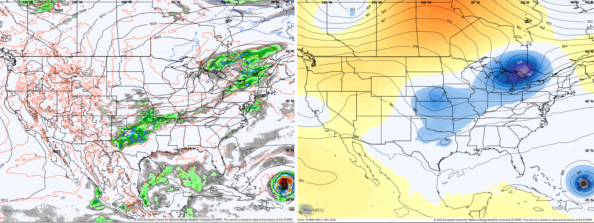
Showers and storms increase across the entire region on Wednesday as a cold front drops into the region from the northwest. Lingering showers and storms take us into Thursday and there’s even the chance for some wraparound showers dropping in from the northwest later Friday and early Saturday. This is something the models are seeing…
EURO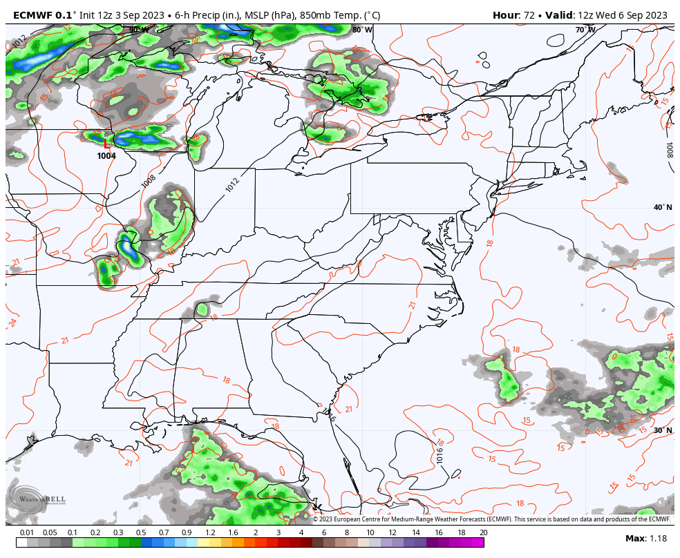
CANADIAN
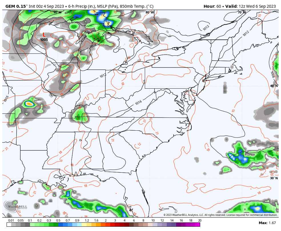
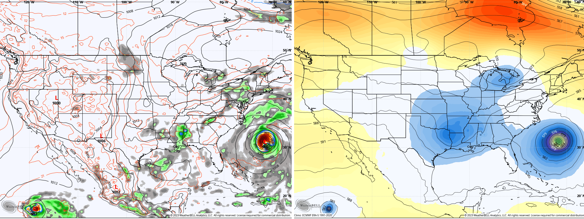
Some of those Wednesday storms may be a bit on the strong side, especially across the west. Here’s the Wednesday Severe Weather Outlook from the Storm Prediction Center…

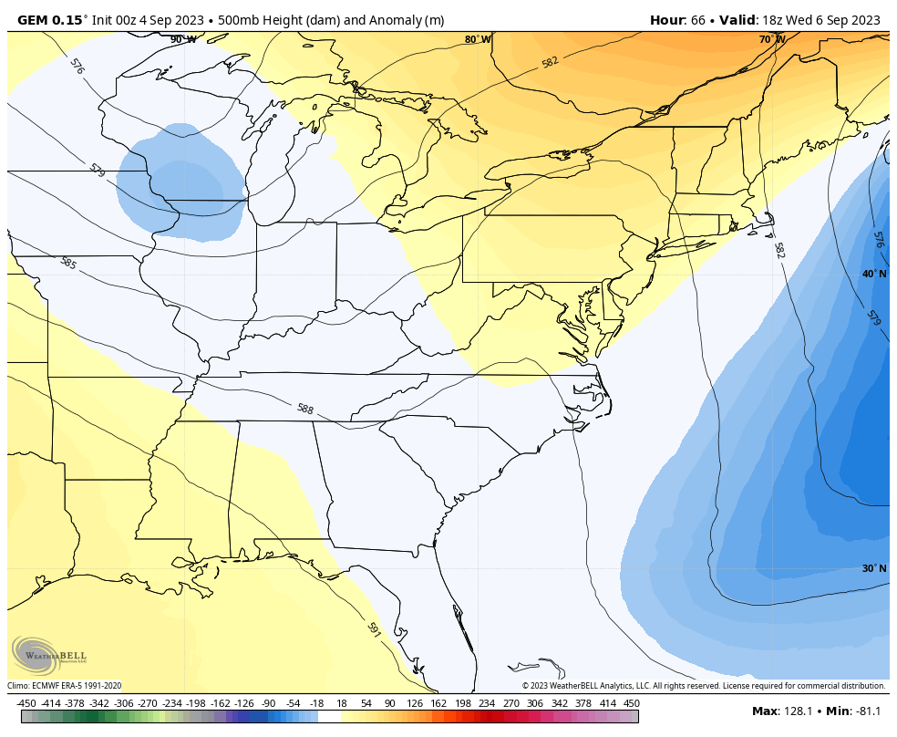
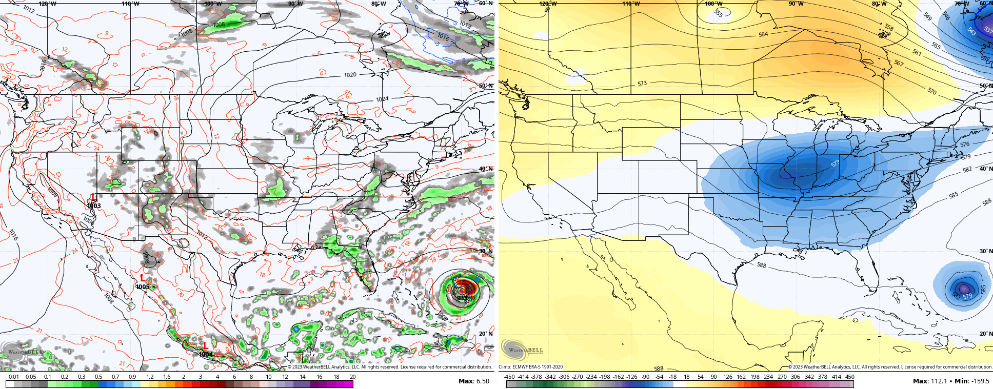
Much cooler temps come in here for the second half of the week into this weekend. It will feel good during this time as out trough digs in…
We still have what’s left of Idalia and two other named systems in the Atlantic. Those three shouldn’t pose any threat but there’s a system well out in the Atlantic that needs to be watched…

That will likely become a named storm over the next day or so as this system rolls toward the west and northwest. The Hurricane Models are tacking this to north of Puerto Rico by the weekend…

We will have to wait and see what happens at this point, but the operational models are picking up on this system off the southeastern coast by early next week. As usual, they vary on when and where, but all seem to have another trough digging into the east at about the same time…
EURO
GFS
CANADIAN
The Control Run of the EURO ENSEMBLES is really gung-ho on a deep trough across the eastern half of the country well into the middle of September…
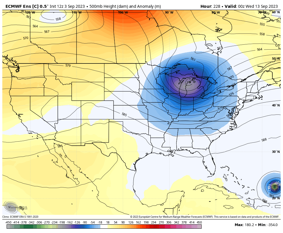
The trend is certainly there for an extended period of pretty awesome mid-September air across our part of the would. That Pot of Chili Alert is getting closer and closer.
Have a great Labor Day and take care.

We don’t need cold weather for chili. 🙂
Thanks Chris. Great, and a very well detailed Blog this morning. Looking like Fall may be taking hold in the coming days. Lets all hope so. Looking forward to those cold frosty mornings.
Happy Labor Day to All.
I’m ready for a cool down and some rain. Happy Labor Day everybody!
Rain chances not over 40% next few days and the weekend looks dry as well. Fire season might be rough.