Good Tuesday, everyone. Our three day holiday weekend is behind us and it’s full steam ahead toward a much cooler setup. A few showers and storms will introduce our new setup that may turn downright cooler than normal for a while.
Let’s begin with today and roll forward. Highs today are down compared to the past few days as some clouds increase. A few showers and storms will also be noted across the western half of the state. Some of these storms in the far west could be strong or severe. This is where the Storm Prediction Center has a low-end severe risk…

Here are your radars for the day…

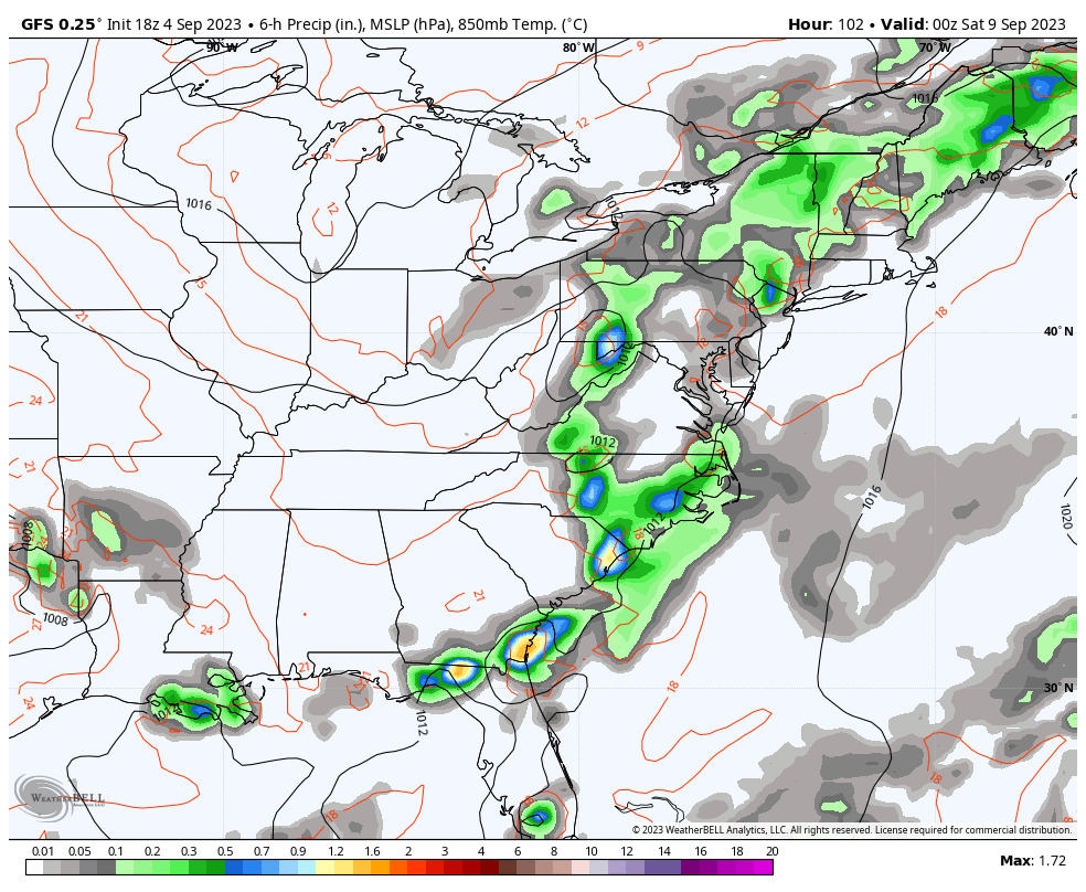
Showers and storms will increase across the entire region on Wednesday as a cold front sweeps into the region. The greatest threat comes during the late afternoon and evening hours.
Once again, there’s the chance for a few strong or severe storms for the western half of the state…

This is from the first in a series of deep troughs digging into the eastern half of the country over the next few weeks. This trough dives in on Thursday and looks to hang around right on through the upcoming weekend…
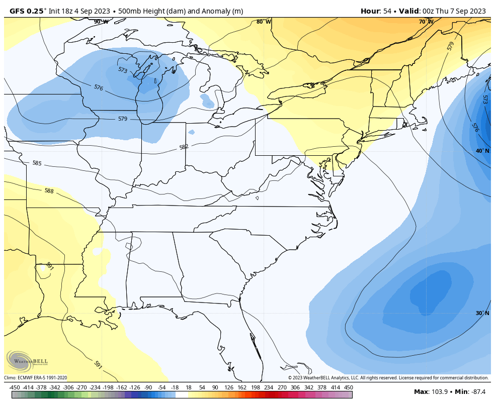
A slow-moving upper low like that may also spit out some showers from time to time, especially the farther east you live…
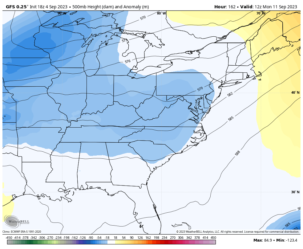
Temps are very pleasant for this time of year and that’s the beginning of a cool setup into next week. The pattern next week has the potential to go “highly anomalous”, depending on what happens with a likely hurricane off the east coast.
The models are developing a HUGE closed low on top of our region as this system curves off the east coast. Can we get this deep trough to partially catch that tropical system and pull it farther west? Does the trough progress a little faster and just push this thing farther out to see? That’s a wait and see, but this is an interesting look…
GFS
CANADIAN
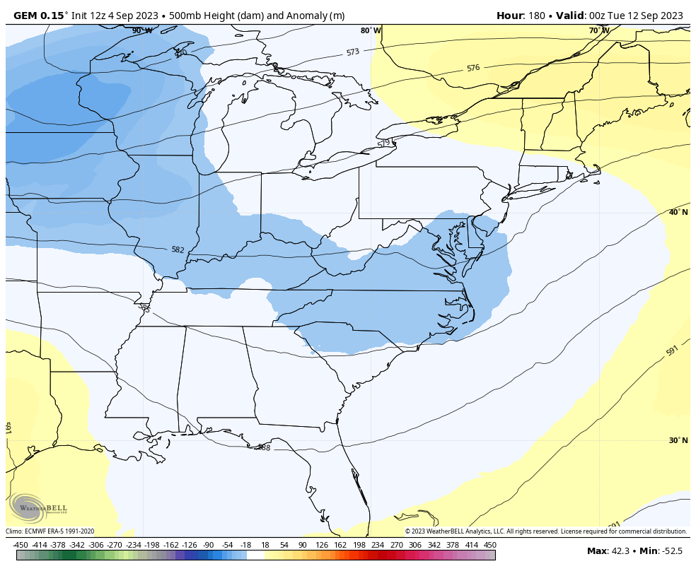
Obviously, a trough of that magnitude would bring some pretty cool mid-September temps into our part of the world.
Here’s the developing tropical system that should get named fairly quickly…

The hurricane models continue to take this system to just north of Puerto Rico this weekend…

Have a terrific Tuesday and take care.

We need that kind of trough in January.
Thanks Chris. Not too confident on the rain today through tomorrow, but I hope the event happens without the severe weather. We need a good soaking rain before we enter October our driest time of the year.
That ” anomalous ” prediction with the trough in place and the Hurricane being drawn westward could happen in an El Nino year. It would be called a ” Nor Easter. ” Interesting.
Score for Monday:
KLEX 93
Mesonet #1 88
Mesonet #2 89
Do any other states have Mesonets like KY does where we can compare the airport temp to the other states close mesonet? I want to see if this is a common thing.
Alabama, Georgia, Ohio, and Missouri have mesonets in our part of the country. Tennessee has just authorized a system that will begin operation in 2024.
https://en.m.wikipedia.org/wiki/Mesonet
Just randomly went to the Missouri one.. Wow, I don’t like the website design nearly as much as ours….
Anyway, I didn’t spend much time there but quickly looked at Mesonet temp vs St Louis apt temp…. 73 mesonet, 76 airport… this must be just the simple fact that airports are hotter and not a good place to record official temps
I would say that is correct Mark.